
|
|
Llansadwrn (Anglesey)Weather
|
 5th: Overnight moisture on the grass had frozen as the temperature dropped to -1.8C. It was cloudier at dawn and the temperature had risen to 1.8C by 0900 GMT. Pressure here was 0984mb; 4 low-pressure areas encircled the British Isles. There was just a drift of chimney smoke from the NNE and the wind remained light and variable all day. The cloud was thin and high giving some bright and occasionally sunny spells and the temperature reached 5.8C by 1300 GMT. There was a shower of rain in the vicinity of the bridges around 14 GMT. A good view of the mountains revealed that any remaining snow was fragmented even on the summits; what remained was patchy and mainly confined to gullies. It was sunnier along the North Wales coast. At Prestatyn 4.2h was the most in the UK in 24-h to 1800 GMT, while Colwyn Bay had 2.5h and Valley only 0.8h. Manchester did quite well with 2.4h while on the East Coast Newcastle had 3.8h and Leeds 4.1h. [Rain tr; Max 6.1C; Min 0.6C; Grass -1.8C]
 12th: With the sun still behind the Snowdonia Mountains there was a vivid red sky at 08 GMT. Pressure was high at 1026mb as high 1034mb was slow moving over Scotland. At 0900 GMT in a temperature of 3.6C (78% RH) the cold fresh E'ly wind was drying the soil. The day was bright with sunny spells. On the mountains the thin snow cover, looking deeper in some beds and gullies, was still lying between 2600-2800 feet. The wind dropped late in the day and there was a clear frosty night. [Rain 0.0mm; Max 5.7C; Min 2.4C; Grass -0.2C]
 at Anglesey Aluminium lingering over NW Anglesey. Photo: © 2001 D. Perkins") 14th: The sun rose above the mountains at 0850 GMT. There was slight hoarfrost on the grass and it was calm. Humidity values continued low since yesterday. Overnight it had been as low as 46% at 04 GMT but was rising by 0900 GMT (2.5C dewpoint -3.4C; RH 65%). The day was sunny with a maximum of 7.1C; in the shade it was quite cold with frost remaining on the ground all day. The sun set at 1620 GMT giving maximum possible 7.5h of sunshine. Another cold night with the air temperature falling to -1.4C and -6.0 on the grass. [Rain 0.0mm; Max 7.1C; Min -0.3C; Grass -5.2C]
14th: The sun rose above the mountains at 0850 GMT. There was slight hoarfrost on the grass and it was calm. Humidity values continued low since yesterday. Overnight it had been as low as 46% at 04 GMT but was rising by 0900 GMT (2.5C dewpoint -3.4C; RH 65%). The day was sunny with a maximum of 7.1C; in the shade it was quite cold with frost remaining on the ground all day. The sun set at 1620 GMT giving maximum possible 7.5h of sunshine. Another cold night with the air temperature falling to -1.4C and -6.0 on the grass. [Rain 0.0mm; Max 7.1C; Min -0.3C; Grass -5.2C] 18th: Pressure was still relatively high (1019mb) but the centre has drifted over Scandinavia and Russia (1032-1037mb). A dull and grey start to the day with the temperature just above freezing (0.7C). With a very light SE'ly about noon the sky cleared to give a spell of sunshine; it remained cloudy over NW Anglesey. The temperature reached 6.5C and frost in the shade melted for the first time for days. By afternoon it was cloudy again and became dark by 1650 GMT whereas in past days, with clear skies and colourful sunsets, it has been light much later. [Rain 0.0mm; Max 6.5C; Min -2.6C; Grass -6.6C]
. Photo: © 2001 D. Perkins.") 23rd: It was becoming cloudy by dawn and by 0900 GMT there were showers in sight with low cloud and mist over the mountains. A heavy shower at Llanbedrgoch in the morning partially flooded the road leading to the Post Office. With the soils still at water capacity, there having been little evaporation, any rain leads to runoff. With more rain expected 70 river flood alerts were in operation throughout the UK. At Aberffraw the dune slacks have been flooded since the Autumn. Dune slacks normally can have water on them during the winter but this year, following the wettest year since records began, the flooding is both more extensive and deeper than usual. The Atlantic low was deepening (945mb) but moving N or NW; in the afternoon there was a period of rain accompanied by force 6-7 SW'ly wind. The barometer reached it lowest (0969mb) between 18-22 GMT. It was windy at night but the sky had cleared by morning. [Rain 6.3mm; Max 9.9C; Min 6.2C; Grass 4.3C]
23rd: It was becoming cloudy by dawn and by 0900 GMT there were showers in sight with low cloud and mist over the mountains. A heavy shower at Llanbedrgoch in the morning partially flooded the road leading to the Post Office. With the soils still at water capacity, there having been little evaporation, any rain leads to runoff. With more rain expected 70 river flood alerts were in operation throughout the UK. At Aberffraw the dune slacks have been flooded since the Autumn. Dune slacks normally can have water on them during the winter but this year, following the wettest year since records began, the flooding is both more extensive and deeper than usual. The Atlantic low was deepening (945mb) but moving N or NW; in the afternoon there was a period of rain accompanied by force 6-7 SW'ly wind. The barometer reached it lowest (0969mb) between 18-22 GMT. It was windy at night but the sky had cleared by morning. [Rain 6.3mm; Max 9.9C; Min 6.2C; Grass 4.3C]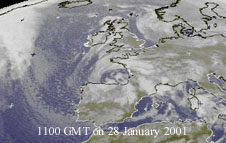 28th: Heavy hoarfrost on the ground with the soil frozen on the surface once again. Temperature 1.1C (dewpoint 0.8C) at 0900 GMT. Pressure was rising slowly (1005mb) as the UK was becoming sandwiched between a ridge of an Atlantic-high (1032mb) and continental-high (1009mb) N Italy and Siberia (1036mb). There was a low in the Bay of Biscay that shows up well on today's satellite picture. Almost sky early with cumulus around in Liverpool Bay and E Snowdonia. But thin high was encroaching from the west and it became overcast by 1130 GMT. Without sunshine the day's maximum was only 5.4C. There was no wind during the day and the air was humid; lowest 87%. As a result with the sky clearing near dusk there was heavy hoarfrost. The night remained clear with just a little cloud at times. Local people have commented about the 'sea freezing'. On the shore where streams and rivers enter the sea there have been large patches of ice at low tide. Even small pools have been iced over. This is happening on the beach at Pentraeth at the moment. On a rising-tide less-dense water from the streams is held back by the denser salt water and when fairly calm only partial mixing occurs. This water can then freeze giving the impression that the 'sea has frozen'. This was most spectacular in the 1962/63 cold spell where large ice-flows were seen floating up and down the Menai Strait. The ice-flows came from such places as the river Cadnant inlet where large amounts of ice were formed by the process described. At high water the ice was lifted off the shoreline and became melting ice-flows! [Rain 0.0mm; Max 5.4C; Min 0.3C; Grass -4.6C]
Return to top of page
Return to home page
1st: An overcast and dull start to the month. At first the cloud was high enough for the Carneddau Mountains to be clear but Snowdon was obscured in cloud. Low 963mb was S of Greenland with a warm front lying N-S over the west. Pressure here was still high (1026mb) but starting to fall. By mid-morning cloud had thickened and there was drizzle and light rain with a further spell later in the afternoon. It remained murky into the night. [Rain 3.9mm; Max 6.8C; Min 0.5C; Grass -2.8C]
2nd: A mild night with little variation in temperature (5C). The morning was still murky with very poor visibility. The wind was a light W'ly. The low was now SW of Iceland (959mb) with several slow moving fronts across the UK and more to follow. By afternoon the cloud was thinning a little but did not clear. There was a band of rain associated with occluded fronts from 21-01 GMT giving 12.2mm. The maximum temperature of 7.8C was just after 04 GMT then there was a fall to the minimum of 5.0C just before 09 GMT on the 3rd. [Rain 12.2mm; Max 7.8C; Min 4.4C; Grass 3.2C]
 on 3 Feb. 2001. Photo © D. Perkins.") 3rd: Another dull start to the day with hints of some break up in the clouds. At 0900 GMT the temperature was 5.0C and 97% RH with a light NW'ly. Visibility was poor with the mountains obscured. Pressure here was 1004mb and falling slowly with the low (986mb) SW of Iceland. A high (1044mb) over N Norway was bringing in cold air from the continent and blizzards to the Northern Isles and parts of Scotland. Another low (991mb) W of Biscay was tracking NE towards the SW Approaches. In the NW'ly wind cloud persisted over this part of the island as the moist air off the Irish Sea confronted the Snowdonia Mountains. To the NW it was much brighter and Valley reported 4.3h sunshine in the 24-h to 18 GMT, the highest in the UK. There were some breaks in the cloud after dark but the sky did not clear. With the passage of an occluded front there was continuous light to moderate rain from 0130 GMT accumulating 9.3mm by 0900 GMT the next day. [Rain 9.3mm; Max 8.5C; Min 5.0C; Grass 1.5C]
3rd: Another dull start to the day with hints of some break up in the clouds. At 0900 GMT the temperature was 5.0C and 97% RH with a light NW'ly. Visibility was poor with the mountains obscured. Pressure here was 1004mb and falling slowly with the low (986mb) SW of Iceland. A high (1044mb) over N Norway was bringing in cold air from the continent and blizzards to the Northern Isles and parts of Scotland. Another low (991mb) W of Biscay was tracking NE towards the SW Approaches. In the NW'ly wind cloud persisted over this part of the island as the moist air off the Irish Sea confronted the Snowdonia Mountains. To the NW it was much brighter and Valley reported 4.3h sunshine in the 24-h to 18 GMT, the highest in the UK. There were some breaks in the cloud after dark but the sky did not clear. With the passage of an occluded front there was continuous light to moderate rain from 0130 GMT accumulating 9.3mm by 0900 GMT the next day. [Rain 9.3mm; Max 8.5C; Min 5.0C; Grass 1.5C]
4th: It was still raining at 0900 GMT but eased soon afterwards. Pressure here 992mb was falling as yesterday's Biscay-low had deepened (986mb) and was approaching SW Ireland. During the morning it brightened and became briefly sunny when the temperature rose from 4.0C at 09 GMT to 9.5C by 1300 GMT. There was light snow over NE Snowdonia as low as 1000ft on Foel-fras and Drum, and in the Nant Ffrancon Pass at Cwm Idwal (other summits were obscured). Light snow at 650 ft was reported at Mold (Flintshire). Snow was also falling in parts of N England including Newcastle, where a football match was postponed 2h before the kick-off, as well as Scotland. Further S it was warm enough for the precipitation to be falling as rain. During the afternoon there were cumulus clouds to the S displaying crepuscular rays, before another front brought a band of moderate rain (6.2mm) from 1500-1700 GMT followed by showers. [Rain 8.1mm; Max 9.5C; Min 3.2C; Grass 1.2C]
 5th: With the Biscay-low now in the S North Sea (958mb) and its fronts cleared away N a complex Atlantic-low (962-979mb) W of Ireland with another set of fronts was beginning to affect the SW. At 0900 GMT it was humid (98%) and showery with a temperature of 5.2C. The wind was a light S'ly. Rain or drizzle in the morning then dry in the afternoon. There was a spell of rain from 23-01 GMT. In Scotland heavy snow and deep drifts brought closed roads and schools. Power lines were brought down and 5000 homes were without electricity. Passengers on a ferry from Shetland bound for Aberdeen were still aboard during the night as it was unable to dock in the high winds. In England rain was the problem and, with soils still saturated with water, was once again causing flooding. A motorist lost his life as he attempted to cross a ford on the Hampshire-Wiltshire border. [Rain 5.2mm; Max 9.8C; Min 3.9C; Grass 3.3C]
6th: At 0600 GMT the low (956mb) was over Shannon (W Ireland); the satellite image shows the swirl of the low and the frontal cloud bringing snow across N Scotland . Winds began to pick up here from 08 GMT and were S'ly force 7 by 0900 GMT. Pressure here was 979mb with a temperature of 8.5C. Later in the morning the wind had reached gale force 8. At Beaumaris it was difficult to walk against the wind; spray was being blown off the crests of waves near the shore at high tide. Several ferry sailings out of Holyhead were cancelled or delayed because of the strong winds on the Irish Sea. During the afternoon Valley was reporting gusts of 60 mph and Capel Curig 69 mph but Mumbles (nr. Swansea) reported a gust of 74 mph . On the A55 Expressway 2 lorries were overturned near Conwy and at Caernarfon some structural damage was reported. High-sided vehicles were diverted from the Britannia Bridge to the Menai Suspension Bridge for a while. Several trees have been blown down in the area. The winds, however, were not as strong as the 'up to 100 mph' that had been forecast at one stage. In Scotland snow was still causing problems with heavy falls, blizzards in the N. A train was derailed when hit by a falling tree, and 40 passengers had to be rescued. Many roads in the Highlands and N were still impassable, power lines down and schools remained closed but further S the snow was beginning to turn to rain. It continued windy at night with frequent squally showers. [Rain 5.4mm; Max 9.6C; Min 5.2C; Grass 4.6C]
7th: Yesterday's low (973mb) was lying between Scotland and S Norway maintaining a SW'ly airflow across the UK. Pressure here 987mb was rising slowly and the temperature at 0900 GMT was 7.5C (dewpoint 6.4C). The morning was showery with poor to moderate visibility and less windy. There was standing water around the garden and on some of the nearby fields. During the afternoon a frontal system on a secondary low in the Irish Sea gave a lot of rain to North Wales. It was very dark with thick cloud and moderate to heavy rain. In the 24-h to 1800 GMT the rainfall here was 19.2mm. Capel Curig reported the largest fall in the UK of 32.5mm while Colwyn Bay had 26.2mm. The rain ceased around dusk as the wind turned N'ly and the sky cleared by morning. In Scotland the snow blizzards continued to cause problems. Passengers on a train from Inverness to Wick were stranded after their train met a 10ft snowdrift at Kinbrace in Sutherland. The heating broke down and the buffet ran out of food. A farmer using a 35-year old ex-army snowcat eventually rescued them after six hours. [Rain 15.6mm; Max 7.5C; Min 6.7C; Grass 6.1C]
 8th: A slight ground frost overnight sufficient to freeze water deposits on the grass. A bright start to the day with a cold NE'ly breeze. The day was mostly sunny but the temperature reached only 4.0C. There was a dusting of snow as low as 2000ft on the Snowdonia Mountains. There was more snow on the NE mountains, particularly from Foel-fras to Drum that still had a moderate covering. There was a colourful sky after sunset with airfrost setting in by 19 GMT. [Rain 0.0mm; Max 4.0C; Min 1.2C; Grass -0.3C]
9th: It was cold overnight with a minimum of -1.6C and -5.2C above the grass. There was hoarfrost on vegetation but it was fast disappearing in the sunshine by 0900 GMT. The morning was sunny the 5 oktas cloud cover diminishing to 2 oktas by 1300 GMT. The temperature had risen to 7.6C in the light variable (NW'ly) wind; later the wind turned S-SE'ly. A spectacular complex halo display was observed at several locations including N England (Manchester and Sheffield) and the Midlands during the morning. These are produced by the sun shining through differently shaped ice crystals in high clouds. While halos are frequently seen the complex sort seen today are quite rare in the UK. Unfortunately I did not see it but you can see what we missed here (Courtesy of Atmospheric Optics). The afternoon continued mainly sunny and after dark it became cold with a minimum of 0.6C (-3.5C on the grass) by 1930 GMT. Later the temperature went down to -1.6C, the lowest minimum of the month. The wind was SE'ly and the relative humidity was 62%. Later it gradually became warmer. [Rain tr; Max 8.0C; Min -1.6C; Grass -5.2C]
10th: With Atlantic-low 970mb SW of Iceland associated fronts were poised to cross the UK. With the S'ly winds the temperature at 0900 GMT was 8.0C, the maximum for the past 24-h. Pressure 1014mb was falling slowly. The wind was a force 5-6 S'ly and there were a few spots of rain. By 1100 GMT it was raining with a strengthening wind but it was mild with the maximum reaching 10.6C by noon. Much of the thin covering of snow on the mountains had melted overnight; there were only patches visible below 3000ft the tops being obscured. There was a period of rain from near midnight to 07 GMT. [Rain 14.0mm; Max 10.6C; Min 0.6C; Grass -3.5C]
11th: There was a complex of lows (977mb) to the N with high-pressure (1044mb) Spain to Germany. This was giving a S'ly airflow with slow moving fronts across S Ireland - Wales - N England and S Wales - Midlands. There was a spell around 0900 GMT when it was not raining before a further spell lasting 18.2h gave 26.5mm before morning, the largest 24-h fall of the month. This brought the February rainfall to 100mm (135% of average). [Rain 26.5mm; Max 8.5C; Min 7.5C; Grass 7.0C]
12th: A dull and misty start to the day with low cloud (1000ft) over the mountains. The cloud soon started to lift and by 11 GMT the sky was clearing with good spells of sunshine in a light NE'ly breeze. After the rain falling temperatures allowed some later showers to fall as snow on Y Wyddfa (Snowdon), Crib-goch and Foel-fras and Carnedd Llywelyn. An intensifying area of high pressure (1024mb) just to the SW was moving NE to cover the UK. A sunny afternoon and a clear frosty night. Snowdrops are in full bloom and there are a few crocus appearing. Bluebell leaves in the wood are 2-4 cm tall. [Rain 0.0mm; Max 8.9C; Min 4.5C; Grass 4.2C]
13th: The high now 1038mb was settled across the UK giving fine but frosty weather. Frozen dew and hoarfrost covered the grass with -3.2C recorded with the grass minimum thermometer. It was a sunny and calm day with a maximum of 10.6C. After sunset about 18 GMT the sky above the horizon was a beautiful peach colour. Another clear and frosty night with bright stars. [Rain 0.0mm; Max 10.6C; Min 1.0C; Grass -3.2C]
14th: A calm and cloudless dawn led to a sunny morning with very good visibility. Again frozen dew and heavy hoarfrost on the grass with a minimum of -5.2C; the frost melted rapidly in the sunshine but remained longer in the shade. It remained sunny all day with a maximum temperature of 10.8C (highest of the month) and relative humidity of 47% in the afternoon (lowest of the month). The afternoon sunshine melted much of the remaining snow on the north-facing slopes of the Snowdonia Mountains. Clear skies at first at night with a ground frost. [Rain 0.0mm; Max 10.8C; Min 0.6C; Grass -5.4C]
 15th: It was becoming cloudy at dawn and there was a pink sky as the sun rose. By 0900 GMT it was overcast and the temperature had risen from a minimum of 1.8C to 4.5C. There was a little brightness at mid-morning but this was short-lived. Pressure 1032mb was still relatively high but a weak cold front moved in from the NW bringing thickened cloud, mist and drizzle in the afternoon. Reports from NASA say that the sun's magnetic field has flipped. This is not unusual and occurs at regular intervals (the next is expected in 2012) and usually when sunspot activity is high; activity is near its highest at the moment. Earth also can flip it magnetic field but has not done so for 740,000 years. Earth flips can occur anywhere between 5000 and 50 million years. It was Galileo, and others, in 1611 who first documented sunspots. It was not until 1843, however, that S.H. Schwabe identified the solar cycle of sunspot maxima every 11 years on average. There have been many attempts over the centuries to correlate sunspot activity with the weather but none have been very convincing. This is possibly because sunspots have very little effect on the light and heat output of the sun. Sunspot numbers are associated with solar flares that affect the earth's magnetic field and can result in spectacular Aurora particularly near the poles, unfortunately not very often here. [Rain 1.5mm; Max 8.6C; Min 1.8C; Grass -3.3C]
16th: The frontal cloud and drizzle cleared away during the night. By morning the clear sky allowed the temperature on the ground to fall to -2.2C freezing water droplets on the grass. Water also froze on some untreated roads in the area making them very icy. Pressure had risen to 1035mb as a high (1037mb) over Ireland persisted. It was a sunny, calm (later light NNE'ly) and almost cloudless morning. A little fresh snow was seen high on the tops of the Carneddau Mountains and more on Crib-goch (Snowdon). There was a little thin cloud in the afternoon, which was mainly sunny. [Rain 0.0mm; Max 7.8C; Min 1.5C; Grass -2.2C]
17th: A cold night with slight airfrost and harder ground frost with a moderate to heavy deposition of hoarfrost. Pressure here at 0900 GMT was 1044mb. The partially cloudy morning was sunny leading to another sunny afternoon. In the morning there was still some snow and ice on the mountaintops mainly above 3200ft with patches below in parts above 2800ft. The night was clear with bright stars. [Rain 0.0mm; Max 8.5C; Min -1.0C; Grass -5.5C]
18th: Cold again overnight (-6.0C above the grass) with a heavy deposition of hoarfrost. The temperature at 0900 GMT was still only 0.0C having been as low as -1.1C. The high-pressure (1043mb) is still centred over the UK with a little (variable) or no wind. In central parts including Cheshire (including Manchester Airport) and Birmingham there were patches of freezing fog until the afternoon. Here it was clear and sunny although there was some inversion mist and smoke in the Menai Strait at first. The mountaintops (above 1500ft) were clear. The afternoon was sunny with just a little S'ly wind at times. Most snow on the mountains melted in the afternoon sunshine of the last 2 days. Alder trees in the area now have a profusion of catkins. A clear night at first with a ground frost (-6.0C lowest of the month) the cloud encroached later bringing higher temperatures. [Rain 0.7mm; Max 7.6C; Min -1.1C; Grass -6.0C]
19th: Pressure was still high (1040mb) but slipping to the S allowing fronts, associated with low (981mb) between N Greenland and Norway, to move in from the NW. There was drizzle and light rain from 0800 GMT and it became misty with light drizzle by mid-morning. The afternoon was bright for a time but the cloud did not clear and was starting to become misty again by dusk. Later in the evening there was thick fog (<100m) which continued until well after midnight. [Rain 0.9mm; Max 7.6C; Min 0.0C; Grass -3.9C]
20th: The fog began to clear by dawn and visibility had improved to poor by 0900 GMT with the temperature at 4.4C. The morning was occasionally bright but again there was no clearance of the cloud. Yesterday's slow-moving front was still nearby to the SW of here with the high (1042mb) 200 miles away in the Atlantic. Later in the afternoon the mist returned and thickened in the night with visibility less than 100m. Temperature range during the 24-h was only 2.6C. [Rain 0.3mm; Max 7.0C; Min 1.2C; Grass -0.5C]
21st: Overnight thick fog was clearing slowly just after dawn but visibility was still very poor at 0900 GMT. Pressure (1032mb) continued to fall slowly along with the declining Atlantic-high (1038mb). The very long slow moving front stretched from the low, now Finland, to mid-Atlantic. The morning was misty with drizzle at times while the afternoon remained dull but mainly dry. Later the mist returned and after midnight fog and light rain until 05 GMT. [Rain 2.0mm; Max 8.3C; Min 4.4C; Grass 4.4C]
22nd: After the rain there was shallow fog across the fields at 07 GMT and some breaks in the cloud that allowed the temperature on the grass to fall to 1.3C. At 0900 GMT the shallow fog had cleared but visibility was still only poor to moderate. The rest of the day remained overcast, with low cloud obscuring the mountains, as the front pivoting over the UK seemed not to have moved during the past 24-h. Colder weather was affecting N Scotland during the day as, with the high (1032mb) now W of Ireland, low (995mb) between Iceland and Norway was bringing cold air from the N. Deposits of light-orange Saharan dust were seen dried on my parked car. [Rain 1.2mm; Max 8.1C; Min 5.2C; Grass 1.3C]
23rd: It became gradually colder overnight as the cold air from the N made its way S. At 0805 GMT there was a slight fall of ice pellets as the air temperature reached 1.8C the lowest of the past 24-h. Around 09 GMT there was a shower of sleet, at a temperature of 2.6C, and this fell as snow on the Snowdonia Mountains. There was light lying snow as low as 500 ft in places. I could see snow on the Carneddau (Black Ladders) and in the Nant Ffrancon Pass at Ogwen Cottage. There was a slight shower of ice pellets at 1019 GMT then the morning was mainly sunny. A small low (Polar Low) in the North Sea off Scotland made its way down the E Coast giving snow in N England during the day. In the afternoon there were cumulus clouds to the S with weak crepuscular rays before clearing again to mainly sunny. The thin snow cover on the mountains had melted up to 1500 ft later in the afternoon. A slight deposition of light-orange dust was again noticed during the 24-h to 09 GMT on the 24th. Deposits were seen on clean-edges, my hail-pad and the screen roof. A look at the synoptic charts suggests that the dust would have made a long circuitous route out to mid-Atlantic from N Africa to get here with a NW'ly airflow. [Rain tr; Max 8.4C; Min 1.8C; Grass -0.2C]
24th: A bright start to the day after a cold night. Pressure 1018mb was rising as a weak ridge from an Iceland-high (1026mb) was affecting the W with the (Polar) low (1006mb) now over Belgium with a front over SE England. Snow was reported from London, Kent and Sussex in the latter part of the day. Isobars all around the UK were slack resulting in light winds. The wind here was a light cool NE'ly. The temperature at 0900 GMT was 1.2C (dewpoint -0.8). The air the last 24-h has been fairly dry, with humidity values in the range 75-67-87% (09-09GMT), which has begun to dry the soil and leaf litter on the ground. Snow on the mountains was lying very thinly at 1600 ft. Sunny at times with active cumulus clouds around noon. Shower of snow (large flakes 3-4cm) at 1723 GMT with further frequent showers of snow pellets, ice pellets and flurries of snow that died out before midnight. [Rain 1.5mm; Max 5.6C; Min 0.2C; Grass -2.4C]
25th: Slight shower of snow pellets around 0530 GMT. These were still on the ground in places together with yesterday's partially melted and refrozen ice pellets at 0900 GMT. There was light snow/ice cover on the mountains as low as 500ft near Snowdon and Llanberis, somewhat higher 800ft under the Carneddau Mountains. The morning was overcast with a light N-NE'ly breeze. Pressure here is steady at 1017mb, as there is still high pressure to the W (1024mb). With lows to the E this situation continues to bring cold air from the N with further wintry showers likely during the day on higher ground. A deepening low S of Iceland later moved SE to towards Malin. [Rain 1.7mm; Max 6.6C; Min 0.5C; Grass -2.7C]
26th: A band of rain, on a cold front from the W, from 05-08 GMT (1.7mm) had given way to light showers by 0900 GMT. Pressure here 995mb had fallen as a low deepening low over Malin moved SE. Wet snow had fallen on the Mountains of Snowdonia at about 1000ft and thin lying snow was seen at 1600ft. The Crimea Pass was blocked in both directions by snow. Heavy snow fell over N and E Scotland and further S later. Movement of the snow was slow leading to large accumulations. Power lines were brought down and many homes were without electricity. There was little precipitation here during the 24-h with only light rain or drizzle at times. [Rain 1.5mm; Max 5.0C; Min 2.7C; Grass 1.0C]
27th: There were showers of light rain and sleet in the night and about 11 GMT in the morning. The slow S'ly moving low (983mb) was centred over the SW English Channel with pressure here of 987mb rising to 991mb during the morning. Snow was lying at 1000ft on the mountains, where driving was difficult, but at lower levels to the E. The A55 Expressway near Holywell was partially closed during the morning. In Northern Ireland there was 18cm of lying snow. A suspected case of foot-and-mouth disease in 3000 sheep at an abattoir in Gaerwen was confirmed causing great concern. A 16km radius 'infected' zone, including the 2 bridges and part of Gwynedd, has been set up by MAFF officials. Footpaths across farmland have been closed so has access to the Snowdonia National Park. In the episode of 1967/68, in North Wales, Cheshire and northern England, the island of Anglesey kept clear of infection. [Rain 1.8mm; Max 4.8C; Min 0.8C; Grass -2.2C]
 28th: As the low 989mb moved further S to be over Brittany by 0600 GMT it allowed the front, that gave snow to the N yesterday, to affect North Wales. There was snow from before dawn that was lying 2cm by 0900 GMT. Pressure here was 1001mb with a temperature of -0.4C (dewpoint -1.6C) and a force 5 NE'ly. There was wet snow as low as 100ft on SE Anglesey and, at higher ground in the high wind there was near blizzard conditions for a while. Roads in the Menai Bridge, Bethel and Bangor area were difficult between 0830-1030 GMT when there were several minor accidents and tailbacks of traffic. The A55 Expressway was reduced to one lane and the A487 between Caernarfon and Porthmadog was just passable. In addition, vehicle disinfectant treatment points to combat foot-and-mouth disease were being set up on the Menai Suspension and Britannia Bridges. Earlier placed mats had been destroyed by heavy traffic and these fared no better and later were also abandoned. Another 2 cases have been confirmed in Powys making the total 26 in the UK. The virus is not killed by cold weather but can be preserved by it. It can also be dispersed many miles by the wind. It is killed by a range of disinfectants; warm weather and plenty of sunshine (UV) can destroy it also. Birds were once thought to be responsible for the spread of the disease; there was much talk about the involvment of starlings. Despite the fears of farmers there is, however, no evidence for transmission by birds. Preparations are being made at Gaerwen to destroy the animals by burning. On the mountains there was some drifting of heavy snow; about half of the schools in Gwynedd (64) were closed. The snow became showery later in the morning and by 1430 GMT there was a little sunshine and less wind as the front cleared away. It was a cold day with the maximum reaching only 3.0C, the coldest of the month. There was a moderate shower of snow pellets at 18 GMT that almost covered the ground. All were beautiful conical-shapes, some were minute 1-2mm, most 6-7mm but about 15% were larger measuring up to 9mm wide by 6.5mm high. Their shape reminded me of the Apollo Spacecraft re-entry capsule. It was a cold night and the snow pellets were still on the ground in the morning. [Rain 0.6mm; Max 3.0C; Min -0.7C; Grass -0.7C]
Return to top of page
Return to home page
1st: A cold clear night so that the snow pellets were still lying on the ground in the morning. There was just a little cloud and a light NE'ly breeze. The morning was sunny and in very good visibility there were spectacular views of the snow-covered Snowdonia Mountains and Lleyn. The afternoon also was sunny but the temperature struggled to reach 3.8C the lowest maximum of the month; the air was reasonably dry with a relative humidity of 58%. The night was again clear and cold. [Rain 0.0mm; Max 3.8C; Min -0.9C; Grass -3.4C]
2nd: It was cold overnight with a minimum of -4.1C, the 3rd coldest night in March on 23y record. A moderate hoarfrost; above the grass the minimum was -8.7C, the coldest on 17y record. Pressure 1001mb has not varied much here over the past 48-h. With high (1034mb) Greenland and low-pressure (993mb) Belgium isobars were slack across the UK with a front over SE England. A clear sky at first with a very light NNE'ly that veered ESE'ly later. It was sunny morning and afternoon (maximum 5.5C) with just a little cumulus cloud from mid-morning. Sunshine at Valley for the 24-h to 18 GMT was 9.0h. Another 4 suspected cases of foot-and-mouth disease have been identified today on Anglesey. [Rain 0.0mm; Max 5.4C; Min -4.1C; Grass -8.7C]
3rd: Another cold night with a minimum of -4.5C, now the 3rd coldest on record. There was hoarfrost and the grass minimum reached -9.0C equalling my 1986 record low. My pen froze noting the 0900 GMT obs. (-2.5C dewpoint -5.6) being not used to these low temperatures! It was not as cold, however, as places in Scotland with Altnaharra reporting a minimum of -21C. A sunny start to the day with a very light SE'ly wind. There was complex high-pressure (1001mb) across the UK stretching from Valencia to Norway. But the barometer at 997mb had begun to fall slowly as low-pressure was pushing in to Northern Ireland. Isobars remain far apart indicating little wind. There is still a little snow and snow pellets in shady areas around the garden; the snowline on the mountains (650') has also changed very little in the last few days. The day was almost cloudless with a maximum of 5.7C and a low relative humidity of 44% (lowest of the month). At 18 GMT a pall of black smoke, in the direction of Gaerwen, indicated that the burning of up to 8000 sheep affected by foot-and-mouth disease had begun. [Rain 0.0mm; Max 5.7C; Min -4.5C; Grass -9.0C]
 |
 10th: A grey and damp start to the day with continuous drizzle and very poor visibility. The temperature at 0900 GMT was 9.0C with 100% relative humidity, the wind a light SW'ly. By 0920 GMT in low cloud visibility had deteriorated to <200 m (fog). There had been little temperature variation over the past 24-h (2.9C). The cloud was slow to lift but by afternoon it was bright, with a few breaks appearing, but was overcast again by dusk. [Rain 1.1mm; Max 10.2C; Min 7.7C; Grass 7.7C]
Pictures of sky from experimental webcam looking NEbr

  |
 16th: A little rain and drizzle around dawn but it only measured 0.3mm. With the cloud cover overnight it remained mild between 4-5C. The 24-h minimum (3.9C) was recorded at 09 GMT on the 15th. Pressure 1008mb had changed little during the past 24-h. . There was low-pressure SW of Ireland and an associated occluded front (Isle of Man) and a cold front behind (Aberystwyth). both across the UK to the E coast. The cold front was expected to slowly make its way N, against high-pressure extending S from Iceland, with the chance of snow over North Wales later in the day. The sky was overcast at 09 GMT with a temperature of 5.5C in an E'ly breeze. As the day went on it became murkier; with poor visibility and no breaks in the cloud cover, the maximum was 7.5C. It was a sunless day. After midnight there were showers of sleet but amounts were small as, with E'ly winds, the station was unusually in a precipitation-shadow area. Snow fell on the mountains of Snowdonia. [Rain 0.1mm; Max 7.5C; Min 3.9C; Grass 3.7C]
  |
Return to top of page
Return to home page
 2nd: Another bright start to the day with a little weak sunshine through thin cloud. The temperature at 0900 GMT was 13.0C in a moderate S'ly wind and soon went on to reach 14.1C. Pressure here 1004 mb and falling with a low (983 mb) was just to the W of Ireland. A trough was lying down through Wales to the Channel Islands with a cold front over Ireland. During the morning the S'ly wind strengthened to force 5-6 as a band of rain affected most of Wales, the West Country and the Channel Islands. There were only a few spots of rain here being at the N'ly tip of the rain-band. Later as the weak cold front passed through the temperature fell away and the sky cleared. The satellite picture at 1704 GMT shows the cloud just clearing Anglesey and the swirl of cloud around the low now off the Western Isles. The evening had sunny spells but it was windy (SSW'ly force 5-6). There are quite a few indications that spring has arrived. There are buds on bluebells in the wood and a few leaves have opened on early sycamore trees. The sticky buds on horse chestnut look like large greeny-yellow candles. The blackthorn is in flower along the hedgerows and bright green leaves of hawthorn are appearing. Birdsong is picking-up as birds pair-up and nest boxes are being closely inspected but, as yet, there is no sign of nesting. I have been listening out for the chiffchaffs; they arrived on the 22 March in 2000 but there is no sign of them yet. [Rain tr; Max 14.1C; Min 9.4C; Grass 6.4C]
|
Pictures of sky from experimental webcam looking NE Note: Timestamp is BST (GMT +1h) 


|
5th: Cloudy by dawn and rain from 0730 GMT the start of a band of rain that moved across from the W. Rain moderate to heavy at times during the morning with a strengthening S'ly wind. The rain (7 mm), sleety at times fell as snow on the Snowdonia Mountains above 1500 ft, before easing before noon. Runoff from fields soon caused local flooding of some roads; the road to Llanbedrgoch had 15 mm of water across it during the morning. Low (987 mb), leader of a pack of several in the Atlantic, was over Ireland with several fronts across Ireland, Wales and the West Country; extensive high (1024 mb) was centred over the Mediterranean. After a lull about noon, as the rain moved eastwards, there was further rain in the afternoon turning to light drizzle by 18 GMT. It was wet over the mountains with Capel Curig reporting 41 mm in the 24-h to 18 GMT, the largest fall in the UK. [Rain 14.4 mm; Max 10.1C; Min 3.6C; Grass -0.3C]
6th: Moderate to heavy rainfall from 07 GMT gave most of the 14.4 mm measured over the past 24-h. Further light rain and drizzle gave another 6 mm by noon. Low (981 mb) to the W of Ireland and associated fronts was responsible for the rain bands. Pressure here was 995 mb; wind was SSW'ly force 4-5 at time during the morning with poor or very poor visibility. There was standing water on many fields and local flooding of some minor roads. It seems that the emergence of tree leaves has been the signal to return to rain! Further heavy rain over the mountains with Capel Curig reporting 30 mm in the 24-h to 18 GMT, the largest amount in the UK in successive days. [Rain 12.7 mm; Max 10.2C; Min 4.8C; Grass 4.3C]
7th: A dismal start to the day with moderate drizzle until 11 GMT. Low (989 mb) was over Northern Ireland and pressure here was 993 mb. Cloudy but dry later and becoming brighter with a few sunny spells in the afternoon. Overnight the sky cleared and there was a ground frost by morning. [Rain 2.9 mm; Max 10.5C; Min 5.3C; Grass 3.0C]
8th: A cloudy start to the day with a temperature of 8.0C at 0900 GMT, the maximum during the morning. The wind a light W'ly became SW'ly later. By 1130 GMT the temperature had begun to fall to 5.0C for most of the afternoon. There was moderate rain from 1230 GMT to 1730 GMT that accumulated 7.7 mm. Snow fell above 3000 feet on the Snowdonia Mountains. At 18 GMT there was light drizzle in a light SE'ly wind. During the night it was a little warmer (7C) rising to 8.8C by the next morning. [Rain 7.7 mm; Max 8.8C; Min 2.2C; Grass -1.7C]
9th: Cloudy at first with the temperature 8.8C at 0900 GMT, the maximum for the past 24-h. Low (1000 mb) was to the W of the Western Isles with pressure here 1013 mb. Around noon there were some sunny spells but later it was showery with a blustery SW'ly wind. There was cumulonimbus cloud seen around 16 GMT but thunder was not heard. [Rain 3.2 mm; Max 12.5C; Min 5.0C; Grass 5.1C]
10th: Low (1005 mb) was over Holland with a cool N'ly airflow over the UK. Dull at first with low cloud and mist over the mountains it became brighter with sunny spells and showers. During the afternoon the sky cleared and after some more cloud around 17 GMT the evening and night was clear. [Rain 0.2 mm; Max 12.0C; Min 7.0C; Grass 6.2C]
11th: Clear sky at first but a little cloud appearing by 0900 GMT. The wind was a light NNE'ly as a ridge of high-pressure was crossing the UK. Pressure here was 1029 mb and the temperature 7.3C (88% RH). The morning was bright and sunny. There was some cumulus cloud development around noon but when this largely dispersed the afternoon was sunny. The temperature reached 10.3C, cooler than might be expected because of the N'ly wind. Excellent views good be seen across Anglesey to Holyhead and the Lleyn Peninsular. The evening was sunny but frontal cloud could be seen encroaching from the W. Valley recorded 12.4h sunshine to 18 GMT but was beaten by Tiree (Western Isles) by 0.1h having 12.5h, highest in the UK. Though there was cloud to the W the evening remained clear and at 2130 GMT there was a spectacular display of aurora (Northern Lights) lasting about an hour (21-22 GMT). In the absence of moonlight it was more intense than the display seen on 31st March. Again there were patches of red turning to orange interspersed with pale-green bands. The northern sky at one stage was brightly lit by a pale blue-green hue that merged into the red and orange overhead. The red colouration extended well to the E of here while there was little to be seen to the S. To the W and NW there were strong bands of slowly fluctuating pale-green colours. Sightings were reported from as far S as Devon, Durham and Shetland that, being in the N, sees auroa more frequently. It was cold out watching the aurora with the minimum on 3.1C and a slight frost on the ground (-0.5C). It has been 16 days since the last confirmed case of foot-and-mouth disease on Anglesey. There was 'growing optimism' that the disease had been contained to the SW corner of the island. [Rain tr; Max 10.4C; Min 3.4C; Grass 0.3C]
12th: A brilliant red sunrise at 0530 GMT before becoming overcast. High (1037 mb) was between Iceland and Denmark with another (1033 mb) in Biscay. Long trailing warm fronts, from a low S of Greenland, were over Ireland and W Wales while a cold front was lying over N England. Sandwiched between, with pressure of 1029 mb at 0900 GMT, we had an overcast day but the cloud was high and thin enough to give some brightness at times and the maximum rose to 10.8C in the afternoon. Throughout the day there was intermittent light rain or drizzle, not enough to wet the bottle in the raingauge, that occasionally wetted the ground. We saw our first swallow of the season at Llanbedrgoch and heard a just-returned chiffchaff in the garden. A stream in SW Anglesey, where 200 fish have been found dead, may have been polluted by strong disinfectant used in foot-and-mouth disease control measures. Strong disinfectants, including those that contain phenols, take many days to break down and could get washed into watercourses causing ecological problems. The Environment Agency is doing tests but are also concerned with the build-up of slurry on farms, affected by restrictions, all over the UK. [Rain 0.1 mm; Max 10.8C; Min 3.1C; Grass -0.5C]
13th: A cloudy night with spots of rain that did eventually record 0.1 mm. With high (1035 mb) Shetland, extending a ridge the length of the UK, and several fronts associated with low (992 mb) SE of Greenland it was a cloudy picture to the W. An overcast and rather murky start to the day. It was calm with a pressure of 1031 mb and a temperature of 9.0C at 0900 GMT. It remained dull and murky most of the day. After a little fine drizzle early in the afternoon it became brighter for a while (maximum 10.6C) before returning to the gloom later. [Rain 1.1 mm; Max 10.6C; Min 6.6C; Grass 5.1C]
 14th: There was fog (<200m), light rain then drizzle around dawn as a warm front passed by, on low (994 mb) between Greenland and Norway. The high of yesterday (1032 mb) had slipped S and broadened and there was a W'ly airflow across the UK. By 0900 GMT (pressure 1026 mb, 9.6C and 97% RH) the fog and low cloud were lifting but the sky had not cleared by midmorning. Although a little brighter before noon, when the temperature reached 12.0C, the afternoon remained dull and uniformly grey. A band of light rain from 1630 GMT until about 21 GMT produced most of the 8.4 mm that accumulated by morning. [Rain 8.4 mm; Max 12.0C; Min 7.2C; Grass 6.8C]
15th: The low (955 mb) was still near Norway but the high (1031 mb) SW UK and Biscay had slipped SW'wards resulting in a NW'ly airflow. There were, at last, some breaks in the cloud sheet appearing by 0830 GMT giving some welcome patches of blue (enough to patch a sailor's trousers). The cloud was beginning to lift off the mountaintops at 0900 GMT. Pressure was 1015 mb and a temperature of 8.5C (dewpoint 6.6C) but still there were dark clouds around. Later in the morning it became sunnier and during the afternoon the temperature rose to 12.1C. [Rain 0.0 mm; Max 12.1C; Min 7.0C; Grass 6.8C]
 16th: It was a cloudy start to the day with a cold N'ly wind. The high-pressure area (1031 mb) had moved N'wards and taken up position just to the W of Ireland. Pressure here rose to 1022 mb and the sky during the morning became clearer and by noon there were good sunny spells. The afternoon was sunny and with good visibility there were clear views across Anglesey and to the Lleyn and Snowdonia Mountains. There are just a few patches of snow to be seen on the northern slopes around 3000 ft. The temperature was kept down to 9.5C by the fresh N'ly wind. Valley (Anglesey) reported 11.1 h sunshine in the 24-h to 18 GMT, the highest in the UK. The evening and night was, at first, almost cloudless with the minimum dropping to 1.8C and some frost on the grass (-1.4C). Central England had a cold night with -3C being recorded at Oxford. [Rain 0.0 mm; Max 9.5C; Min 4.8C; Grass 2.6C]
17th: It was cloudier by dawn and soon overcast. The Atlantic-high was declining and being squeezed as a low just off Norway was moving S. Associated fronts were starting to affect N Scotland (wintry showers) and to work S during the day. The satellite picture shows the swirl of cloud around the low with frontal cloud just reaching North Wales. There was light rain or drizzle from 1030 GMT, with poor visibility. But the rain had only accumulated 1 mm by 17 GMT. The maximum, that was reached before noon, was 8.2C. The first bluebells were in flower in the wood. [Rain 1.6 mm; Max 8.2C; Min 1.8C; Grass -1.4C]
18th: It was a cold night with the minimum down to 1.7C and -0.6C on the grass. There were frequent slight showers of snow pellets from 0715 GMT and a sprinkling of snow could be seen as low as 2250' on the mountains. At 0900 GMT the temperature was 4.7C (dewpoint 0.0) and a relative humidity of 71%. It felt cold in the brisk NNE'ly wind. Showers of snow pellets and flurries of snow continued at first in the morning but died out by noon. The afternoon was mainly sunny and the temperature reached 8.4C and the relative humidity fell to 55%; in the evening snow showers could be seen falling over the mountains. Partially cloudy at night but with sufficient clear spells for a touch of ground frost (-0.5C) before morning. [Rain tr; Max 8.4C; Min 1.7C; Grass -0.6C]
19th: A fine start to the day but there were cumulus clouds, threatening later showers, on the horizon to the W and over the Snowdonia Mountains. The summits were sprinkled with snow.
Another cold night inland away from the coasts with temperatures of -2C. With lows (996 mb) in the North Sea and over Denmark the Atlantic-ridge of high-pressure (1026 mb) W or Ireland promised a mainly fine day to the W of the UK. Showers were already affecting the E coast from Scotland to the Wash. At 0900 GMT pressure was 1016 mb and the temperature was 6.5C (dewpoint 2.6C); there were crepuscular rays to be seen in the Nant Ffrancon Pass. The morning was sunny and just after noon the temperature reached 10.0C the highest of the day. The afternoon was sunny, but we caught a slight shower of snow pellets around 14 GMT. There were snow showers over the Mountains that left Carnedd Dafydd and C. Llywelyn with shining white caps in the later afternoon sunshine. Towards 17 GMT the sky was became clearer as the cumulus clouds dispersed. [Rain 0.2 mm; Max 10.0C; Min 1.6C; Grass -0.5C]
20th: A bright and sunny start to the day. Pressure here at 0900 GMT was 1017 mb as the ridge of high-pressure remained over northern Britain. The day was sunny with fair-weather cumulus clouds and good visibility but it remained cool (maximum 9.4C) in the NE'ly breeze. During the afternoon 2 or 3 fires could be seen burning on the lower slopes of the Snowdonia Mountains. Burning should not be carried out after the end of March because of nesting birds. Towards evening the sky cleared resulting in a ground frost later in the night. [Rain 0.0 mm; Max 9.4C; Min 2.6C; Grass -0.1C]
21st: The grass was covered at dawn with frost; frozen dew and some hoar frost (-3.0C above the grass) that soon melted. The minimum of 1.0C was the coldest of the month. Pressure was falling (1016 mb) as the ridge of high-pressure declined allowing fronts on an Icelandic-low to encroach from the W. It was bright at first with some weak sunshine as the cloud was thin and high. The leading front could be seen to the W at 0900 GMT (7.5C) but it did not reach here until about 14 GMT. The temperature had risen to 10.0C around noon. By 16 GMT there was some fine drizzle and this turned to light rain by 20 GMT. The band of rain was slow moving and it rained all night with slow decrease in temperature to a minimum of 4.2C. Rainfall for the 24-h period was only 3.7 mm but 11.5 hours duration. With temperatures around 5C here on the mountains it was cold enough to fall as snow above 2000'. [Rain 3.7 mm; Max 10.0C; Min 1.0C; Grass -3.0C]
 22nd: Steady but light rain overnight with about 3.7 mm rain accumulated by 09 GMT. Cloud was seen hanging over the Snowdonia Mountains, the summits were obscured but snow was lying between 2000-2500'. Pressure 999 mb was still declining and the occluded fronts had not yet cleared. The wind was a light S'ly and the temperature beginning to rise at was 6.5C but later could only reached a maximum of 7.0C, the lowest of the month. The intermittent rain and drizzle around 09 GMT soon turned to light rain again and continued until 18 GMT when it appeared to brighten a little. In the 24-h to 18 GMT Capel Curing recorded 32 mm rainfall while here there was 10 mm. By 21 GMT the sky had cleared and there was a slight ground frost (-1.4C). After midnight it became cloudier and there was a slight shower just before 03 GMT. Mean temperatures were above average at the beginning of the month but in recent days have been running below average [Rain 6.5 mm; Max 7.0C; Min 5.0C; Grass 4.2C]
23rd: A cloudy start to the day with a little drizzle and mist looking towards the mountains. By 0900 GMT there was a hint of a break in the cloud sheet and it was looking brighter. Pressure 1000 mb was rising as the low over Wales was moving SE. The temperature was 6.4C (dewpoint 5.5C). A moderate cover snow was lying about 1500' at Cwm Idwal and on the summits of the Carneddau and Y Wyddfa. During the morning the sky cleared leaving well-developed cumulus clouds hanging over the mountains. The afternoon was clear with the white-topped summits of the central Snowdonia Mountains sparkling in the sunshine. Clear sky at first at night with a touch of ground frost but it became cloudier later. [Rain trace; Max 12.3C; Min 2.4C; Grass -1.4C]
24th: An overcast dawn with the wind very light from the SE. Pressure was 997 mb and the temperature 9C at 08 GMT. With a low (989 mb) to the SW of Ireland and there were associated rain-bearing fronts moving in from the SW into the West Country and Wales. There were some spots of rain just before 09 GMT and these continued intermittently during the morning and into the afternoon. From 15 GMT to 19 GMT there was a period of light rain on a passing occluded front and was followed, through the night, by frequent showers. [Rain 6.9 mm; Max 9.3C; Min 4.6C; Grass -0.5C]
25th: The sky was clearing at dawn leaving some towering cumulus clouds over Snowdonia. At 0900 GMT pressure 997 mb was rising and a sunny day ensued. Some passing fair-weather cumulus over Anglesey gave way to almost clear skies during the afternoon. Winds were a light SSW'ly and there was a maximum of 12.4C. Much of the light snow cover on the Carneddau and Y Wyddfa melted during the day leaving only patches. The evening was sunny with little or no wind but it was cloudier by 21 GMT and there was a shower of rain. A further shower about midnight brought the rainfall total to 1.3 mm for the 24-h period. [Rain 1.3 mm; Max 12.4C; Min 6.8C; Grass 4.4C]
 26th: Overcast with thick haze at dawn as a trough of comparatively 'high' low-pressure (1004 mb) was over the UK at midnight. Pressure gradients are slack with the most significant low (971 mb) Newfoundland and highs (1027 mb) Azores, (1025 mb) Russia and (1022 mb) Mediterranean. Here at 08 GMT the temperature was 7.7C and pressure had risen to 1009 mb; it was brighter as the sky was starting to clear. The morning became sunny later and the afternoon had almost a clear sky. Some coastal areas in the west had the highest sunshine with Fishguard reporting 11.6h in the 24-h to 18 GMT. The evening became overcast but it remained dry. [Rain 0.0 mm; Max 13.8C; Min 5.2C; Grass 2.0C]
27th: An overcast morning but the cloud was thin and high with weak sunshine at first. Around noon it was sunniest with the temperature reaching 13.4C. Low (980 mb) E of Greenland had an occluded front stretching from Iceland to Ireland with a trough over W Scotland and Wales. The afternoon was sunny for a while but cumulus clouds were towering over the mountains. Later it became rather murky and there were a few showers of rain. The SW'ly wind had strengthened through the day reaching force 4-5 by 18 GMT. From 18-21 GMT the front brought moderate to heavy rain amounting to 8.8 mm. [Rain 8.8 mm; Max 13.4C; Min 4.6C; Grass 1.0C]
28th: As the front cleared away E'wards it was a bright start to the day but there were cumulus clouds in the vicinity. The infra-red satellite picture at 0636 GMT shows the long front, cleared to the E, and the low now S of Iceland. Also shown is the cloud over Wales, the showers to come to the W and further frontal development over Ireland. In sunny spells the temperature at 0900 GMT was 9.1C. After noon there were well-developed cumulus clouds to the S over Snowdonia. Later there were cumulonimbus and soon here when there were showers of rain and ice pellets but no thunder was heard. A sprinkling of lying snow was seen above 3200' on Carnedd Llywelyn, Crib Goch and Y Wyddfa. During the night a low (997 mb) developed over Wales and there were showers and longer spells of rain; later later there was sleet that fell as snow over the mountains of Snowdonia. [Rain 8.5 mm; Max 11.4C; Min 5.0C; Grass 2.4C]
 29th: Showers of sleet continuing at 0900 GMT . Snow could be seen at 1500' on the Carneddau and Moel Eilio; the summits were obscured in cloud. The temperature was 3.6C (dewpoint 3.4C) and visibility was moderate to poor. Low 997 mb was over Merseyside at 06 GMT but pressure here 1000 mb at 0900 GMT was rising slightly. There was some standing water on soil and grassed areas as the soil remained saturated. Further sleet and snow showers gave way to sunny spells by noon. By 13 GMT the cloud had lifted to reveal the snow on the mountaintops. The afternoon was sunny between passing cumulus clouds some of which looked threatening but there was no further precipitation. [Rain 2.5 mm; Max 11.1C; Min 3.0C; Grass 1.4C]
30th: A low rumble was heard at 0239 GMT, there were no sferics reported and it is likely it was an earth tremor. It was overcast at dawn and there were prolonged showers affecting North Wales and Merseyside. At 0900 GMT there were cumulus clouds in the vicinity but it remained dry here. The sky soon cleared and it was a sunny day but remained cool in the NE'ly breeze with a maximum of 11.5C. The evening and night was clear and the grass minimum dropped to 0.5C, but it had turned cloudy by dawn. [Rain 0.0 mm; Max 11.5C; Min 3.5C; Grass 0.3C]
Return to top of page
Return to home page
 12th: A sunny and warm start to the day with the temperature at 0900 GMT already 18.9C. Visibility, poor at first, improved as the sky cleared from the 2 oktas. There was a slight NE'ly wind off the sea that moderated the temperature during the afternoon. It was a warm and pleasant evening and we were able to have our evening meal in the garden for the first time this year. Southampton reported a maximum of 27C, the highest in the UK. [Rain 0.0 mm; Max 23.7C; Min 14.0C; Grass 9.5C]
 17th: A grey overcast morning with some slight drizzle just before 0900 GMT. The cloud was hanging low over the mountains with mist on the lower slopes. At noon low (997 mb) had just cleared the Wash and pressure here 999 mb at 0900 GMT was continuing to rise. The satellite picture at 1247 GMT shows the position of the low and the cloud and rain affecting S Britain. It became brighter from 13-15 GMT and there was a little sunshine as the cloud temporarily cleared away and the temperature reached 13.4C. To the E of Manchester and around Leeds there were thunderstorms moving S during the afternoon. Later in the afternoon it became overcast again here with a strengthening N'ly wind reaching force 5 in exposed places. [Rain tr; Max 13.4C; Min 6.8C; Grass 4.0C]
 20th: It was again disappointingly overcast by dawn and with just 1 or 2 breaks in the cloud by 0900 GMT was beginning to brighten. Visibility was only moderate in the haze. Temperature was 13.3C with a relative humidity of 88%. Pressure here was 1028 mb and this applied to most of S Britain and Ireland that was mostly covered by thin cloud. Out to the W Atlantic-low (991 mb) with a band of much thicker cloud, associated with fronts that stretched from Iceland to N Africa, was being kept back by the high-pressure over the UK. Cloud thickened during the day here and there was some coastal fog patches. Late in the afternoon the cloud dispersed to give a sunny end to the day. [Rain 0.0 mm; Max 16.3C; Min 10.2C; Grass 8.2C]
Return to top of page
Return to home page
1st: Not a glorious start to June as nearly all the UK was covered with a blanket of cloud. The high-pressure area (1036 mb) had moved to the W of Ireland; fronts associated with low-pressure centres near Newfoundland and Norway were lying N-S down Ireland and W Britain. Pressure here at 0900 GMT was 1024 mb with a W'ly airflow and a temperature of 12.3C that managed to rise to 13.2 by noon. The cloud was thick to make the day very dull and dark with a little rain in the morning. Later in the day some rain affected W Scotland, N England and parts of N Wales. The night remained cloudy and there was some intermittent light rain between 02-05 GMT. [Rain 1.2 mm; Max 14.1C; Min 10.3C; Grass 9.7C]
2nd: A dull and grey start to the day with a cold feeling N'ly wind. Pressure was still high (1036 mb) in the Atlantic W of Ireland and the low (993 mb) just off Bergen in Norway. Isobars had tightened in the North Sea and there were strong winds off the E coast. At 0900 GMT with pressure here 1018 mb it was a cool 9.9C with low cloud and mist on the summits of Snowdonia. A few spots of rain at first but the cloud began to lift before noon to give a sunny afternoon and evening. The cool N'ly wind persisted with a maximum of 13.5C but in the old walled-garden at Gadlys, where Anna-Mari and Dilwyn had their Wedding Reception, it felt warmer in the sunshine. The night was mainly clear and moonlit, although the wind lessened there was no frost. [Rain tr; Max 13.5C; Min 9.5C; Grass 9.7C]
3rd: Pressure was still high (1035 mb) in the Atlantic and fronts on low (994 mb) Denmark had cleared away S. Another low (1004 mb) was N of Iceland and fronts on this was bringing a little rain to the N of Scotland. Pressure here had risen to 1027 mb with the cold N'ly wind persisting. The temperature at 0900 GMT was 10.4C (dewpoint 6.1C) with good sunny spells. Visibility was very good and there were good views to be had across Anglesey and towards the Snowdonia Mountains. A cloudier day than yesterday but a little warmer reaching 16.0C in the afternoon. The evening became overcast and it remained mostly cloudy, but dry, through the night. [Rain 0.0 mm; Max 16.0C; Min 6.4C; Grass 2.3C]
4th: Being cloudy overnight the minimum kept to 8.7C and 6.3C above the grass. Pressure remained high with the Atlantic-high (1030 mb) elongating to stretch from Newfoundland to the UK and on into France. There is a lot of cloud in the system and the morning remained cloudy with a light W'ly wind. Low Iceland (999 mb) had fronts affecting N Scotland and into the North Sea. The day remained overcast with just a few brighter spells and occasional glimpse of the sun. Later the wind backed SW'ly and it remained dry through the night. [Rain 0.0 mm; Max 14.4C; Min 8.7C; Grass 6.3C]
 5th: A cloudy and uniformly grey start to the day. The cloud was high and began to thin later. Pressure had dropped to 1017 mb as the elongated high-pressure area began to collapse over the UK. By noon low (1015 mb) had formed between Valencia and Land's End with troughs affecting the SW. This was to produce some heavy rain in Devon and Cornwall with Newquay reporting 54 mm in 24-h to 18 GMT. But it was a sunny morning in Caernarfon and as the cloud dispersed sunshine spread to Anglesey and North Wales by the afternoon. By 13 GMT it was almost cloud free for a while and the temperature reached 18.5C about 15 GMT. By 17 GMT it was became cloudy again as the cold front affecting NW Scotland moved further S. The night remained cloudy but dry until morning. [Rain tr; Max 18.5C; Min 9.6C; Grass 7.1C]
6th: With the wind W'ly and the sky covered with cloud the temperature held up during the night to a minimum of 10.1C. Just before 0900 GMT there was some rain that was the prelude to a day of drizzle or light rain. With a low-pressure area (1007 mb) hovering over the Irish Sea the very slow-moving cold front was now stretching from Norway through the Isle of Man, Ireland out to mid-Atlantic. During early afternoon it brightened, the sun attempted an appearance, but this was short lived and it soon returned to rain but with increasing SSW'ly wind reaching force 5 or 6 by 17 GMT. Rainfall was heaviest just to the N of here with Ronaldsway (Isle of Man) reporting 17 mm in 24-h to 18 GMT. The day's maximum of 12.6C was the lowest of the month. [Rain 2.5 mm; Max 12.6C; Min 10.1C; Grass 9.2C]
 7th: It had been a cool night with a minimum of 5.0C. The sky was clearest early in the day but by 07 GMT there were well-developed cumulus clouds over the Snowdonia Mountains. By 0900 GMT these had increased over Anglesey as well. Pressure 1010 mb had risen as the low 996 mb was just S of Norway resulting in a W'ly showery airflow across the UK. Atlantic-high (1027 mb) was still in position W of Ireland. The day was bright with sunny spells but in the cool wind it did not feel very warm. Although the clouds looked dark and threatening from time to time it kept dry. The temperature reached 13.2C in a sunny spell in the afternoon. The night was clearer with some patchy cloud. [Rain tr; Max 13.2C; Min 5.0C; Grass 2.6C]
8th: Cloudier after dawn and a slight shower at 0720 GMT. It had been a cool night with the minimum 3.5C but there was no ground frost the temperature above the grass falling to 0.9C. Both minimums were the lowest of the month and lowest since 1991 (2.0C and 0.1C respectively). At 0900 GMT pressure was rising at 1015 mb and there was a light N'ly wind with a temperature of 9.5C (dewpoint 4.6C). The day was sunny, between the frequent cumulus clouds; there were no further showers during the during the day. It was sunnier towards Holyhead the sky did not clear here until the evening. It was cloudy again after dark with the temperature falling to 7.4C and the wind backing to W'ly. [Rain 0.4 mm; Max 13.6C; Min 3.5C; Grass 0.9C]
 9th: A shower about 08 GMT gave 0.4 mm rain just enough to 'lay the dust' but not to adequately water the garden. It was an overcast start to the day with clouds covering the summits of the Snowdonia Mountains. Cloud and a complex of weak fronts was covering most of the UK and Ireland with pressure low in the North Sea. It was also cloud covered in N Spain and France with a low just to the W of N Portugal but it looked clear in the Channel! The morning remained cloudy with occasional showers with amounts of rain that were insufficient to measure. The afternoon was brighter and eventually with sunny spells lead to a sunny evening as the sky cleared. The night was clear with bright stars but there was no frost (3.7C above the grass) as there was a light wind. [Rain tr; Max 15.6C; Min 7.4C; Grass 5.3C]
10th: A sunny start to the day with just a little cloud over the Snowdonia Mountains. Pressure 1019 mb had risen and the wind was a cool NNE'ly (10.7C, 75% RH at 0900 GMT). Pressure was still high (1027 mb) W of Ireland and low (1009 mb) in the S North Sea. The W of the UK was today free of the fronts that have brought cloud for the several past days. The morning remained sunny but some cumulus clouds were seen to the SW before noon. The afternoon remained sunny but still with the cool NE'ly wind; cloud encroached from the W in the evening. [Rain 0.0 mm; Max 13.7C; Min 7.1C; Grass 3.7C]
11th: It was overcast at dawn and the grey sky was to remain most of the day. Pressure 1022 mb was still high as the Atlantic-high drifted SE. The wind was from the W or SW and was a little warmer. There was some intermittent fine drizzle in the morning but it was brighter for a while in the afternoon and the temperature reached 13.7C. Later it became cloudier again from the W. [Rain 0.0 mm; Max 13.7C; Min 6.8C; Grass 3.7C]
12th: A dull start to the day but became brighter later although the cloud did not break-up or thin sufficiently to give any sunshine. It was a warmer day, maximum 16.2C, as the wind was generally S'ly. Visibility was good but hazy. [Rain 0.0 mm; Max 16.2C; Min 10.3C; Grass 9.5C]
13th: A brighter day with some weak hazy sunshine. Calm at first the wind remained light and variable. The sky was clearer later in the afternoon and evening when there was some sunshine. [Rain 0.0 mm; Max 15.9C; Min 9.1C; Grass 7.2C]
14th: With some clear sky patches overnight the temperature above the grass had fallen to 4.6C and there was dew. A bright start to the day with a little sunshine. Wind was a light ENE'ly. Pressure 1011 mb was falling as a low (992 mb) just SW of Ireland with associated fronts brought rain and strengthening winds to South West England and Ireland. By midmorning it had become overcast and there was rain by the afternoon. In the night between 03-07 GMT there was further moderate to heavy rain bringing the total for the day to 14.1 mm that was the largest 24-h fall of the month. [Rain 14.1 mm; Max 16.9C; Min 8.1C; Grass 4.6C]
15th: It was a misty start to the day with the band of rain ceasing by 07 GMT. The cloud was beginning to lift by 0900 GMT giving some bright and sunny spells. With the wind S'ly it was a warm 15.1C (dewpoint 13.6C). There were cumulus clouds in the vicinity, however, and it was not long before there were several showers. Pressure was 1004 mb with the depression still lying SW of Ireland. It was a mixture of sunshine and showers through the day, I heard no thunder although there were several storms in S Britain. Showers died out towards evening, when there was some further sunshine, and the wind backed NE'ly. [Rain 4.2 mm; Max 18.7C; Min 11.5C; Grass 11.0C]
16th: An overcast start to the day with some cloud hanging low over the Menai Straits. Visibility deteriorated from good, around dawn, to poor as the haze thickened. Low (998 mb) was centred over Plymouth with an occluded front over the Scottish border. Pressure was high (1027 mb) over the Azores and (1018 mb) E Mediterranean. Much of the UK was still covered with cloud. It was a little cooler than several past mornings, 13.3C at 0900 GMT, the wind was NE'ly drawn from the North Sea. The morning remained rather dull but it brightened during the afternoon when there was a sunny spell raising the temperature to 16.4C. During the evening there was a shower of rain. There were heavy showers and thunderstorms in the Midlands and SE including the London area during the day. In Coventry it was the wettest June day since 1892 with 42 mm rain being reported. In London heavy rain partially flooded Horse Guards Parade, where the Trooping of the Colour parade was taking place, and a flypast by the RAF was cancelled. [Rain 0.3 mm; Max 16.4C; Min 11.2C; Grass 8.4C]
17th: Dawn was overcast but soon the sky began to clear. Pressure 1018 mb had risen as the low moved E over Belgium (1005 mb). An occluded front was lying over the SE of England. At 0900 GMT the temperature was 11.4C in a brisk N'ly wind. The sky gradually cleared in the morning to give a mainly sunny day. The West had the best sunshine with Valley reporting 8.6h sunshine in 24-h to 18 GMT, Tenby reported 8.2h while Stornoway (Outer Hebrides) the highest with 12.2h. Again the cool N'ly breeze kept the maximum temperature down to 14.3C. We seemed to have the best of the weather as rain was again affecting the SE during the day with Norwich reporting 53 mm in the 24-h to 18 GMT. With an initial clear sky the minimum in the night was 6.5C and 4.0C above the grass with moderate dew. [Rain 0.0 mm; Max 14.3C; Min 9.4C; Grass 9.0C]
18th: It was overcast at dawn and by 0900 GMT the wind was S'ly. The temperature as a result of the warmer airflow reached 14.2C just 0.1C less than yesterday's maximum. A ridge of high pressure 1027 mb, along the length of the UK, was being squeezed by an Atlantic-low (987 mb) bringing in the warmer air. Associated fronts were just W of Ireland and brought rain there in the morning. Here the morning was bright with a little sunshine at times. The day's maximum of 17.0C occurred before noon and from 1330 GMT it became cloudier with some drizzle. In the evening there was intermittent slight rain but amounts were small. [Rain 0.4 mm; Max 17.0C; Min 6.5C; Grass 4.0C]
19th: Overcast, misty and poor visibility with intermittent slight rain. The analysis chart looked more or less the same with the Atlantic-low anchored W of Ireland, high-pressure was between Iceland and Norway, and Biscay, with a ridge over the UK. Pressure here at 0900 GMT was 1023 mb with a force 4-5 S'ly wind and a temperature of 14.0C. Another disappointing day with the low cloud, mist and rain continuing. There was a sudden clearance about 16 GMT; the low cloud lifted clearing the mountaintops and soon the coast around Anglesey. This brought a sunny end to the day. But cloud returned later with rain 2230-0330 GMT amounting to 5.5 mm. [Rain 5.5 mm; Max 16.2C; Min 11.7C; Grass 10.8C]
20th: There was early morning fog that began to clear by 06 GMT. At 0900 GMT pressure 1018 mb had fallen a little and a weak cold front had passed through. It was cloudy but there 1 or 2 breaks in the cloud during the morning and visibility improved. The wind recently S-SW veered W'ly. During the afternoon the sky cleared giving a sunny end to the day. Later there was patchy cloud that remained until morning. [Rain 0.0 mm; Max 18.6C; Min 12.1C; Grass 11.6C]
 21st: A cloudy start to the day. Pressure was high (1022 mb) W of Ireland and low (1004 mb) in the North Sea with a N'ly airflow. High cloud persisted across the N of the UK (see satellite image). Along the North Wales Coast, there were 1 or 2 brief sunny spells with maximums of only 15C, but further S it was sunnier and warmer with Cardiff having 21C and Southampton 23C. [Rain 0.0 mm; Max 15.5C; Min 7.4C; Grass 4.5C]
22nd: It was still cloudy at dawn and up to 0900 GMT no sign of the persistent 'northern' cloudbank streaming on to the North Wales coast breaking up. The temperature was a cool 11.7C (RH 75%) in calm or very light N'ly wind. Although the grass minimum was 9.3C there was dew on the grass. The cloud was high and with good visibility (slightly hazy) the mountaintops could be seen. Pressure here was steady at 1020 mb but high-pressure was intensifying to the N and W of Scotland. At noon when the temperature was 14.0C the cloud began to disperse giving a mainly sunny afternoon. With a NE'ly cool breeze off the sea the highest afternoon temperature was 18.0C. After a sunny end to the day the night became overcast as cloud once again drifted over from the NW. [Rain 0.0 mm; Max 18.5C; Min 9.8C; Grass 9.3C]
23rd: A change today as the wind was S'ly and warmer. By 0900 GMT, the sky was clearing and the temperature reached 18.5C thus becoming the maximum for the past 24h. Pressure 1017 mb was falling very slowly as the high-pressure (1021 mb) moved E across the UK to the North Sea. Atlantic-low (997 mb) had an associated fronts over the W of Ireland but was filling. The morning and afternoon remained disappointingly overcast with variable light wind. There were 2 or 3 bright spells when the sun appeared briefly raising the temperature to a maximum of 19.9C. After 18 GMT the sky cleared giving a sunny end to the day but leaving it very hazy with only moderate to poor visibility. The night was clear at first but by morning there was again patchy cloud. [Rain 0.0 mm; Max 19.9C; Min 10.3C; Grass 8.2C]
24th: Mostly cloudy with bright or sunny spells. At 0900 GMT with a temperature of 17.2C the wind was a gentle SSW'ly. Pressure was 1020 mb with low 1000 mb W of Rockall and high (1024) Biscay and (1019) North Sea. The morning was mostly bright with some sunny spells. There were some weak cumulus clouds around noon then the sky cleared to give a warm afternoon with a maximum of 21.5C. To the S it remained hot with temperatures of 25C in Cardiff and up to 28C in London. [Rain 0.0 mm; Max 21.5C; Min 11.0C; Grass 8.5C]
25th: By morning there was a thin veil of cloud, mainly cirrostratus and cirrus, covering the sky. Pressure had risen to 1024 mb as high-pressure intensified over the North Sea. The temperature at 0900 GMT was 18.2C with 79% relative humidity. The warm temperatures and high-humidity were expected to generate thunderstorms in the S and W later. There was some cumulus development around noon then the wind veered NE'ly and, following convergence of warm and cool air, the sky cleared leaving cirrus clouds and much haze. Temperatures in the S were again high with London 28C, Cardiff 30C and Jersey 31C. But here the maximum was a modest 20.3C.[Rain 1.4 mm; Max 20.3C; Min 12.5C; Grass 9.8C]
 26th: A thundery-low developed over Biscay and worked its way NE'wards up the Irish Sea towards Anglesey. It was a warm night with a minimum at dusk of 14.0C. Rumbles of thunder (4) were between 0400-0430 GMT. By 0430 GMT a storm cell was to the SW of here, moving to the W-NW, giving moderate to heavy thunder and lightning. Between 0430-0500 I counted 30 rumbles of thunder and saw 10 flashes of lightning, some forked to ground. At 0441 GMT for 2-3 minutes there was moderate rain preceded by large drops that made splashes up to 3 cm diameter on concrete. The large drops of rain indicated that there was considerable convection taking place in the clouds. From 0500-0530 GMT another more distant storm cell moved SE-NE and delivered another 28 rumbles of thunder and 4 flashes of lightning. There was further light rain from 0505 GMT. Total rainfall was however only 1.4 mm. By 0900 GMT it was bright and sunny with pressure 1013 mb still falling. The temperature was 18.2C and this rose to 23.2C by noon. The afternoon had some sunny spells at first, visibility remained poor in the thick haze, but became cloudier later. It was a warm 25.8C, the highest of the month, but Colwyn Bay had 30C and Northolt 32C, while Shetland reported only 11C. The storms moved on to Scotland where Leuchars reported 17 mm rainfall, the highest in the 24-h to 18 GMT. [Rain trace; Max 25.8C; Min 14.0C; Grass 12.2C]
27th: Fog in the early hours until 05 GMT only slowly improved to very poor, with intermittent drizzle, before 0900 GMT. It had been a warm night (minimum 14.2C) after the temperature had fallen 10C between 1500-2200 GMT. Pressure was 1008 mb with a low (1004 mb) over Northern Ireland. There was a light SSW'ly wind with a temperature of 15.7C. The morning was dull and misty but became brighter around noon as the cloud thinned. In the afternoon the sky cleared and it was sunny but windy with the SW'ly reaching force 5 at times. The evening was cloudier with a little sunshine. [Rain trace; Max 19.8C; Min 14.2C; Grass 14.2C]
 28th: Overcast and dull with low cloud giving mist on the lower slopes of the Snowdonia Mountains. The low (1002 mb) had moved to Orkney and and there was an occluded front lying across Ireland through Snowdonia to East Anglia. During the morning the cloud lifted slowly but there was still 7 oktas cover at noon. In the afternoon it brightened considerable as the front passed with strengthening SSW'ly wind. There were good sunny periods, with a maximum of 20.0C at 15 GMT, but there were well developed cumulus clouds around and we caught a light shower at 18 GMT. Pressure was falling slowly through the night and it became windy by morning. [Rain 0.3 mm; Max 20.0C; Min 12.9C; Grass 12.0C]
 29th: A warm night with the temperature not falling below 15.5C. The 24-h minimum of 15.3C, the highest of the month, was recorded at 0900 GMT on the 28th. A blustery morning with the force 6 S'ly wind stripping leaves from trees and making low-tide water choppy on the Menai Strait at Beaumaris. The temperature was 17.0C and visibility was only moderate in the low cloud and mist. Pressure was 1012 mb with a low (990 mb) W of Rockall and a slow moving warm front N-S down the UK and a cold front behind in the Irish Sea. The morning remained dull but the cold front had passed by 1330 GMT giving an almost clear sky for several hours over Anglesey and the Lleyn peninsular in the afternoon (see satellite image). Colwyn Bay (Conwy) reported 11.8h sunshine in the 24-h to 18 GMT, the most in the UK. Cumulus clouds formed over the Snowdonia Mountains and distant views were obscured by moderate haze. The S-SW'ly wind that remained strong reaching force 7 at times in the afternoon moderated in the mainly sunny evening until the clouds seen off the E Irish coast arrived. [Rain 0.0 mm; Max 19.7C; Min 15.3C; Grass 14.8C]
30th: Further low cloud reached here during the night and the day dawned dull with mist on the lower slopes of the mainland mountains. Before 0900 GMT there were some short-lived breaks in the cloud; pressure 1016 mb had risen slightly. Pressure was low (1001 mb) to the north of Scotland that had troughs crossing western coasts. Pressure was high over the Azores (1027 mb) and the Mediterranean but another Atlantic-low (991 mb) and associated fronts seemed poised to bring further cloud to the NW in the following days. After early brightness it was mainly cloudy in the morning but brightened before noon. In the afternoon there were occasional sunny spells but it was still windy (SW'ly force 5) and the highest temperature was 19.8C. The evening was reasonably sunny and the night partly cloudy and dry. [Rain 0.0 mm; Max 19.8C; Min 13.5C; Grass 12.9C]
Return to top of page
Return to home page

 2nd: It was misty early and by 0600 GMT there was fog but this cleared by 0630 GMT to give a sunny morning. Clearance of the fog left haze and some pollution smoke looking towards the SW horizon (just visible low above the trees in the clear photograph). Air pollution levels across the UK are high at the moment. At 0900 GMT pressure was 1029 mb and the temperature was 19.0C with 84% relative humidity. An anticyclone (1030 mb) was centred over the UK, N France and Belgium. Fronts and troughs were to the W of Ireland associated with a low (995 mb) S of Greenland. During the morning some cloud was beginning to form but it remained mostly sunny. The sky cleared in the afternoon becoming cloudless the temperature reaching 23.5C around 15 GMT. Temperatures in other parts remained greater with Cardiff, Great Malvern and Jersey on 28C; Aberdeen managed 27C. The heatwave proved too much for some new First North Western class 175 trains that run along the North Wales coast. A safety device in the engines cut the power supply when the temperature reached 70C. The evening here remained clear with a temperature of 18C but it began to fall at dusk. Later in the night it became cloudy with fog by dawn. [Rain 0.0 mm; Max 23.5C; Min 12.4C; Grass 10.7C]
 3rd: Early fog did not clear until 07 GMT and left mist unlike yesterday when there was rapid clearance to sunshine. Pressure (1020 mb) was falling as a trough associated with low (1009 mb) W of Ireland brought the threat of thunderstorms later in the day (see satellite image). At 0900 GMT the temperature was 16.5C with 92% relative humidity. The cloud appeared to be thinning and the sun loomed through momentarily but visibility was poor. Later there was some sunshine when the temperature reached 21.3C. Around noon it was cloudier but the wind was now NE'ly and sea fog was affecting the coast around Benllech and Red Wharf Bay. The afternoon, after a little sunshine, became very murky until distant rumbles of thunder were heard at 1445 GMT. Storms moving N were affecting Brittany, the Channel Islands and western Britain (see lightning sferics map; blue is strikes to 10 GMT, green = 11-15 GMT and yellow 16-18 GMT). Thunder increased in frequency as the storm moved N, mainly to the E and SE of here over Snowdonia, the Conwy Valley and the North Wales Coast . Fine rain started at 1610 GMT before further thunder and lightning and heavier rain with more local and heavy TL at 1722 GMT, 2002-2017 GMT. Total rainfall amounted to 11.2 mm, the largest fall of the month. The storm continued until 2115 GMT. There were violent storms further along the coast where there were flash floods. An eyewitness at Tal y Cafn in the Conwy Valley described the lightning as being similar to that experienced in the tropics. Houses were flooded in Colwyn Bay, Mochdre, Llandudno and Llanwrst. Llandrillo College in Rhos on Sea was flooded and had to close early. Roads were badly affected and parts of the A55 Expressway were flooded with surface water and described as being treacherous. In Llandudno there was 67 mm rainfall. By evening water, reported from 6 inches to 2 feet deep in some parts, affected houses, groundfloor flats and some business premises. In 1993 Llandudno was severely flooded by a similar storm. The Promenade to the E and the West Shore beach appears to hold back natural drainage from the town basin. Eight years ago there was over 250 mm rain and the tide was high and largely prevented water draining away. This time high tide was about 2130 GMT there was less rainfall and new flood precautionary measures were in place. Electricity supply to over 2,500 homes was disrupted. Farther south at Llanucwchllyn, near Bala, a flash flood on a river swept away several caravans. Several occupants had very lucky escapes from the rapidly rising water. The village school at Parc near Bala was flooded as the River Llafar burst its banks. UK temperatures in the S remained high with Jersey reporting a maximum of 32C, London and Cardiff 28C. Manchester was 26C. [Rain 11.2 mm; Max 21.3C; Min 13.4C; Grass 11.5C]
 4th: After the storms it was a quiet night but dawn was a dismal dark affair with poor visibility. Soon there was drizzle and fog. At 0900 GMT pressure at 1012 mb was steady; temperature was 14.1C with 100% RH and a light NE'ly. Another thundery trough was over the Irish Sea, South Wales and the West Country with yet another stretching from Cork, Lands End and the entire W coast of France. There was a large storm moving NW centred over S and W Wales, where there was heavy rain making driving to work difficult, but clear of Anglesey and the North Wales coast. Lightning disrupted electricity supply to 50,000 homes in South Wales, 15,000 were still cut off late in the afternoon. Several houses were struck and set on fire at Cowbridge and Pontypool. There was flooding in Cathays in Cardiff and at Pontllanfraith. Here the dismal morning gradually gave way to some warm afternoon sunshine as the mist and cloud cleared. The maximum temperature of 21.0C was reached about 16 GMT. There was a sunny evening and dry night. The highest temperature of the day was at Northolt with 29C. Coastal and northern area were cooler with the Isle of Wight having 21C, similar to here and Fair Isle (Shetland) only 12C. [Rain trace; Max 21.0C; Min 14.0C; Grass 14.0C]
 and the 'Ship Inn' on 5 July 2001. Photo: © D. Perkins.") 5th: A bright start to the day with some hazy sunshine through cirrus and cirrostratus clouds. Temperature through the night had fluctuated but did not go below the minimum of 14.2C set for the past 24-h at 09 GMT on the 4th.. There was moderate dew on the grass with a minimum of 13.1C. By 0900 GMT the temperature had risen to 19.0C with the pressure at 1015 mb. The morning and afternoon was mainly sunny although the moderate cool NE'ly wind persisted until evening the maximum rose to 19.8C. The night was partly cloudy and there was a good view of the full moon low in the southern sky after midnight. The moon was strongly coloured, a pinky orange, due to the high level of pollutants in the lower atmosphere at the moment. Towards dawn it was misty as the temperature dipped to 11.6C. [Rain 0.0 mm; Max 19.8C; Min 14.2C; Grass 13.1C]
5th: A bright start to the day with some hazy sunshine through cirrus and cirrostratus clouds. Temperature through the night had fluctuated but did not go below the minimum of 14.2C set for the past 24-h at 09 GMT on the 4th.. There was moderate dew on the grass with a minimum of 13.1C. By 0900 GMT the temperature had risen to 19.0C with the pressure at 1015 mb. The morning and afternoon was mainly sunny although the moderate cool NE'ly wind persisted until evening the maximum rose to 19.8C. The night was partly cloudy and there was a good view of the full moon low in the southern sky after midnight. The moon was strongly coloured, a pinky orange, due to the high level of pollutants in the lower atmosphere at the moment. Towards dawn it was misty as the temperature dipped to 11.6C. [Rain 0.0 mm; Max 19.8C; Min 14.2C; Grass 13.1C] 11th: At midnight the low (995 mb) was over N Scotland with strong to gale force winds around SW'ern coasts. Irish Sea ferries were being affected by the bad weather and fast ferries out of Holyhead and Fishguard were disrupted. The gusty winds continued with squally showers in the night and at a few minutes to 6 am (05 GMT) that brought leaves and large twigs off trees. At 0900 GMT with light showers pressure 1003 mb was rising slowly and the wind a force 5 W'ly. The temperature was a cool 11.7C. The day remained cloudy and blustery with showers or rain at times. It was windy on the summit of Snowdon with gusts of 51 mph. Towards evening it was sunnier for a while. [Rain 1.6 mm; Max 15.6C; Min 10.1C; Grass 7.6C]
 13th: A few slight showers in the night and a grey start to the day. Pressure was low 1006 mb and with slack isobars over the UK there was light wind but N-NW'ly in direction. This would mean a cloudy day here with cloud forming in the vicinity of the Snowdonia Mountains. The satellite image at 1246 GMT shows a cloudy S Anglesey and North Wales but clear skies over N and NE Anglesey, the North Wales coast and the Lleyn Peninsular, much of Powys and the Pembrokeshire coast, Gower and Glamorgan. Note also some cloud over Prescelly, Black Mountains and Brecon Beacons of South Wales. There were some further slight showers in the morning but this gave way to a brighter afternoon. The sky was clearer over Red Wharf Bay, to the W and the coast around Holyhead but it did not clear here until the evening. Another cool day with the temperature only reaching 15.6C. [Rain trace; Max 15.6C; Min 9.9C; Grass 5.9C]
 16th: A clear sky at dawn until a few clouds began to appear just before 0900 GMT. The grass was wet with dew (minimum 7.2C and 4.5C above the grass) but it was sunny and with a temperature of 15.4C (dewpoint 6.9C 57% RH). Visibility was very good the cliffs on the northern sides of the mainland mountains were clearly outlined in the early morning light. Pressure 1017 mb remained high over the UK but Atlantic-low (999 mb) NW of Ireland was moving SE and deepening. A low over Spain was bringing cloudy weather to the western Mediterranean. Here early in the day the wind was SE'ly then SW'ly during the morning and became NE'ly in the afternoon affecting the position of our persistent cloud. Clouds were soon to develop here, and to the S, with some towering cumulus far to the SW. During the morning cumulus activity diminished but cloud remained to the SW with veils of high cirrus. It was a sunny morning with a maximum of 18.4C, but the cloud encroached soon after noon giving a mainly cloudy afternoon. Around the coasts and the Lleyn Peninsular it remained sunny with Valley reporting 15.0h sunshine in 24-h to 18 GMT, near the UK maximum of 15.4h at Morecambe the other side of Liverpool Bay. [Rain 0.0 mm; Max 18.4C; Min 7.2C; Grass 4.5C]
 17th: At midnight the complex Atlantic-low (996 mb) was just SW of Ireland and an associated slow-moving occluded front was bringing rain to the SW. It was a grey but dry start to the day with falling pressure 1003 mb at 0900 GMT. The wind was E'ly with a temperature of 13.4C (dewpoint 8.0C) and had just backed from SE'ly. This gave a period of Föhn-like wind that raised the temperature from the 9.4C minimum to 13.4C with fall in relative humidity to 55%. With the wind E'ly the RH had increased to 70%. It became very murky during the day with dark clouds S and SE over the Snowdonia Mountains. Heavy rain affected the SW, Bristol and South Wales in the morning. The band of rain pivoted on the Mersey as the low tracked SE, with just spits and spots here being in a rare rain shadow area, and went on to bring heavy rain to London and Birmingham later on. Heavy rain affected Shrewsbury during the night and Lake Vyrnwy (S of Bala) recorded 40 mm rain in 11 hours. During the day the E'ly wind backed to NE'ly and strengthened to force 6 by evening and force 7 in the night touching gale force 8 at times. The NE facing Anglesey and North Wales coastline received quite a battering and with sea spray blown inland. The winds and high seas brought problems for Irish Sea ferries and several, especially the fast craft and HSS, were delayed or cancelled. Boats out of South Wales ports and Portsmouth to Cherbourg were also affected. [Rain 4.1 mm; Max 16.0C; Min 9.4C; Grass 6.5C]
 18th: A windy night with lots of leaves blown off the trees littering lawns and roads. At midnight the complex low (989 mb) was centred in the Bristol Channel and Lands End with the occluded front over Brest to Shrewsbury to N of London and a cold front over France. The day started grey and was still windy with up to 50 swallows and house martins catching insects low across the fields in the lee of shelter belt trees. Pressure at 0900 GMT was 1001 mb and rising a little and the wind seemed to have moderated but there were blustery moments, Aberdaron (Lleyn) reported a gust of 52 mph, and more leaves were removed from the trees. The ground looked more like November than July but these events are not unusual. The temperature at 10 a.m. of 12.7C and day maximum of 14.7C was also unlike summer; November temperatures often exceeding these. At noon the low now filling (992 mb) was centred in mid-channel S of Brighton. The frontal cloud formations can be seen on the satellite image at 1335 GMT. Cloud was just beginning to clear Anglesey to give a much brighter afternoon with some sunshine. In the evening the sky cleared but there was some patchy cloud later in the night. Rainfall amounts here remained small but several stations in England reported >25 mm with Weybourne (Norfolk) on 79 mm and Birmingham on 49 mm (in 24-h to 18 GMT) .[Rain 1.3 mm; Max 14.7C; Min 11.7C; Grass 10.9C]
 20th: An almost clear start to the day, with very good visibility, but there were cumulus clouds to be seen at 0545 GMT over the Snowdonia Mountains. Several contrails of early flights in and out of Manchester were moving S across the station and expanding into high cirrus-type clouds. In the sunshine the temperature rose to 15.3C before 0900 GMT so this was credited as the maximum for the 19th (24-h 09-09h). The wind was a light SW'ly. The day's maximum of 16.8C was before noon when the sky became overcast although it was still bright through thin fairly high cloud. Pressure 1014 mb had continued to rise a little but the Atlantic-low (996 mb) was moving in and frontal cloud was already bringing rain into the W of Ireland. The rain did not reach here until afternoon when a weak cold front passed between 16-1730 GMT with a fall in temperature of 2.5C to the 24-h minimum of 12.5C. A following warm front ensured a mild night with a minimum of 13.7C. Amounts of rain associated with both events at 17 GMT and 22 GMT were small with total of only 0.7 mm. [Rain 0.7 mm; Max 16.8C; Min 9.4C; Grass 6.2C]
 21st: A dull and grey start to the day with ragged low cloud obscuring the mountaintops. Pressure was 1010 mb and the temperature 15.8C (86% RH) at 0900 GMT. The complex low (1000 mb) was to the NW of Ireland with a frontal system lying across Scotland down the E side through London and on to Brittany. The low cloud varied in thickness through the morning, sometimes thin and bright or thicker with drizzle. In the afternoon it was windier as a band of light showery rain moved across from the W. The evening and night remained overcast but dry. A pollution incident has affected 12 miles of the Anglesey coastline between Carmel Head and Point Lynas. The coast was contaminated by white and yellow globules of what at first was thought to be could be a 'substantial' amount of vegetable oil. The source of the oil was unknown; the coastguard took samples for chemical analysis that showed that the oil was likely to be a high temperature lubricating oil or grease. A man was lucky to be rescued, by another yacht, after falling overboard in the Irish Sea between the Lleyn Peninsula and Wicklow in Ireland. Mt. Etna in Sicily, the largest volcano in Europe, has erupted again with lava flows and emissions of ash. The satellite image from Noaa 16 at 1303 GMT today, courtesy of Roger Ray, shows a large plume of ash moving SE across the Mediterranean. Aircraft flightpaths are usually diverted to avoid plumes from volcanoes. If sufficient fine ash from remains suspended in the atmosphere the weather can be affected. Dust storms on Mars have raged during the past month obscuring satellite views of the Red Planet. The storms, the largest for 25 years, have increased temperatures at the surface by as much as 30C as heat has become trapped in the weak atmosphere. As dust builds up this may reverse as sunlight is obscured leading to reductions in normal temperature. You can read more about it here at the NASA website. The latest image from the Hubble Telescope as the storms were beginning, when the planet was 43 million miles from Earth, shows frosty white water ice clouds and swirling orange dust storms. One storm can be seen above the northern polar cap with a smaller one nearby. Another large dust storm can be seen spilling out of the giant Hellas impact basin in the southern hemisphere. [Rain 0.2 mm; Max 17.5C; Min 12.5C; Grass 11.3C]
 22nd: It was a mild and dry night with a minimum of 13.9C. Pressure remains low (1005 mb) over the Western Isles while high-pressure (1025 mb) N Italy and (1020 mb) Mediterranean is keeping much of S Europe cloud-free. Here most of the UK remains cloudy! The temperature at 0900 GMT was 14.6C and there was a light shower of rain. Visibility was poor with low cloud and mist affecting higher ground. Before noon the cloud began to break-up and it was brighter and warmer. At first in the afternoon there were some dark active looking cumulus clouds in the vicinity but these soon dispersed to give a sunny afternoon with the maximum reaching 20.7C. It was a sunny evening and mostly clear night. [Rain trace; Max 20.7C; Min 13.9C; Grass 12.8C]
 25th: A brighter start to the day and by 0900 GMT the temperature has risen to 17.5C masking yesterday's disappointing daytime temperature as it got credited to the 24-h maximum of the 24th. Pressure here was 1020 mb with high 1022 mb in the North Sea. Low Iceland 1009 mb had a warm front over Glasgow and Edinburgh so they have the cloud today. The morning soon became sunny and by 1130 GMT my 20C yardstick of a warm summer's day in these parts was met. The afternoon was warm with the maximum reaching 22.8C. There was cloud about but was high affording good views across the Straits to the mountains of Snowdonia and the Lleyn Peninsula. I paid a quick visit to Traeth Bychan where holiday makers were enjoying the warm sunshine and the view across Traeth Goch (Red Wharf Bay) to Penmon and Ynys Seriol (Puffin Island). The evening too was sunny and warm so no complaints of the July day today. [Rain 0.0 mm; Max 22.8C; Min 14.0C; Grass 13.0C]
 28th: Between 0240 - 0340 GMT noctilucent clouds, the highest clouds in the atmosphere, were seen and photographed from Anglesey by John Rowlands. Another sunny and warm start to the day with 21.0C at 0900 GMT. A moderate dew was drying off in an intermittent light NE'ly. Pressure 1023 mb remained high with the persistent ridge across the UK. It was a warm day and with only a light sea breeze the temperature rose to 25.9C, the highest of the month. There were high cirrus clouds throughout the day with some altocumulus. Temperatures in S Britain continue high with 32C at London (Heathrow). In the N there are more modest temperatures with 14C at Fair Isle (Shetland). [Rain 0.0 mm; Max 25.9C; Min 13.7C; Grass 11.1C]
 29th: It was a warm and dry night with a minimum of 16.9C and 15.1C above the grass, both the highest of the month. The night's minimum was the 5th highest in the records. The highest July minimum, since 1979, was 17.6C in 1995. There was low cloud blowing across the island in a moderate SW'ly wind but there were some breaks to give some sunshine from time to time. Around some parts of the coast, including Valley, there was fog. It remained mostly cloudy through the day but there were, at times, sunny spells. The sky cleared a bit during the evening leaving some cumulus clouds over the Snowdonia Mountains. Later in the night patchy cloud returned. [Rain 0.0 mm; Max 21.8C; Min 16.9C; Grass 15.1C]
Return to top of page
Return to home page
1st: A sunny start to the day with little or no wind. At 0900 GMT the wind was a gentle SE'ly with a temperature of 18.0C already at yesterday's maximum. Pressure 1026 mb is still high across the S of the UK. Low (1010 mb) S of Iceland and W of the Western Isles had fronts affecting Northern Ireland and Western Scotland. Thundery weather over S Spain was expected to move N into France and the S of the country later. It was a mainly sunny and warm day, with a maximum of 24.2C (a relative humidity of 55% was the lowest of the month), with some cloud around at times over the S of the island and Snowdonia. The day was the warmest of what would turn out to be a rather poor month. Around noon near high tide the water between Penmaenmawr and Puffin Island appeared glassy with hardly a ripple with yachts struggling to find a puff of wind. The N of the island remained clear and Valley reported 14.6h of sunshine in the 24-h to 18 GMT, the highest in the UK. It became cloudier in the evening but the night was warm and dry. [Rain 0.0 mm; Max 24.2C; Min 10.1C; Grass 7.4C]
2nd: Pressure remained low (1001 mb) to the S of Iceland and W of Scotland. A long cold front stretched from Shetland through the Western Isles and Ireland out to the Atlantic. This brought cloud and rain to the south west during the day although rain here was just a few spots, or intermittently light, there was heavy rain in Falmouth 28 mm, Bristol 13 mm and Cardiff 17 mm in the 24-h to 18 GMT. There was little or no wind again through the day; this did not please competitors in the annual Menai Straits Regatta off Beaumaris. There were many thunderstorms over the whole of France during the day. [Rain 2.6 mm; Max 20.6C; Min 15.0C; Grass 13.4C]
3rd: A dull, dark and misty start to the day with intermittent light rain or drizzle. It was raining hard at 0900 GMT, I don't mind it in the winter but this time of year I prefer not to be in an anorak! Still quite dark, due to thick cloud, and the temperature was at its lowest 12.1C with the passing of the cold front. But pressure 1010 mb was rising slowly after being lowest 1007 mb between 03-07 GMT. The wind was N'ly and visibility was poor but improved by noon when the cloud began to lift and the sky clear. The afternoon had good sunny spells in between the passing of cumulus clouds but it remained dry. The temperature, cooler than recent days, rose to 19.0C. Pressure is high (1022 mb) St. Petersburg (E Baltic) and the Mediterranean (Sicily) but with the low (997 mb) between Iceland and Cape Wrath the weather seems to be now rather unsettled over the UK. [Rain 0.6 mm; Max 19.0C; Min 12.1C; Grass 12.4C]
 4th: A bright start to the day with very good visibility. There were cirrus clouds overhead but cumulus clouds were towering to the SW. With the wind SSW'ly it was warmer with the temperature on 15.0C (dewpoint 11.3C) at 0900 GMT. The low to NW Scotland was still there but filling (1000 mb) it's fronts transferred to France and Germany. There is another Atlantic-low (986 mb) just S of Greenland with attendant fronts waiting to move into the W. Pressure here 1014 mb continued to rise very slowly. The morning was mainly cloudy but with sunny spells at first. Before long a dark looking cumulonimbus cloud was seen to the SE and there was a rumble of thunder. In the afternoon there were short showers of large-dropped rain a good indication of considerable convection in the clouds. The sky became clearer in the evening as the active clouds diminished. The night was mostly cloudy but dry. [Rain 3.3 mm; Max 19.0C; Min 10.6C; Grass 7.8C]
5th: The morning was sunny at times but there were towering cumulus clouds in the vicinity. Although these clouds appeared dark and threatening at times (photo at 1047 a.m.) we did not have any rain from them. As the day went on they diminished to give a sunny afternoon. Towering cumulus clouds remained over Snowdonia and the Lleyn Peninsula. Occasionally one would quickly increase in height then settle down again as quickly as its energy was used up. Pressure remained around 1015 mb with the filling low (1000 mb) anchored S of Greenland but it's fronts moving close to S Ireland. Around 18 GMT there was a change in the cloud formation; the cumulus gave way to stratus as the first warm front approached over the Irish Sea. In the night there was rain from 01-05 GMT amounting to 7.3 mm as the front passed over. [Rain 7.3 mm; Max C; Min C; Grass C]
6th: It was a damp and grey start to the day with some light drizzle around 07 GMT. By 0900 GMT with pressure at 1008 mb the drizzle had ceased and visibility was good but there was little sign of the cloud lifting. The temperature was 15.4C with relative humidity of 95%. A low (1006 mb) developed and was over Bardsey at 06 GMT part of the now complex Atlantic-low (1003 mb). With pressure also low to the NE of Scotland and fronts strung across central Britain and Ireland the picture looks grey and damp for a while yet. Conditions deteriorated again later in the morning with heavy drizzle or light rain with poor visibility until evening. There was rain later. [Rain 9.2 mm; Max 16.7C; Min 11.5C; Grass 11.2C]
![]()
![]() 7th: A miserable start to the day with moderate to heavy rain from 07 GMT. This spell of rain contributed most to the 24-h total of 9.2 mm. At 0900 GMT in moderate rain it was calm; the temperature was only 11.9C with poor visibility. The morning was wet with interment light rain or drizzle and poor visibility. Low 997 mb Bardsey at noon (see satellite image taken at 1327 GMT) was slow-moving with an occluded fronts over North Wales and Scotland. A cold front was lying across the Channel to Brest and on to the Atlantic followed by showers. Frontal cloud cleared W Gwynedd about 13 GMT. A clear slot gave about 2 hours sunshine before dark cumulus clouds moved across about 15 GMT (see photograph) to give showers the rest of the day. The wind here, near the centre of the low, calm at first or light E'ly backed through the day NE, N, NW to W by late afternoon. By midnight the low now 993 mb was in the North Sea just to off the E coast. [Rain 7.0 mm; Max 18.7C; Min 11.1C; Grass 9.2C]
7th: A miserable start to the day with moderate to heavy rain from 07 GMT. This spell of rain contributed most to the 24-h total of 9.2 mm. At 0900 GMT in moderate rain it was calm; the temperature was only 11.9C with poor visibility. The morning was wet with interment light rain or drizzle and poor visibility. Low 997 mb Bardsey at noon (see satellite image taken at 1327 GMT) was slow-moving with an occluded fronts over North Wales and Scotland. A cold front was lying across the Channel to Brest and on to the Atlantic followed by showers. Frontal cloud cleared W Gwynedd about 13 GMT. A clear slot gave about 2 hours sunshine before dark cumulus clouds moved across about 15 GMT (see photograph) to give showers the rest of the day. The wind here, near the centre of the low, calm at first or light E'ly backed through the day NE, N, NW to W by late afternoon. By midnight the low now 993 mb was in the North Sea just to off the E coast. [Rain 7.0 mm; Max 18.7C; Min 11.1C; Grass 9.2C]
8th: A brighter start to the day with improving visibility from poor at dawn to moderate at 0900 GMT. Pressure had risen to 1000 mb and it was warm at 14.0C but the morning remained mostly cloudy. The low 993 mb was still just off the E coast with cloud and rain circulating close by. Towards noon it was brighter and the active looking cumulus clouds soon disappeared to give a sunny afternoon and evening. It was coolest about midnight with a minimum of 10.3C and 8.4C above the grass. As cloud encroached from the W it became warmer. The autumn rains of 2000 has been reported to have caused the roots of 60,000 young cider apple trees worth £1m, mainly in Herefordshire, to rot. [Rain mm; Max 17.8C; Min 10.3C; Grass 8.4C]
![]() 9th: With the low (992 mb) just offshore of S Norway at midnight a trough brought a band of rain over Wales and the SW during the night. Rain, that was heaviest in the S, reached here about 05 GMT and continuing until 07 GMT accumulating about 1.5 mm. After the rain it was brighter with signs of the sky clearing but cloud was still covering the mountaintops. The weather remains generally unsettled but there was high-pressure in the Atlantic to the SW with a ridge over France that was to give some respite later. At 0900 GMT pressure 1013 mb had risen, the temperature was 13.6C with a light N'ly wind. The morning brightened towards noon and with the sky clearing over Anglesey the afternoon and evening was sunny. There was a cool N'ly breeze and this kept the maximum to 17.5C. There were storms during the day in S England and France (see the satellite image for storm clouds and good weather in North Wales, Merseyside and Cornwall). There was a 20-minute hailstorm in Essex and heavy rain at Northolt (38 mm in 1 hour) that had the largest 24-h fall in the UK of 54 mm. At Gosport (Hampshire) a man was injured where a reported tornado lifted a caravan over a car on to another caravan. [Rain 0.0 mm; Max 17.5C; Min 10.3C; Grass 8.4C]
9th: With the low (992 mb) just offshore of S Norway at midnight a trough brought a band of rain over Wales and the SW during the night. Rain, that was heaviest in the S, reached here about 05 GMT and continuing until 07 GMT accumulating about 1.5 mm. After the rain it was brighter with signs of the sky clearing but cloud was still covering the mountaintops. The weather remains generally unsettled but there was high-pressure in the Atlantic to the SW with a ridge over France that was to give some respite later. At 0900 GMT pressure 1013 mb had risen, the temperature was 13.6C with a light N'ly wind. The morning brightened towards noon and with the sky clearing over Anglesey the afternoon and evening was sunny. There was a cool N'ly breeze and this kept the maximum to 17.5C. There were storms during the day in S England and France (see the satellite image for storm clouds and good weather in North Wales, Merseyside and Cornwall). There was a 20-minute hailstorm in Essex and heavy rain at Northolt (38 mm in 1 hour) that had the largest 24-h fall in the UK of 54 mm. At Gosport (Hampshire) a man was injured where a reported tornado lifted a caravan over a car on to another caravan. [Rain 0.0 mm; Max 17.5C; Min 10.3C; Grass 8.4C]
![]() 10th: It was a mostly clear night and with the temperature dipping to 8.5C, 1 of the 2 coldest nights of the month, and 6.1C above the grass. In the early morning light the grass on the fields glistened with heavy dew. Pressure 1024 mb was still rising as the Atlantic high-pressure (1028 mb) pushed into the SW. It was a bright morning with the cool NW'ly wind persisting. Early altocumulus and stratocumulus clouds were soon replaced by developing cumulus clouds. By 0900 GMT these were towering over Snowdonia. The temperature was 14.2C and the dewpoint 10.8C. The morning was sunny with some well-developed cumulus clouds from time to time; by noon the temperature had risen to 17.8C. In the afternoon many of the clouds dispersed over N Anglesey some remaining here and over the mountains.
10th: It was a mostly clear night and with the temperature dipping to 8.5C, 1 of the 2 coldest nights of the month, and 6.1C above the grass. In the early morning light the grass on the fields glistened with heavy dew. Pressure 1024 mb was still rising as the Atlantic high-pressure (1028 mb) pushed into the SW. It was a bright morning with the cool NW'ly wind persisting. Early altocumulus and stratocumulus clouds were soon replaced by developing cumulus clouds. By 0900 GMT these were towering over Snowdonia. The temperature was 14.2C and the dewpoint 10.8C. The morning was sunny with some well-developed cumulus clouds from time to time; by noon the temperature had risen to 17.8C. In the afternoon many of the clouds dispersed over N Anglesey some remaining here and over the mountains.
![]() The satellite image at 1255 GMT shows cloud formed in the lee of high-ground along the W of the UK, Northern Ireland and NW France. The west did well for sunshine with 12.6h at Valley and 12.8h at the Isle of Man with Newquay (Cornwall) having 14.0h the most in the 24-h to 18 GMT. Although the evening remained sunny frontal cloud (on the satellite image) could be seen encroaching from the W to be overhead here at 8 pm. These fronts were associated with the low (992 mb) between S Greenland and Iceland. The high-pressure was being displaced slowly S'wards. A following cold front and trough was in mid-Atlantic at midnight.
The first of the warm fronts brought light to moderate rain and mist from 03-09 GMT . Rain 6.3 mm; Max 18.8C; Min 8.5C; Grass 6.1C]
The satellite image at 1255 GMT shows cloud formed in the lee of high-ground along the W of the UK, Northern Ireland and NW France. The west did well for sunshine with 12.6h at Valley and 12.8h at the Isle of Man with Newquay (Cornwall) having 14.0h the most in the 24-h to 18 GMT. Although the evening remained sunny frontal cloud (on the satellite image) could be seen encroaching from the W to be overhead here at 8 pm. These fronts were associated with the low (992 mb) between S Greenland and Iceland. The high-pressure was being displaced slowly S'wards. A following cold front and trough was in mid-Atlantic at midnight.
The first of the warm fronts brought light to moderate rain and mist from 03-09 GMT . Rain 6.3 mm; Max 18.8C; Min 8.5C; Grass 6.1C]
11th: A wet and misty start to the day with a short period of low cloud fog just before the rain eased towards 0900 GMT. Pressure 1021 mb was falling slowly as the high-pressure (1030 mb) Atlantic-Biscay slipped S. The temperature was 16.1C with 100% relative humidity. Intermittent light rain or drizzle, a longer spell of light to moderate rain in the morning and again in the afternoon. Windy the SW'ly reaching force 6 or 7 at times. Hawarden in Flintshire was the warmest place with 23C with Breakish in Skye was the wettest with 28 mm. [Rain 4.4 mm; Max 16.7C; Min 13.7C; Grass 12.1C]
![]() 12th: A mild night with the minimum 15.2C. Very small temperature variation only a 1C range in the last 24-h 09-09 GMT. The low cloud persisted with moderate fog or fog through the day. Pressure 1012 mb at 0900 GMT was falling slowly as yet another Atlantic-low (998 mb) had fronts pushing into the W. These brought areas of rain that crossed the SE and NW of the UK through the day. There was light to moderate rain here during the morning and afternoon until 1630 GMT. Later was no better with slight drizzle at times. Some further rain between 04-05 GMT brought the total for the day to 6.1 mm over 7.8h. Rosemary, a Deputy Weather Observer, witnessed a spectacular thunderstorm at Halkidiki in Greece during the evening. Vivid sheet and forked lightning, that lit up the sky for about 4 hours, was accompanied by torrential rainfall. [Rain 6.1 mm; Max 17.0C; Min 15.2C; Grass 15.0C]
12th: A mild night with the minimum 15.2C. Very small temperature variation only a 1C range in the last 24-h 09-09 GMT. The low cloud persisted with moderate fog or fog through the day. Pressure 1012 mb at 0900 GMT was falling slowly as yet another Atlantic-low (998 mb) had fronts pushing into the W. These brought areas of rain that crossed the SE and NW of the UK through the day. There was light to moderate rain here during the morning and afternoon until 1630 GMT. Later was no better with slight drizzle at times. Some further rain between 04-05 GMT brought the total for the day to 6.1 mm over 7.8h. Rosemary, a Deputy Weather Observer, witnessed a spectacular thunderstorm at Halkidiki in Greece during the evening. Vivid sheet and forked lightning, that lit up the sky for about 4 hours, was accompanied by torrential rainfall. [Rain 6.1 mm; Max 17.0C; Min 15.2C; Grass 15.0C]
13th: Another grey and damp start to the with no respite in sight. Low (985 mb) S of Iceland is keeping the warm and moist airstream over the UK with fronts over Northern Ireland and Scotland. Pressure was high (1022 mb) N Italy. Pressure here was 1011 mb at 0900 GMT and the temperature 17.0C, the maximum for the past 24-h. There has continued to be little variation in temperature and humidity that has been around 100% for the past 60h. A little improvement this morning the drizzle has stopped and the humidity was 99% but the drizzle returned later. The afternoon and evening continued with the low cloud and fog around the coast. On the mainland coast around Llanfairfechan it was sunny most of the afternoon and evening as the cloud was breaking-up in the lee of mountains. Across the Menai Straits Anglesey could be seen enveloped in cloud and fog. Cloud and fog around the coasts was, however, general across the UK. [Rain 0.3 mm; Max 18.1C; Min 15.0C; Grass 14.8C]
14th: It had been a warm night with a minimum of 16.2C, the warmest of the month. A brighter start to the day; the cloud was thinner and a chink of blue sky could be seen over Conwy. Low (992 mb) was still S of Iceland and a front just W of Ireland would bring rain to Ireland and SW Scotland later in the day. By noon there was the occasional sunny spell and the temperature had risen to 19.0C. The afternoon was even better with some good spells of sunshine when the temperature reached 20.8C. The night remained dry with a few fairly clear spells. [Rain 0.0 mm; Max 20.8C; Min 16.2C; Grass 15.8C]
![]() 15th: A bright start to the day with some hazy sunshine. There was heavy dew on the grass that took a long time to dry. At 0900 GMT it was cloudier but the cloud was high and at first thin so it remained bright. The temperature was 17.0C but the humidity was 90%. Pressure was 1011 mb as low 1008 mb was placed over Central England. There was a cold front lurking in the Irish Sea and thundery troughs were to the SW and France, and N England. The coastal fringe of Anglesey to the W was affected by fog and drizzle through the day but here it remained dry until 15 GMT when light rain began after the sky became very dark. No thunder was heard here but it the rain became moderate to heavy lasting until 2100 GMT. The 24-h fall of 11 7 mm was the second highest of the month. South Wales and the West Country also saw moderate to heavy thundery rain as well as W France, Spain. Later the storms affected the E coast of England before moving out into the North Sea. [The colours of the sferics on the map give an indication of the time of occurrence of the storms.] [Rain 11.7 mm; Max 19.5C; Min 12.7C; Grass 10.9C]
15th: A bright start to the day with some hazy sunshine. There was heavy dew on the grass that took a long time to dry. At 0900 GMT it was cloudier but the cloud was high and at first thin so it remained bright. The temperature was 17.0C but the humidity was 90%. Pressure was 1011 mb as low 1008 mb was placed over Central England. There was a cold front lurking in the Irish Sea and thundery troughs were to the SW and France, and N England. The coastal fringe of Anglesey to the W was affected by fog and drizzle through the day but here it remained dry until 15 GMT when light rain began after the sky became very dark. No thunder was heard here but it the rain became moderate to heavy lasting until 2100 GMT. The 24-h fall of 11 7 mm was the second highest of the month. South Wales and the West Country also saw moderate to heavy thundery rain as well as W France, Spain. Later the storms affected the E coast of England before moving out into the North Sea. [The colours of the sferics on the map give an indication of the time of occurrence of the storms.] [Rain 11.7 mm; Max 19.5C; Min 12.7C; Grass 10.9C]
![]()
![]() 16th: After the rain the was a showery spell and that were still around after dawn. At 0900 GMT with pressure on 1010 mb it was still very humid (97%; temperature 14.5C) and there were well-developed cumulus clouds in the vicinity that looked dark and threatening. There were some sunny spells, however, and visibility was good. Pressure was low (1004 mb) in the North Sea where the cold front that brought yesterday's storms and rain was located just off the E coast. Pressure was high (1022 mb) in the Atlantic SW of Ireland and (1021 mb) N Italy and (1025 mb) Russia with troughs to the NW of Ireland and Scotland. The sky gradually cleared during the day as most of the clouds dispersed. Convective clouds over Snowdonia persisted in the afternoon and a spectacular large cumulonimbus was seen over Snowdon around 4 p.m. (click icon for photograph). The evening was sunny and clear. The storms of yesterday later moved across and affected Europe. In Norway the lightning was very intense (30,000 strikes in 20h were recorded, a daily record). Oslo airport was closed for 30 min and the control tower evacuated at the height of the storm. There were many trees brought down and power supplies, road and train services were severely disrupted. [Rain 0.3 mm; Max 18.5C; Min 13.0C; Grass 11.9C]
16th: After the rain the was a showery spell and that were still around after dawn. At 0900 GMT with pressure on 1010 mb it was still very humid (97%; temperature 14.5C) and there were well-developed cumulus clouds in the vicinity that looked dark and threatening. There were some sunny spells, however, and visibility was good. Pressure was low (1004 mb) in the North Sea where the cold front that brought yesterday's storms and rain was located just off the E coast. Pressure was high (1022 mb) in the Atlantic SW of Ireland and (1021 mb) N Italy and (1025 mb) Russia with troughs to the NW of Ireland and Scotland. The sky gradually cleared during the day as most of the clouds dispersed. Convective clouds over Snowdonia persisted in the afternoon and a spectacular large cumulonimbus was seen over Snowdon around 4 p.m. (click icon for photograph). The evening was sunny and clear. The storms of yesterday later moved across and affected Europe. In Norway the lightning was very intense (30,000 strikes in 20h were recorded, a daily record). Oslo airport was closed for 30 min and the control tower evacuated at the height of the storm. There were many trees brought down and power supplies, road and train services were severely disrupted. [Rain 0.3 mm; Max 18.5C; Min 13.0C; Grass 11.9C]
![]() 17th: It had turned showery again by morning with a light shower at 0700 GMT. There were showers in the vicinity at 0900 GMT and a slight one occurred soon after at the station and was to be repeated during the morning, some of which were moderate to heavy but of short duration. Pressure 1015 mb had risen overnight with high (1021 mb) over Belgium. But an Atlantic-low (997 mb) W of Biscay was steaming towards the English Channel bringing freshening winds to the SW (see Noaa 16 satellite image). Rain on a trough ahead of fronts on the low had already brought rain near the SW Ireland and Land's End. In the afternoon the showers ceased and the cloud thinned a little so it was brighter, but the sky did not clear. The evening and night was cloudy but dry. [Rain 3.6 mm; Max 18.1C; Min 13.3C; Grass 12.0C]
17th: It had turned showery again by morning with a light shower at 0700 GMT. There were showers in the vicinity at 0900 GMT and a slight one occurred soon after at the station and was to be repeated during the morning, some of which were moderate to heavy but of short duration. Pressure 1015 mb had risen overnight with high (1021 mb) over Belgium. But an Atlantic-low (997 mb) W of Biscay was steaming towards the English Channel bringing freshening winds to the SW (see Noaa 16 satellite image). Rain on a trough ahead of fronts on the low had already brought rain near the SW Ireland and Land's End. In the afternoon the showers ceased and the cloud thinned a little so it was brighter, but the sky did not clear. The evening and night was cloudy but dry. [Rain 3.6 mm; Max 18.1C; Min 13.3C; Grass 12.0C]
![]() 18th: Light rain started at 08 GMT soon becoming moderate as a large area of rain, on an occluded front, affected SE Ireland, Wales and SW England and moved NE'wards. Pressure 1012 mb at 0900 GMT had fallen slightly as low 995 mb reached the SW approaches (see satellite image). The day remained wet with rain that was light to moderate at times and interspersed with drizzle. Visibility became poor in the afternoon. Rainfall for the 24-h period was 14.5 mm the wettest of the month. It was not a good day for the Air Show at RAF Valley but flying displays were brought forward to make the most of the weather and few, except the parachute jumps, were curtailed. Bad weather did not stop the RAF but spectators got very wet but made the most of the show that is only held periodically (last 7 years ago). It attracts many visitors from North Wales, and afar, but the displays are appreciated best in good weather. [Rain 14.5 mm; Max 16.3C; Min 13.4C; Grass 12.4C]
18th: Light rain started at 08 GMT soon becoming moderate as a large area of rain, on an occluded front, affected SE Ireland, Wales and SW England and moved NE'wards. Pressure 1012 mb at 0900 GMT had fallen slightly as low 995 mb reached the SW approaches (see satellite image). The day remained wet with rain that was light to moderate at times and interspersed with drizzle. Visibility became poor in the afternoon. Rainfall for the 24-h period was 14.5 mm the wettest of the month. It was not a good day for the Air Show at RAF Valley but flying displays were brought forward to make the most of the weather and few, except the parachute jumps, were curtailed. Bad weather did not stop the RAF but spectators got very wet but made the most of the show that is only held periodically (last 7 years ago). It attracts many visitors from North Wales, and afar, but the displays are appreciated best in good weather. [Rain 14.5 mm; Max 16.3C; Min 13.4C; Grass 12.4C]
![]() 19th: At midnight low (998 mb) was mid way between Land's End and Brest with fronts across Wales and NW England. A misty and murky start to the day with one or two small breaks in the low cloud. It was warmest at 16.3C around 1130 GMT when cloud was thin. This did not last long as thickening cloud led to a fall in temperature through the rest of the day. Coastal areas fared no better with low cloud and fog rolling in from time to time throughout the day. At Point Lynas the fog horn was in duty as visibility around the headland was reduced in fog and light drizzle. Around noon it did brighten up and the sun appeared for a while. In Llansadwrn it remained dry and there was a little weak sunshine in the evening. There were 1 or 2 clearer spells in the night when the minimum fell to 11.0C between 05-07 GMT. Just above the grass it fell to 8.3C and there was moderate dew. [Rain 0.0 mm; Max 19.7C; Min 14.1C; Grass 13.6C]
19th: At midnight low (998 mb) was mid way between Land's End and Brest with fronts across Wales and NW England. A misty and murky start to the day with one or two small breaks in the low cloud. It was warmest at 16.3C around 1130 GMT when cloud was thin. This did not last long as thickening cloud led to a fall in temperature through the rest of the day. Coastal areas fared no better with low cloud and fog rolling in from time to time throughout the day. At Point Lynas the fog horn was in duty as visibility around the headland was reduced in fog and light drizzle. Around noon it did brighten up and the sun appeared for a while. In Llansadwrn it remained dry and there was a little weak sunshine in the evening. There were 1 or 2 clearer spells in the night when the minimum fell to 11.0C between 05-07 GMT. Just above the grass it fell to 8.3C and there was moderate dew. [Rain 0.0 mm; Max 19.7C; Min 14.1C; Grass 13.6C]
![]() 20th: A cloudy start to the day with many cumulus cloud around. There were only a few small breaks in the cloud that was below summit level on the mountains. Pressure 1011 mb at 0900 GMT was rising as high pressure (1018 mb) was pushing in from the S. With the fronts moved E'wards a fair day seemed in prospect. Visibility was good but hazy and there was more wind (WSW force 3) than of recent days. But 2 Atlantic-lows (981 mb) SW Iceland and (989 mb) far W of Ireland were waiting in the wings suggesting a continuation of the unsettled weather pattern. The cumulus clouds soon dispersed over Anglesey to give a sunny day. The sky cleared in the afternoon leaving only the Snowdonia Mountains with some cumulus clouds (see satellite image), but later the stratus-type cloud seen in the W reached here by 1800 GMT. The night remained cloudy but dry with some clear patches seen just after dawn that resulted in slight dew on the grass. [Rain 0.0 mm; Max 19.4C; Min 11.0C; Grass 8.3C]
20th: A cloudy start to the day with many cumulus cloud around. There were only a few small breaks in the cloud that was below summit level on the mountains. Pressure 1011 mb at 0900 GMT was rising as high pressure (1018 mb) was pushing in from the S. With the fronts moved E'wards a fair day seemed in prospect. Visibility was good but hazy and there was more wind (WSW force 3) than of recent days. But 2 Atlantic-lows (981 mb) SW Iceland and (989 mb) far W of Ireland were waiting in the wings suggesting a continuation of the unsettled weather pattern. The cumulus clouds soon dispersed over Anglesey to give a sunny day. The sky cleared in the afternoon leaving only the Snowdonia Mountains with some cumulus clouds (see satellite image), but later the stratus-type cloud seen in the W reached here by 1800 GMT. The night remained cloudy but dry with some clear patches seen just after dawn that resulted in slight dew on the grass. [Rain 0.0 mm; Max 19.4C; Min 11.0C; Grass 8.3C]
21st: The 2 Atlantic-lows (977-982 mb) identified yesterday were merging over Iceland and Rockall and a warm front over Ireland had brought rain into Ireland and the Isle of Man by 0900 GMT. Pressure here 1012 mb was falling and the S'ly wind was freshening (force 5-6) as isobars tightened across the Irish Sea. Ahead of the rain the temperature was 16.0C and the air was relatively dry (76%), dewpoint 11.8C. The morning became duller and windier but except for a few spots of rain around noon remained dry. The S'ly wind was force 6-7 at times and the afternoon fast ferry from Holyhead to Dublin was cancelled. Rain eventually reached here at 1530 GMT but the amount at 1.3 mm was small, most falling well N of here; at South Uist 18 mm was reported in the 24-h to 18 GMT .[Rain 1.3 mm; Max 18.4C; Min 13.3C; Grass 10.4C]
22nd: Overnight the wind had lessened and the sky cleared with a minimum temperature of 7.5C above the grass resulting in heavy dew; the day began bright with hazy sunshine. At 0900 GMT pressure 1023 mb had risen as high-pressure (1027 mb) extended towards Scandinavia. The low pressure now (984 mb) near Iceland still had associated with it the remnant front of yesterday lying across the UK. This meant some cloud over central areas but, under the influence of the high-pressure, it was dry. At noon it was cloudy but most dispersed later to give a sunny end to the day. [Rain 0.0 mm; Max 19.5C; Min 10.8C; Grass 7.5C]
23rd: The low (992 mb) was still between and S of Greenland and Iceland at midnight. With remnant cloud hanging over most of central UK another cloudy day seemed likely. There was a little rain in South Wales early on. It had been a bright start to the day with a little hazy sunshine. Pressure 1021 mb at 0900 GMT had fallen a little and it was cloudier. The temperature was 15.5C and visibility good apart from haze. It was calm or a light S'ly breeze at first in the afternoon a light NE'ly set in. It was a mainly cloudy but reasonably warm day with the temperature reaching 19.0C. During the afternoon there were 2 or 3 episodes of fine drizzle, when visibility was reduced to poor, but these hardly wetted the ground but 0.1 mm was caught in the raingauge. [Rain 0.1 mm; Max 19.0C; Min 11.6C; Grass 9.0C]
![]() 24th: A dull and hazy morning although the sun was trying to appear behind a thinner patch of cloud around 0900 GMT; it failed! Pressure was 1016 mb with the low S of Iceland (997 mb) now filling. Fronts were still lurking over the UK with the cloud thick enough to produce rain over South Wales and the S Irish Sea associated with a small low on the front in Biscay. The temperature was 16.5C with 91% relative humidity and poor visibility. There was soon heavy drizzle or light rain; this continued during the morning and into the afternoon. At Gallows Point in Beaumaris, under grey skies, boats were drawn up on the hard on a receding tide (see photograph). The view of the mountains across the Menai Strait was obscured by low cloud and fog. There was a spell of light to moderate rain in the evening that dampened the opening night of the Faenol Festival held out of doors. The audience was well prepared with waterproof clothing and were able to enjoy the Opera Gala, led by Bryn Terfel who was joined by Lesley Garret, under a covered stage. [Rain 4.7 mm; Max 17.8C; Min 12.4C; Grass 9.5C]
24th: A dull and hazy morning although the sun was trying to appear behind a thinner patch of cloud around 0900 GMT; it failed! Pressure was 1016 mb with the low S of Iceland (997 mb) now filling. Fronts were still lurking over the UK with the cloud thick enough to produce rain over South Wales and the S Irish Sea associated with a small low on the front in Biscay. The temperature was 16.5C with 91% relative humidity and poor visibility. There was soon heavy drizzle or light rain; this continued during the morning and into the afternoon. At Gallows Point in Beaumaris, under grey skies, boats were drawn up on the hard on a receding tide (see photograph). The view of the mountains across the Menai Strait was obscured by low cloud and fog. There was a spell of light to moderate rain in the evening that dampened the opening night of the Faenol Festival held out of doors. The audience was well prepared with waterproof clothing and were able to enjoy the Opera Gala, led by Bryn Terfel who was joined by Lesley Garret, under a covered stage. [Rain 4.7 mm; Max 17.8C; Min 12.4C; Grass 9.5C]
25th: Another grey and misty dawn with drizzle making visibility poor. Pressure 1016 mb remains relatively high over the Irish Sea to low (998 mb) now just SE of Iceland. The persistent front that meanders N and S of here remains resulting in the low cloud, drizzle and rain we have been getting. A trough over S Ireland was associated with a slow-moving area of rain. Temperature was 15.4C with 100% relative humidity at 0900 GMT. There was fog in the Menai Strait and in the vicinity of the bridges. The morning and afternoon were similar with continuous heavy drizzle or light rain that continued into the evening. The day was sunless. The maximum temperature here was 17.6C around noon with the afternoon temperature was around 15-16C, thereafter it fell slowly to the minimum of 11.0C about 06 GMT the following morning. Further S than here sweltered in temperatures up to the 32C seen in London. In the evening there were thunderstorms in Lincolnshire and at Coningsby 22 mm rain fell in 1 hour. The coolest place in the UK was Sella Ness that saw only 15C. The second night of the Faenol Festival,l featuring Welsh Rock Bands, was again dampened by rain. [Rain 2.2 mm; Max 17.6C; Min 13.0C; Grass 10.8C]
![]()
 26th: A bright and sunny start to the day the cloud having cleared away from most of Anglesey by dawn. Pressure was fairly steady at 1020 mb as a small area of high-pressure moved in from the SW. The cooler air that we have here, 14.7C at 0900 GMT moved S during the day. The front that caused yesterday's wet weather had slide SE but the edge could be seen over the Snowdonia Mountains. The photograph, showing the frontal edge over the eastern end of the range (Penmaenmawr to Carnedd Dafydd) with cirrus clouds over the Menai Strait, was taken at 10.35 a.m. near Gaerwen It took the best part of the day to clear giving a cloudy day along the North Wales coast and Chester. Along the S coast of England thunderstorms were generated that gave a wet start to the first day of the Notting Hill Carnival in London. It was Anglesey's turn for the sunshine as it was clear skies to the N of the frontal cloud; Valley reported 10.3h in 24-h to 18 GMT. The temperature reached a maximum of 17.5C during the day, but with clear sky in the evening and night the temperature above the grass fell to 5.5C, the lowest of the month but credited to the 27th, with heavy dew. This was the best weather for the concluding evening of the Faenol Festival. Unfortunately Bryn Terfel had laryngitis and made an early appearance, on the then sunlit stage, to say he could not sing. Many blamed this 'on the weather'. The Festival ended, still on a dry but chilly night, with a firework display. [Rain 0.0 mm; Max 17.5C; Min 11.0C; Grass 7.8C]
27th: A bright start to the day with a little patchy cloud mainly over Snowdonia. Pressure was high 1027 mb as an anticyclone moved across the Irish Sea from W of Ireland. Prospects for another dry sunny day were good but at 0900 GMT it was becoming cloudier as some cumulus clouds built up in the vicinity. There was a cool NNE'ly wind and visibility was very good. As the morning went on the cumulus dispersed and were confined to the S over Snowdonia. Although sunny most of the day the maximum temperature was only 16.7C. The sky cleared towards evening and remained mostly clear at night. [Rain 0.0 mm; Max 16.7C; Min 9.3C; Grass 5.5C]
28th: The overnight minimum of 8.5C was 1 of the 2 coldest nights of the month. But there was a sunny start to the day with just a little lenticular cloud low to the S and W. There had been some mist patches in low lying areas early and heavy dew with the grass minimum registering 5.9C. In the sunshine and the light S'ly wind it soon began to warm up and visibility was very good. The small area of high pressure 1022 mb remains over the UK but low (994 mb) S of Iceland has attendant fronts close to Northern Ireland and the outer Isles. During the afternoon the temperature reached 21.8C and it was very pleasant indeed. More of the same please before the autumn set in. A clear and hazy evening with the haze taking on a pinkish hue with the sun low in the sky. Rain 0.0 mm; Max 21.8C; Min 8.5C; Grass 5.9C]
29th: The fronts on the filling low (999 mb) S of Iceland made only slow progress E'wards overnight. Pressure here (1017 mb) was falling slowly and cloud could be seen to the NW. A sunny morning and it remained so with the frontal cloud making little progress, even dispersing over Anglesey, giving another sunny day. Warmer too with the maximum reaching 22.5C in the afternoon. A sunny evening but there was rain falling over Ireland and western Scotland at 17 GMT. Thundery troughs over France gave a lot of storms there during the day. The rain reached here about 03 GMT and continued moderate at times until 05 GMT. [Rain 2.4 mm; Max 22.5C; Min 10.3C; Grass 7.3C]
![]()
![]() 30th: It was a dull and misty start to the day. At 09 GMT it was almost calm with a temperature of 13.2C with 98% humidity and only moderate visibility. During the morning there were spells of moderate drizzle and poor visibility. Pressure 1012 mb had fallen and there was a cold front approaching across the Irish Sea. This passed over during the afternoon when there were showery bursts of heavy rain; 1 local burst at 1240 GMT deposited 2 mm in minutes led to a lot of water on the roads. It was quite dark and nearly all vehicles were using lights. The frontal cloud began to clear away near Caernarfon at 3.23 pm. The first photograph in the harbour, under Caernarfon castle walls, with an incoming tide the moored boats were still on the mud. The clearing sky is just appearing over the parked cars at the harbour entrance next to the castle tower. The second photograph at 3.57 pm shows the western entrance to the Menai Strait with the clearing sky over Aber Menai Point. Remnant cumulus clouds, responsible for the showers earlier, can also be seen in a line nearer the horizon being blown along on the now NW'ly wind. The maximum during the day was only 16.2C, the lowest of the month, but the evening was bright and sunny but well-developed cumulus clouds remained over the mountains of Snowdonia. The clouds returned during the night to give 6 sharp showers between midnight 05 GMT. Some sferics were recorded over North Wales between 03-04 GMT but I did not hear any thunder. [Rain 7.2 mm; Max 16.1C; Min 12.2C; Grass 10.2C]
30th: It was a dull and misty start to the day. At 09 GMT it was almost calm with a temperature of 13.2C with 98% humidity and only moderate visibility. During the morning there were spells of moderate drizzle and poor visibility. Pressure 1012 mb had fallen and there was a cold front approaching across the Irish Sea. This passed over during the afternoon when there were showery bursts of heavy rain; 1 local burst at 1240 GMT deposited 2 mm in minutes led to a lot of water on the roads. It was quite dark and nearly all vehicles were using lights. The frontal cloud began to clear away near Caernarfon at 3.23 pm. The first photograph in the harbour, under Caernarfon castle walls, with an incoming tide the moored boats were still on the mud. The clearing sky is just appearing over the parked cars at the harbour entrance next to the castle tower. The second photograph at 3.57 pm shows the western entrance to the Menai Strait with the clearing sky over Aber Menai Point. Remnant cumulus clouds, responsible for the showers earlier, can also be seen in a line nearer the horizon being blown along on the now NW'ly wind. The maximum during the day was only 16.2C, the lowest of the month, but the evening was bright and sunny but well-developed cumulus clouds remained over the mountains of Snowdonia. The clouds returned during the night to give 6 sharp showers between midnight 05 GMT. Some sferics were recorded over North Wales between 03-04 GMT but I did not hear any thunder. [Rain 7.2 mm; Max 16.1C; Min 12.2C; Grass 10.2C]
31st: Cloud was broken with some cumulus still in the vicinity after dawn. There were no further showers and the day became bright and sunny with the afternoon almost cloudless over Anglesey. The NNW'ly wind increased in strength during the day (it was force 4-5 at midday) but by evening had moderated considerably. Valley reported 12.3 h sunshine close to the UK highest 9.4 h (24-h to 18 GMT) in Glasgow. Thunderstorms broke out over SE England during the afternoon and moved across to France, Belgium and N Italy later. [Rain 0.0 mm; Max 17.1C; Min 11.8C; Grass 9.0C]
Return to top of page
Return to home page
1st: There was a brilliant red sky at 0515 GMT that soon merged into pink across Anglesey for a short while. The 'sailor's warning' on this occasion was correct as rain was already into W Ireland and had reached the Irish Sea by 0900 GMT. Most of it seemed to be going N so perhaps we may escape most of it. Low (992 mb) S of Iceland was responsible with warm fronts to the W of Ireland at midnight. Pressure here had risen 1020 mb as a weak ridge from Azores-high (1026 mb) extending towards the SW. The temperature on the grass fell to 7.9C and there was slight dew. By 0900 GMT the temperature was 14.2C and the wind a force 2-3 W'ly this increasing to 4-5 at times during the day. It remained cloudy with some thinner patches from time to time and in between a few drops of rain. In the afternoon it turned to light rain of drizzle. In the evening there was a spell of light to moderate rain. [Rain 4.4 mm; Max 16.8C; Min 10.5C; Grass 7.9C]
2nd: It was a wet and warm night with the minimum not falling below yesterday's morning reading of 14.2C. The thermohydrograph trace showed that after being 15C in the evening the temperature rose to 16.2 (not unusual for the time of year) between 11-01 GMT before falling slowly to the morning reading today of 15.3C. At midnight low (995 mb) was between Iceland and Cape Wrath with the warm front over the Midlands and the following cold front over Ireland and the Scottish border. At 0900 GMT pressure was 1015 mb. Cloud was low on the summits of Snowdonia but visibility was good. During the day the cloud lifted and thinned and began to clear giving some sunny spells by 15 GMT. The fronts moved on to the SE during the day, including the London area giving moderate to heavy rain. [Rain 1.5 mm; Max 17.3C; Min 14.2C; Grass 14.2C]
3rd: After midnight a band of light showers passed over. By morning it was brighter with the cloud lifting a bit and breaking up but there were still cumulus clouds in the vicinity threatening more showery rain. Pressure 1015 mb was similar to yesterday with the low (999 mb) now on the coast of S Norway and high (1029 mb) in mid-Atlantic. This was keeping a NW'ly airstream with showery troughs over the W and E coasts of the UK. A cold front was over N France. The day was occasionally bright but the cloud did not clear; it remained dry until 2100 GMT when there was a light shower and another at 2330 GMT. [Rain 0.8 mm; Max 16.3C; Min 11.3C; Grass 10.9C]
4th: The sky after partially clearing began to become cloudier soon after dawn. At 0900 GMT there were some well-developed cumulus clouds in the vicinity. Pressure 1020 mb had risen as mid-Atlantic high (1032 mb) edged closer. We were still in a cool N'ly airstream with the temperature on 13.0C and 85% RH. Early cloud was dispersing around noon to give good sunny spells. The afternoon and evening were mainly sunny. Low (994 mb) between Greenland and Iceland, moving E, deepened and an attendant fronts pushed SE'wards bringing rain across the UK during the night. After a maximum temperature of 16.3C the temperature fell to 10.0C (7.3C on the grass) at 2030 GMT before rising again as the warm front went over. [Rain 4.3 mm; Max 16.3C; Min 10.8C; Grass 7.6C]
5th: There was rain from 04 GMT that turned to a fine drizzle at 0900 GMT. Pressure was 1022 mb with the low (988 mb) NE of Iceland. Relative humidity was 100% with low cloud and mist just at the tops of tall nearby trees. Visibility was very poor and remained so most of the day that had further drizzle and a spell of moderate rain from 1400-1900 GMT. [Rain 8.6 mm; Max 16.3C; Min 10.0C; Grass 7.3C]
![]()
 6th: A bit brighter this morning with a few small breaks in the cloud but it was still hanging low over the mountaintops that were shrouded in mist. After falling pressure 1021 mb had kicked up a little. Temperature at 0900 GMT was 13.2C and humidity was 90%. A coincidence with the maximum and minimum readings being the same as yesterday (16.3C and 10.0C). Some would say I had not reset the thermometers! But I have a trusty check Six's thermometer in the screen that showed the same and the thermograph trace confirmed it. I can't remember if I have had this double coincidence before. It is not unusual to have individual readings the same on successive days.. The grass minimum readings were different! By midmorning it had brightened in Beaumaris and shoppers and holiday makers were soon enjoying some sunshine. The across the Menai Strait (just seen between the old Court House and the White Lion on the left and the Museum of Childhood on the right) the cloud lingered over the mountains into the afternoon. The afternoon was better with the sky clear apart from some fair-weather cumulus clouds. But by evening it was cloudier again with high cloud moving in from the NW. The night remained cloudy but dry.[Rain 0.2 mm; Max 18.2C; Min 10.0C; Grass 7.9C]
![]() 7th: A dull and grey start to the day. Pressure was 1018 mb with the high 1034 mb anchored in mid-Atlantic. Low (986 mb) was near Newfoundland while complex lows (1007 mb) S Iceland and Rockall had warm fronts over the N of Britain and Ireland.(The satellite image shows the cloud associated with the low over Scotland).
It was a wet morning over Scotland and N England and there was a little rain here before long, but the amount was small. Later it became brighter with some sunshine but was breezy. Even so the temperature in the afternoon reached 18.3C but it became cloudier before evening. [Rain 0.5 mm; Max 18.3C; Min 11.7C; Grass 11.0C]
7th: A dull and grey start to the day. Pressure was 1018 mb with the high 1034 mb anchored in mid-Atlantic. Low (986 mb) was near Newfoundland while complex lows (1007 mb) S Iceland and Rockall had warm fronts over the N of Britain and Ireland.(The satellite image shows the cloud associated with the low over Scotland).
It was a wet morning over Scotland and N England and there was a little rain here before long, but the amount was small. Later it became brighter with some sunshine but was breezy. Even so the temperature in the afternoon reached 18.3C but it became cloudier before evening. [Rain 0.5 mm; Max 18.3C; Min 11.7C; Grass 11.0C]
8th: Partly cloudy overnight with slight showers at 02 GMT and 0900 GMT. Atlantic high (1031 mb) was still in position but has a ridge extending to Iceland and on to Greenland. Pressure is low to the E with some fairly tight isobars running down the E of the UK brought a cool and showery airflow from the NW. At 0900 GMT pressure here was 1019 mb and the temperature 12.6C but there were a few spots of rain. By noon there were good sunny spells but there were 2 slight showers in the afternoon but the amount was unmeasurable. It was a clear evening but the wind did not lessen. In the sunshine house martins and swallows were catching insects low across the old cricket field in the lee of the trees. [Rain trace; Max 15.5C; Min 10.7C; Grass 8.3C]
![]() 9th: At dawn there was some patchy cloud that increased by 0900 GMT. Pressure was 1023 mb with the high (1030 mb) W of Ireland with a ridge extending towards the Western Isles and on to Iceland. Low (976 mb) over the Baltic continued to bring tight isobars in the North Sea and a cool N wind to the UK. It is unusual on the N Atlantic charts to see the lowest pressure to the E and not anywhere the W (see swirl of cloud on the satellite image). Despite the treat from some dark looking cumulus clouds at first the day became quite sunny with the cloud soon clear of most of the mountaintops. The cool N'ly wind kept the temperature to a maximum of 15.1C. At night there was patchy cloud but it was dry. [Rain 0.0 mm; Max 15.1C; Min 9.3C; Grass 6.8C]
9th: At dawn there was some patchy cloud that increased by 0900 GMT. Pressure was 1023 mb with the high (1030 mb) W of Ireland with a ridge extending towards the Western Isles and on to Iceland. Low (976 mb) over the Baltic continued to bring tight isobars in the North Sea and a cool N wind to the UK. It is unusual on the N Atlantic charts to see the lowest pressure to the E and not anywhere the W (see swirl of cloud on the satellite image). Despite the treat from some dark looking cumulus clouds at first the day became quite sunny with the cloud soon clear of most of the mountaintops. The cool N'ly wind kept the temperature to a maximum of 15.1C. At night there was patchy cloud but it was dry. [Rain 0.0 mm; Max 15.1C; Min 9.3C; Grass 6.8C]
10th: A cloudy dawn but mostly fairly thin with some cumulus in the vicinity. Visibility was good but the cool N'ly wind was still apparent with the temperature at 12.2C at 0900 GMT. There was dew on the grass but it had not rained. Overnight pressure remained steady with a weak warm front on low (979 mb) off the Newfoundland coast was lying near Malin Head on to the Western Isles and Iceland keeping the NW cloudy but dry. There were some bright spells during the morning with a little sunshine when the day's maximum of 15.5C occurred. The afternoon became increasingly dull as the cloud thickened but it remained dry. The night remained cloudy. [Rain 0.1 mm; Max 15.5C; Min 10.5C; Grass 8.8C]
11th: At midnight the high (1032 mb) was just SW of Ireland but would slip S during the day. Low (986 mb) just off Greenland was moving E. A grey dawn and soon there was some intermittent drizzle and later light rain. At 0900 GMT pressure was 1020 mb and the temperature 14.2C with the wind a light NW'ly. Later in the morning the rain stopped and by early afternoon there was some sunshine with the temperature reaching 18.0C before becoming cloudier again. As the low moved towards Iceland the wind backed to SW later in the afternoon. [Rain 0.9 mm; Max 18.0C; Min 12.0C; Grass 10.8C]
12th: Pressure had fallen to 1013 mb by 06 GMT. The SSW'ly wind had freshened to force 4-5 but it was still dry. A suite of fronts on the deepening low (983 mb) now approaching the Faeroes and had spawned another (988 mb) heading for Rockall. This brought moderate rain to W Scotland, heavy in Fort William, and patchy rain was over Ireland. At 0900 GMT the rain arrived here and it became very blustery and turned moderate to heavy for a while (7 mm to 13 GMT). With the low moving towards Cape Wrath, and isobars tightening, force 7 winds affected exposed parts of Northern Ireland, Western Scotland and North Wales during the day. Later the rain turned to blustery showers, some heavy, that continued into the night. Some ferry services on the Irish Sea were disrupted. [Rain 18.0 mm; Max 14.5C; Min 12.4C; Grass C]
![]()
![]() 13th: A band of rain moving SE'wards affected S Scotland, N England (heaviest around Carlisle), and North Wales soon after dawn. The W'ly wind had eased during the night but was picking up again by morning. Breaks in the cloud allowed some sunny spells between the showers and visibility was moderate to poor. At 06 GMT the low (988 mb) was over Scotland with pressure here falling slowly at 1002 mb (see weather chart). By 1340 GMT the filling low was near Merseyside (993 mb) and pressure here was its lowest at 999 mb (see satellite image that also shows a low off the coast of Greenland). Later on the the frequency of showers decreased; in the afternoon the wind turned NW'ly and increased to force 7 tearing many leaves off trees in the area, but it was sunnier. By nightfall it was cloudier again and there was a sharp shower about 21 GMT, but later the sky was to clear. [Rain 1.9 mm; Max 14.7C; Min 9.6C; Grass 6.1C]
13th: A band of rain moving SE'wards affected S Scotland, N England (heaviest around Carlisle), and North Wales soon after dawn. The W'ly wind had eased during the night but was picking up again by morning. Breaks in the cloud allowed some sunny spells between the showers and visibility was moderate to poor. At 06 GMT the low (988 mb) was over Scotland with pressure here falling slowly at 1002 mb (see weather chart). By 1340 GMT the filling low was near Merseyside (993 mb) and pressure here was its lowest at 999 mb (see satellite image that also shows a low off the coast of Greenland). Later on the the frequency of showers decreased; in the afternoon the wind turned NW'ly and increased to force 7 tearing many leaves off trees in the area, but it was sunnier. By nightfall it was cloudier again and there was a sharp shower about 21 GMT, but later the sky was to clear. [Rain 1.9 mm; Max 14.7C; Min 9.6C; Grass 6.1C]
![]()
![]() 14th: With clear sky before dawn the minimum fell to its lowest point (8.0C) of the month. The grass minimum fell to 3.0C, the lowest since June 8th (0.9C), shallow fog form on nearby fields (see photograph at 7.10 am).. The fog soon disappeared in the warmth of the sun but it was cloudier by 0900 GMT. Pressure had risen to 1013 mb as a ridge of high-pressure was crossing the UK; the temperature was 12.5C. The low near Greenland yesterday moved to Iceland (991 mb) and there was a cold front to the NW. The morning was bright and sunny at first but cloud on the weak cold front (but well-defined on the Noaa 16 satellite image at 1330 GMT) encroached from the NW giving a cloudy but dry afternoon. A following band of showers coalesced to give an hour of moderate to heavy during the evening (2040 GMT 4.1 mm). [Rain 4.1 mm; Max 14.6C; Min 8.0C; Grass 3.0C]
14th: With clear sky before dawn the minimum fell to its lowest point (8.0C) of the month. The grass minimum fell to 3.0C, the lowest since June 8th (0.9C), shallow fog form on nearby fields (see photograph at 7.10 am).. The fog soon disappeared in the warmth of the sun but it was cloudier by 0900 GMT. Pressure had risen to 1013 mb as a ridge of high-pressure was crossing the UK; the temperature was 12.5C. The low near Greenland yesterday moved to Iceland (991 mb) and there was a cold front to the NW. The morning was bright and sunny at first but cloud on the weak cold front (but well-defined on the Noaa 16 satellite image at 1330 GMT) encroached from the NW giving a cloudy but dry afternoon. A following band of showers coalesced to give an hour of moderate to heavy during the evening (2040 GMT 4.1 mm). [Rain 4.1 mm; Max 14.6C; Min 8.0C; Grass 3.0C]
15th: A fairly bright start to the day and still with the cool showery NW'ly airstream. Pressure was at 1015 mb with the Atlantic-high (1027 mb) re-established and the low (990 mb) now just NE of Iceland. The temperature at 0900 GMT was 12.0C (dewpoint 0.7C) and visibility good but hazy. The day was mainly cloudy but there were a few sunny spells when the temperature rose to 15.5C. There were 2 short but light showers in the afternoon and another after midnight. [Rain 0.8 mm; Max 15.5C; Min 9.2C; Grass 5.6C]
 16th: A cloudy start to the day but pressure 1022 mb was rising with the Atlantic-high (1029 mb) intensifying. With low pressure (1001 mb) over Norway isobars were being squeezed along the E coast of Britain. Another low (969 mb) was just S of Greenland was NW of the high-pressure. The wind was NW'ly and cool with low cloud and showers over the Snowdonia Mountains. The morning was mainly cloudy and dull with the odd light shower, but it brightened up later in the afternoon with some sunny spells. [Rain 0.2 mm; Max 15.6C; Min 8.0C; Grass 3.2C]
![]() 17th: It was a cloudy dawn but as the sun rose a golden hue cloud be seen towards Conwy. By 0900 GMT with pressure (1027 mb) still rising the cloud was breaking up and the base was just above the summits of the mountains, even Snowdon was clear. Visibility was very good and the cumulus clouds were being driven along on a force 3-4 NNE'ly wind. The temperature was 11.5C with 77% relative humidity. The sky was clearing over the E end of the Menai Strait but was persisted near the bridges and inland most of the day. The photograph shows the new research vessel 'Prince Madog', tied up at Menai Bridge pier, that has recently replaced the original boat of the same name. The view is of the Menai Strait looking towards Bangor pier and beyond is the Great Orme at Llandudno. There were good sunny spells in the afternoon, but the temperature only reached 13.0C, the lowest of the month. It turned cloudier again by evening. Coastal areas of Wales, SW England and the Isle of Man had good sunshine during the day as did Ireland and W Scotland (see the Noaa 16 satellite image) with Glasgow having the highest sunshine 11.3h in the 24-h to 18 GMT.[Rain 0.0 mm; Max 13.0C; Min 10.5C; Grass 6.4C]
17th: It was a cloudy dawn but as the sun rose a golden hue cloud be seen towards Conwy. By 0900 GMT with pressure (1027 mb) still rising the cloud was breaking up and the base was just above the summits of the mountains, even Snowdon was clear. Visibility was very good and the cumulus clouds were being driven along on a force 3-4 NNE'ly wind. The temperature was 11.5C with 77% relative humidity. The sky was clearing over the E end of the Menai Strait but was persisted near the bridges and inland most of the day. The photograph shows the new research vessel 'Prince Madog', tied up at Menai Bridge pier, that has recently replaced the original boat of the same name. The view is of the Menai Strait looking towards Bangor pier and beyond is the Great Orme at Llandudno. There were good sunny spells in the afternoon, but the temperature only reached 13.0C, the lowest of the month. It turned cloudier again by evening. Coastal areas of Wales, SW England and the Isle of Man had good sunshine during the day as did Ireland and W Scotland (see the Noaa 16 satellite image) with Glasgow having the highest sunshine 11.3h in the 24-h to 18 GMT.[Rain 0.0 mm; Max 13.0C; Min 10.5C; Grass 6.4C]
18th: It had been a cloudy but dry night and a dull grey start to the day. Pressure (1025 mb) had a little and unlike yesterday cloud was below the mountaintops. But the west had the best of the weather as a complex area of low-pressure over the Low Countries had revolving bands of rain affecting the SE of England during the day. Here, the cloud thinned and there were some bright spells during the afternoon. The NNE'ly wind again made it feel cool with the temperature rising to just 14.5C. [Rain 0.2 mm; Max 14.5C; Min 10.1C; Grass 8.1C]
![]() 19th: It had been a dry night but there was a little rain from 07 GMT. But by 09 GMT there were a few breaks showing in the cloud and the intermittent rain soon stopped. Low (998 mb) was in the S North Sea with an occluded front lying down the spine of the UK. The Atlantic-high (1027 mb) had moved to mid-ocean and a low (1005 mb) was W of Ireland. There was rain in the SE at first but the west again had the best of the weather. By noon it was quite bright although sunshine was sparse. The temperature reached 15.6C before the cloud thickened once more by late afternoon as a band of rain worked its way westward. There was rain around Merseyside but it died out before reaching here. At the moment with lows to the E we are enjoying being in the rain shadow area for a change! The Western Isles had a very sunny day (see satellite image) with Tiree reporting 11.3h the highest in the UK. Sloy also reported the highest temperature of 22C. [Rain 0.3 mm; Max 15.6C; Min 11.6C; Grass 9.9C]
19th: It had been a dry night but there was a little rain from 07 GMT. But by 09 GMT there were a few breaks showing in the cloud and the intermittent rain soon stopped. Low (998 mb) was in the S North Sea with an occluded front lying down the spine of the UK. The Atlantic-high (1027 mb) had moved to mid-ocean and a low (1005 mb) was W of Ireland. There was rain in the SE at first but the west again had the best of the weather. By noon it was quite bright although sunshine was sparse. The temperature reached 15.6C before the cloud thickened once more by late afternoon as a band of rain worked its way westward. There was rain around Merseyside but it died out before reaching here. At the moment with lows to the E we are enjoying being in the rain shadow area for a change! The Western Isles had a very sunny day (see satellite image) with Tiree reporting 11.3h the highest in the UK. Sloy also reported the highest temperature of 22C. [Rain 0.3 mm; Max 15.6C; Min 11.6C; Grass 9.9C]
![]() 20th: A dry and partially cloudy night with a bright start to the day with some sunshine. Pressure (1018 mb) had risen a little with high (1024 mb) stationed near Rockall likely to give the Western Isles further good weather. There was a patch of rain affecting the E coast around Aberdeen first thing. The filling low (1003 mb) was making its way E along the coast to N Germany still had cloud and rain circulating around it. Here at 0900 GMT the temperature was 12.7C; the cloud base was high and above some cumulus clouds there was much cirrus to the NW. Visibility was good but a bit hazy. The cloud began to disperse later in the morning to give a mainly sunny afternoon. The cool wind persisted and the temperature rose to only 15.7C. At Caernarfon at 3.40 pm there was a good view across the Menai Strait towards the Mermaid Inn near Brynsiencyn with cumulus clouds to the N. The tide was receding high water at Caernarfon was 12.50 pm. The quay is near the site of the old Tal-y-Foel ferry pier, an important crossing to Caernarfon, in the 15th century. In the late afternoon with cloud well over the tops of the Snowdonia Mountains there were some clear views of some of the rock faces. By evening it had become cloudier once more. Rain 0.0 mm; Max 15.7C; Min 11.4C; Grass 9.3C]
20th: A dry and partially cloudy night with a bright start to the day with some sunshine. Pressure (1018 mb) had risen a little with high (1024 mb) stationed near Rockall likely to give the Western Isles further good weather. There was a patch of rain affecting the E coast around Aberdeen first thing. The filling low (1003 mb) was making its way E along the coast to N Germany still had cloud and rain circulating around it. Here at 0900 GMT the temperature was 12.7C; the cloud base was high and above some cumulus clouds there was much cirrus to the NW. Visibility was good but a bit hazy. The cloud began to disperse later in the morning to give a mainly sunny afternoon. The cool wind persisted and the temperature rose to only 15.7C. At Caernarfon at 3.40 pm there was a good view across the Menai Strait towards the Mermaid Inn near Brynsiencyn with cumulus clouds to the N. The tide was receding high water at Caernarfon was 12.50 pm. The quay is near the site of the old Tal-y-Foel ferry pier, an important crossing to Caernarfon, in the 15th century. In the late afternoon with cloud well over the tops of the Snowdonia Mountains there were some clear views of some of the rock faces. By evening it had become cloudier once more. Rain 0.0 mm; Max 15.7C; Min 11.4C; Grass 9.3C]
21st: The sky cleared before dawn and shallow fog formed on the fields. There was sea fog around the headlands but as the sun rose it began to disperse. By 0900 GMT, with pressure 1019 mb and a temperature of 12.0C, it had cleared except some mist and low cloud over the mountains. Pressure was high (1025 mb) in the Norwegian Sea with a ridge of high-pressure extending to Rockall, the Western Isles and NW Ireland. Pressure remained low over the Baltic and there were further lows just W of Portugal and mid-Atlantic. The sunny morning soon gave way to thickening cloud and a few showers over SW Anglesey (including Gaerwen and Brynsiencyn) but it remained dry here. The N of the island remained sunny. By mid-afternoon the sky began to clear again here and there was a sunny but hazy evening. The N-NE'ly wind was light all day and the temperature reached 15.5C. [Rain 0.0 mm; Max 15.5C; Min 8.5C; Grass 5.8C]
![]() 22nd: A dull start to the day with a fairly uniform cloud covering. Calm at first there was just a slight N'ly wind at 0900 GMT. Visibility was just good with a lot of haze. Pressure was little changed with the high (1028 mb) anchored in the Norwegian Sea. A vigorous low (981 mb) was between Greenland and Iceland and pressure remained low W of Portugal. It was a cloudy day here with a maximum of 14.4C. Many western parts were cloudy as were Spain and the S of France (see satellite image at 1346 GMT). Towards late afternoon the cloud thinned and it was brighter and cleared altogether after dusk to give a fine night with bright stars. [Rain trace; Max 14.4C; Min 10.7C; Grass 8.0C]
22nd: A dull start to the day with a fairly uniform cloud covering. Calm at first there was just a slight N'ly wind at 0900 GMT. Visibility was just good with a lot of haze. Pressure was little changed with the high (1028 mb) anchored in the Norwegian Sea. A vigorous low (981 mb) was between Greenland and Iceland and pressure remained low W of Portugal. It was a cloudy day here with a maximum of 14.4C. Many western parts were cloudy as were Spain and the S of France (see satellite image at 1346 GMT). Towards late afternoon the cloud thinned and it was brighter and cleared altogether after dusk to give a fine night with bright stars. [Rain trace; Max 14.4C; Min 10.7C; Grass 8.0C]
![]() 23rd: A colder night with the temperature on the grass falling to 5.3C. There was heavy dew and some patches of mist on the surrounding fields before dawn but the day started sunny. The ridge of high-pressure from the intensifying Norwegian Sea high (1031 mb) was persisting over the UK. Low (1008 mb) Denmark also persisting as was the now filling Atlantic-low (996 mb) S of Greenland and Iceland. There was a cool ENE'ly wind with a temperature of 11.4C at 0900 GMT. Visibility was good but hazy and there were 2 or 3 small lee wave clouds overhead for a while. As the wind changed direction they disappeared but larger ones returned later (see photograph taken at 1023 GMT looking S). The clouds remained almost stationary for about 40 minutes. Around noon it was cloudier but brightened again later with some sunny spells. [Rain 0.5 mm; Max 14.7C; Min 8.6C; Grass 5.3C]
23rd: A colder night with the temperature on the grass falling to 5.3C. There was heavy dew and some patches of mist on the surrounding fields before dawn but the day started sunny. The ridge of high-pressure from the intensifying Norwegian Sea high (1031 mb) was persisting over the UK. Low (1008 mb) Denmark also persisting as was the now filling Atlantic-low (996 mb) S of Greenland and Iceland. There was a cool ENE'ly wind with a temperature of 11.4C at 0900 GMT. Visibility was good but hazy and there were 2 or 3 small lee wave clouds overhead for a while. As the wind changed direction they disappeared but larger ones returned later (see photograph taken at 1023 GMT looking S). The clouds remained almost stationary for about 40 minutes. Around noon it was cloudier but brightened again later with some sunny spells. [Rain 0.5 mm; Max 14.7C; Min 8.6C; Grass 5.3C]
![]() 24th: A band of light showers passed over from 03 GMT but the total amount of rain was only 0.5 mm. Pressure 1016 mb was still relatively high and was higher (1029 mb) to the N of Scotland. The Atlantic-low (1000 mb) with associated fronts had edged nearer to Ireland but had filled (see Noaa 16 satellite image at 1325 GMT). The showers died out during the morning and just after noon it was bright with a few sunny spells. Later there were a few more showers before the drier but still cloudy evening. [Rain 0.2 mm; Max 15.0C; Min 10.0C; Grass 6.8C]
24th: A band of light showers passed over from 03 GMT but the total amount of rain was only 0.5 mm. Pressure 1016 mb was still relatively high and was higher (1029 mb) to the N of Scotland. The Atlantic-low (1000 mb) with associated fronts had edged nearer to Ireland but had filled (see Noaa 16 satellite image at 1325 GMT). The showers died out during the morning and just after noon it was bright with a few sunny spells. Later there were a few more showers before the drier but still cloudy evening. [Rain 0.2 mm; Max 15.0C; Min 10.0C; Grass 6.8C]
![]() 25th: A bright start to the day but by 0900 GMT it was becoming cloudier. The wind was a light ESE'ly and visibility was poor with thick haze. Pressure 1016 mb remained little changed. The morning was mainly cloudy but bright with moderately high cloud over the summits of Snowdonia. By noon the temperature had reached 14.5C with relative humidity of 81%. Visibility had improved to good but it was still hazy. Atlantic-low now (1001 mb) W of Ireland had fronts approaching SW Ireland. The high (1029 mb) is now over Iceland. On the way to Caernarfon I spotted a few crepuscular rays over the town and on my return about 3.15 pm there were well-developed cumulus clouds over Llansadwrn and Penmon, some also over Snowdonia, but they began to disperse by 4 pm (the clouds can be seen on the Noaa 16 image). The day remained dry here but by 18 GMT a band of rain had reached SW Ireland and was approaching Cornwall. [Rain 0.0 mm; Max 15.5C; Min 10.0C; Grass 8.0C]
25th: A bright start to the day but by 0900 GMT it was becoming cloudier. The wind was a light ESE'ly and visibility was poor with thick haze. Pressure 1016 mb remained little changed. The morning was mainly cloudy but bright with moderately high cloud over the summits of Snowdonia. By noon the temperature had reached 14.5C with relative humidity of 81%. Visibility had improved to good but it was still hazy. Atlantic-low now (1001 mb) W of Ireland had fronts approaching SW Ireland. The high (1029 mb) is now over Iceland. On the way to Caernarfon I spotted a few crepuscular rays over the town and on my return about 3.15 pm there were well-developed cumulus clouds over Llansadwrn and Penmon, some also over Snowdonia, but they began to disperse by 4 pm (the clouds can be seen on the Noaa 16 image). The day remained dry here but by 18 GMT a band of rain had reached SW Ireland and was approaching Cornwall. [Rain 0.0 mm; Max 15.5C; Min 10.0C; Grass 8.0C]
26th: A clear night and a sunny start to the day. There was heavy dew with the grass minimum temperature down to 4.2C. The sky was clear overhead and to the E but frontal cloud could be seen to the SW. It had made very slow progress overnight with the rain having only just reached Lands End at 0900 GMT. Here it was calm with good but hazy visibility. The cloud reached here midmorning but it remained dry until 1800 GMT. There were bands of rain, some moderate falls, 18-21 GMT, 02-03 GMT and from 08 GMT onwards. I can tell when it rains because the autographic rainfall recorder shows the trace. I don't have to be awake all hours of the night! But I did look out between midnight and 1 am to see if I could see predicted aurora, there was some clear sky but none were seen. [Rain 6.1 mm; Max 17.5C; Min 8.2C; Grass 4.2C]
27th: A dismal day from first light with rain and mist on and off most of the day (mountains obscured). With low (980 mb) W of Ireland a warm front passed through from 04 GMT. Pressure remains high (1027 mb) Greenland and Iceland; also S France and the Mediterranean (1022 mb). The wind was S'ly for the first time for a while. Rain was light to moderate at times, one heavy pulse around 3 pm in Caernarfon soon led to rivulets running in the streets. There were 1 or 2 further showers later, the last around midnight, before the sky began to clear before dawn. [Rain 6.3 mm; Max 16.5C; Min 11.0C; Grass 7.8C]
![]()
![]()
![]() 28th: It had been a warm night with the minimum not falling below the 15.1C seen at 0900 GMT on the 27th, the highest of the month. A bright and sunny start to the day with a S-SSE'ly wind. Pressure was unchanged at 1007 mb and visibility was good with cloud high over the mainland mountaintops. It was to be a day of lee wave clouds, lots of them (too many to count) hanging over the Menai Strait and as far as Llansadwrn and as far as Pentraeth at times. The pattern changed slowly through the day with the Carneddau and Snowdon competing for the best display. What was unusual was the length of time they remained, well into the afternoon as the SSE'ly wind was constant from 07- 15 GMT. We don't see these clouds very often here as SE'ly winds are fairly rare. It was a largely sunny day between the clouds and a warm one, the temperature reaching 22.4C, the highest of the month. It was also the least humid with a low of 56%. Later in the afternoon the cloud pattern changed as frontal cloud edged in from the W. Lows (980-082 mb) W of Ireland were approaching with a cold front on the W coast. [Rain 18.5 mm; Max 22.4C; Min 15.1C; Grass 13.5C]
28th: It had been a warm night with the minimum not falling below the 15.1C seen at 0900 GMT on the 27th, the highest of the month. A bright and sunny start to the day with a S-SSE'ly wind. Pressure was unchanged at 1007 mb and visibility was good with cloud high over the mainland mountaintops. It was to be a day of lee wave clouds, lots of them (too many to count) hanging over the Menai Strait and as far as Llansadwrn and as far as Pentraeth at times. The pattern changed slowly through the day with the Carneddau and Snowdon competing for the best display. What was unusual was the length of time they remained, well into the afternoon as the SSE'ly wind was constant from 07- 15 GMT. We don't see these clouds very often here as SE'ly winds are fairly rare. It was a largely sunny day between the clouds and a warm one, the temperature reaching 22.4C, the highest of the month. It was also the least humid with a low of 56%. Later in the afternoon the cloud pattern changed as frontal cloud edged in from the W. Lows (980-082 mb) W of Ireland were approaching with a cold front on the W coast. [Rain 18.5 mm; Max 22.4C; Min 15.1C; Grass 13.5C]
![]() 29th: The front reached here at 0143 GMT with heavy thunder and lightning. Sferics showed lightning over west Wales from midnight to 04 GMT. At 0200 GMT there were 2 local TL with heavy rain (18.5 mm in 3 h). At Gaerwen at 0210 GMT, it was reported that just before a heavy discharge of thunder, there was sound of a 'rushing wind that disturbed objects out of doors'. A band of rain moved across most western areas. By morning cloud was lifting and it was bright with a few sunny spells. The day remained dry with some sunny spells the temperature reaching 17.5C. [Rain 0.1 mm; Max 17.5C; Min 13.5C; Grass 12.0C]
29th: The front reached here at 0143 GMT with heavy thunder and lightning. Sferics showed lightning over west Wales from midnight to 04 GMT. At 0200 GMT there were 2 local TL with heavy rain (18.5 mm in 3 h). At Gaerwen at 0210 GMT, it was reported that just before a heavy discharge of thunder, there was sound of a 'rushing wind that disturbed objects out of doors'. A band of rain moved across most western areas. By morning cloud was lifting and it was bright with a few sunny spells. The day remained dry with some sunny spells the temperature reaching 17.5C. [Rain 0.1 mm; Max 17.5C; Min 13.5C; Grass 12.0C]
30th: With low (956 mb) S of Iceland it was a windy start to the day. By 0900 GMT pressure here had fallen to 998 mb and the S'ly wind was force 6-7 and very blustery. There had been a few light showers. The temperature was 14.7C. An occluded front was over Ireland and with isobars tightening a windy day and night can be expected. The day remained blustery but there were some sunny periods between the showers. During the afternoon heavy rain was moving into Ireland and another band, that had been moving up the channel, was nearing the London area. During the evening the wind rose to gale force 8 as pressure reached a low of 986 mb. Valley reported gusts up to 52 mph. There was moderate to heavy rain from 1700-2200 GMT during which 16.3 mm accumulated. This was followed by blustery showers. The 24-h period with 19.7 mm was the wettest of the month just beating the 28th that had 18.5 mm. [Rain 19.7 mm; Max 16.7C; Min 13.6C; Grass 12.3C]
Return to top of page
Return to home page
![]()
![]()
![]() 1st: The was moderate thunder and lightning at 0453 GMT and further heavy bursts at 0523 GMT and 0712 GMT. Thunder and lightning was widespread over Ireland and the west of the UK. The S'ly wind was still near gale force at 0900 GMT. But pressure at 989 mb was rising slowly with lows (958 mb) still S of Iceland. The morning was blustery with showers over the mountains and low cloud shrouding most of Anglesey. During the afternoon with the wind again reaching gale force 8 the Britannia Bridge was closed to high-sided vehicles and other restricted to 20 mph. Fast ferry services out of Holyhead were disrupted. A dry day here despite the threat of showers. [Rain 0.0 mm; Max 16.0C; Min 12.6C; Grass 11.1C]
1st: The was moderate thunder and lightning at 0453 GMT and further heavy bursts at 0523 GMT and 0712 GMT. Thunder and lightning was widespread over Ireland and the west of the UK. The S'ly wind was still near gale force at 0900 GMT. But pressure at 989 mb was rising slowly with lows (958 mb) still S of Iceland. The morning was blustery with showers over the mountains and low cloud shrouding most of Anglesey. During the afternoon with the wind again reaching gale force 8 the Britannia Bridge was closed to high-sided vehicles and other restricted to 20 mph. Fast ferry services out of Holyhead were disrupted. A dry day here despite the threat of showers. [Rain 0.0 mm; Max 16.0C; Min 12.6C; Grass 11.1C]
2nd: A dry but windy night and a bright start to the day. With the sky clearing only the mountains had cumulus clouds towering over them. It was still windy with the SW'ly force 6-7 with the low (960 mb) between Iceland and Cape Wrath. Anglesey was sunny all day and the SW'ly remained strong to gale with restrictions in force on the Britannia Bridge. At Y Felinheli (Port Dinorwic) the wind had made the Menai Strait very choppy with sky over Anglesey almost clear of cloud. Plas Newydd is hidden behind the trees on the left of the Strait while the Britannia Bridge (also hidden) is just around the bend on the right. Anglesey was the sunniest place in the UK with Valley reporting 8.6h in the 24-h to 18 GMT. It was a dry night and increasingly cloudy with the minimum on 13.4C, the highest of the month. [Rain 0.0 mm; Max 16.2C; Min 13.4C; Grass 12.1C]
3rd: A cloudy start to the day with a little brightness over Conwy. The wind had moderated to WSW'ly force 5. At 0900 GMT pressure was rising at 1005 mb and the temperature 13.0C (dewpoint 10.5C). The low (972 mb) was now N of Scotland moving into the Norwegian Sea. There was a hint of a ridge of high-pressure in the Atlantic with a low (992 mb) just behind moving our way. During the morning there were a few breaks in the cloud but it remained low over the mountains where there were some showers. The afternoon was bright with a little sunshine. The night was partially cloudy but the full 'harvest moon' could be seen. It remained dry until next morning. [Rain trace; Max 16.0C; Min 11.5C; Grass 9.5C]
![]()
![]()
![]() 4th: A light shower around 0715 GMT set the pattern for the day. Pressure was 1008 mb and starting to fall as the deepening Atlantic-low (966 mb) moved nearer. But it was a bright start with cirrus and contrails overhead and a little sunshine. At Traeth Benllech, there was time for a walk on the beach as shower clouds gathered just before high water. In the photograph looking E, beyond Trwyn Dwlban and across Red Wharf Bay, Bwrdd Arthur can be seen. Looking N in the second photograph 2 empty oil tankers can be seen 'awaiting orders' lying in the shelter of Point Lynas under a clearer sky. As the day progressed the showers became more frequent and of longer duration as warm frontal cloud moved across. The S'ly wind had freshened by evening. [Rain 2.1 mm; Max 16.5C; Min 12.0C; Grass 10.5C]
4th: A light shower around 0715 GMT set the pattern for the day. Pressure was 1008 mb and starting to fall as the deepening Atlantic-low (966 mb) moved nearer. But it was a bright start with cirrus and contrails overhead and a little sunshine. At Traeth Benllech, there was time for a walk on the beach as shower clouds gathered just before high water. In the photograph looking E, beyond Trwyn Dwlban and across Red Wharf Bay, Bwrdd Arthur can be seen. Looking N in the second photograph 2 empty oil tankers can be seen 'awaiting orders' lying in the shelter of Point Lynas under a clearer sky. As the day progressed the showers became more frequent and of longer duration as warm frontal cloud moved across. The S'ly wind had freshened by evening. [Rain 2.1 mm; Max 16.5C; Min 12.0C; Grass 10.5C]
![]() 5th: Overnight it was blustery with occasional light rain of drizzle. The morning started somewhat gloomy with low cloud and mist over Snowdonia and around the coast. Pressure 998 mb had fallen and the Atlantic-low (959 mb) had continued to deepen but moved only slightly NW by 06 GMT. By midmorning with the fresh S'ly the sky cleared over Anglesey to give some sunshine. But further rain on a cold front was over Ireland and SW England. By midday with 'cap' clouds over Snowdonia the Menai Strait almost clear of cloud and there were lee-wave clouds over Llansadwrn and more over Pentraeth, but were not as well defined as on the 28th September. Visibility had improved to good. The temperature had risen to 17.5C and soon went on to 18.2C. Prestatyn in Flintshire was the warmest place in the UK with 21C. We did better for sunshine here today as Valley only reported 1.3h and Prestatyn 4.6h. By 14 GMT the weak front over the Irish Sea could be seen edging into the W and had reached here by 15 GMT with patchy light rain by 1530 GMT. There was moderate rain (7.5 mm) from 2130-0100 GMT and this was followed by showers. [Rain 10.5 mm; Max 18.2C; Min 12.7C; Grass 11.8C]
5th: Overnight it was blustery with occasional light rain of drizzle. The morning started somewhat gloomy with low cloud and mist over Snowdonia and around the coast. Pressure 998 mb had fallen and the Atlantic-low (959 mb) had continued to deepen but moved only slightly NW by 06 GMT. By midmorning with the fresh S'ly the sky cleared over Anglesey to give some sunshine. But further rain on a cold front was over Ireland and SW England. By midday with 'cap' clouds over Snowdonia the Menai Strait almost clear of cloud and there were lee-wave clouds over Llansadwrn and more over Pentraeth, but were not as well defined as on the 28th September. Visibility had improved to good. The temperature had risen to 17.5C and soon went on to 18.2C. Prestatyn in Flintshire was the warmest place in the UK with 21C. We did better for sunshine here today as Valley only reported 1.3h and Prestatyn 4.6h. By 14 GMT the weak front over the Irish Sea could be seen edging into the W and had reached here by 15 GMT with patchy light rain by 1530 GMT. There was moderate rain (7.5 mm) from 2130-0100 GMT and this was followed by showers. [Rain 10.5 mm; Max 18.2C; Min 12.7C; Grass 11.8C]
![]() 6th: A heavy shower of rain pelting the slates woke me up at at 6 am! The Atlantic-low (966 mb) had moved nearer to Shannon and was filling but still had tightly packed isobars. By 10 am with pressure at 995 mb the sky had cleared to 3 oktas and it was sunny, but towering cumulus clouds remained over the mountains. Gradually the cloud lifted from the Carneddau but Snowdon remained obscured. It was a sunny but breezy morning at Port Penrhyn in Bangor with fair-weather cumulus clouds overhead. On Anglesey around headlands and higher ground at Llansadwrn the wind was a strong S'ly that sometimes reached gale force 8. The afternoon was cloudier with several light showers. The sky was clear at times in the night. [Rain 3.2 mm; Max 16.6C; Min 11.6C; Grass 10.1C]
6th: A heavy shower of rain pelting the slates woke me up at at 6 am! The Atlantic-low (966 mb) had moved nearer to Shannon and was filling but still had tightly packed isobars. By 10 am with pressure at 995 mb the sky had cleared to 3 oktas and it was sunny, but towering cumulus clouds remained over the mountains. Gradually the cloud lifted from the Carneddau but Snowdon remained obscured. It was a sunny but breezy morning at Port Penrhyn in Bangor with fair-weather cumulus clouds overhead. On Anglesey around headlands and higher ground at Llansadwrn the wind was a strong S'ly that sometimes reached gale force 8. The afternoon was cloudier with several light showers. The sky was clear at times in the night. [Rain 3.2 mm; Max 16.6C; Min 11.6C; Grass 10.1C]
7th: It was bright at first with good hazy visibility. Pressure had fallen to 991 mb. A low (982 mb) had developed W of Brest while the Atlantic-low (970 mb) was off NW Scotland. Cloud and mist kept on the mountaintops and there were some heavy showers. Gaerwen caught one during the morning but we only had a few spots of rain here. By the afternoon the SW'ly wind had backed to the SE and it became very murky and started to rain about 1330 GMT. There was heavy rain over S Wales, SW England and Brittany where it was also very windy. Alderney at 1300 GMT was reporting a mean wind speed of 55 mph rising to 69 mph (force 11) with 84 mph gusts at 1400 GMT. There were also plenty of lightning sferics in the SW approaches. There was little wind here as we were near the centre of the depression. Lowest pressure here was 0972 mb about 2000 GMT. There were spells of rain in the night that had accumulated 11.0 mm by morning. [Rain 11.0 mm; Max 14.6C; Min 11.0C; Grass 9.1C]
8th: The low (975 mb) was over the Tay Estuary at 06 GMT. There was a little golden brightness in the E at sunrise and the sky cleared some more by 0900 GMT. It was a fresher feel to the force 4 WSW'ly wind with the overnight minimum in single figures at 9.5C. Pressure 0990 mb was rising. There were well-developed cumulus clouds in the vicinity and the mountaintops were still covered with cloud and mist. There were areas of rain to both the N and S of here. Rain kept away here during the day that had some good sunny spells but we caught a heavy shower (3 mm in a few minutes) at 1700 GMT. There was further rain between 1930-02 GMT (another 3.3 mm). [Rain 6.6 mm; Max 16.0C; Min 9.5C; Grass 7.4C]
9th: A dull start to the day and with a NW'ly wind there was mist and low cloud hanging about the mountaintops. Pressure 1008 mb had risen as a ridge of high-pressure was crossing the UK. This looked as if it would be short lived as low (966 mb) Greenland already had several weather fronts just to the W of Ireland. Yesterday's low (992 mb) was nearing Norway. It was slow to brighten up but did so in the afternoon, cloud lifting with some sunny spells. By the end of the afternoon, however, it was again cloudy but remained dry until morning. The minimum (10.9C) occurred at 20 GMT, thereafter it became gradually warmer. [Rain 2.1 mm; Max 15.8C; Min 10.6C; Grass 9.0C]
10th: A wet and misty start to the day with light-moderate rain from 08 GMT. Visibility in low cloud was very poor with relative humidity at 99% at a temperature of 13.7C. Pressure was 1015 mb with a warm front over the Irish Sea, on low (972 mb) between Greenland and Iceland. A following cold front was not far behind over Ireland. There were spells of light rain or drizzle most of the day. The temperature range was small rising only 0.8C to 14.5C. The minimum temperature was 10.9C about 23 GMT. It was drier and warmer during the night but drizzle had started again just after dawn. [Rain 4.7 mm; Max 14.5C; Min 10.9C; Grass 8.1C]
![]()
![]()
 11th: Very murky in low cloud and drizzle with very poor visibility (drizzle here not showing on the radar). This was affecting Irish Sea and Channel coasts. Still quite windy with the SW'ly force 5 at times. Pressure at 0900 GMT was 1022 mb with small Atlantic-low formed on a weather front from mid-Atlantic to Scotland where a patch of rain was showing up on radar. Pressure was high over the Continent (1035 mb) where there was freezing fog and frost. Here it remained dismal with low cloud and mist persisting all day. Yet just to the E of here from Beaumaris and along the North Wales coast it was clear and sunny. Whereas Valley reported no sunshine Colwyn Bay and Prestatyn had 7.8h and 7.9h respectively. Jersey had the most with 9.4h (all in 24-h to 18 GMT). Later the sky cleared to give a bright starlit night. [Rain 5.1 mm; Max 15.1C; Min 10.9C; Grass 9.5C]
![]()
![]() 12th: It was a sunny start to the day with just a little cloud low to the NE and S of here. Pressure remained high (1031 mb) over the Continent and low (980 mb) over Iceland and N Norwegian Sea. Here with pressure at 1020 mb there was a S'ly wind and good but hazy visibility. Soon after 09 GMT spectacular lee-wave clouds formed in the lee of the Snowdonia Mountains here and to the SE over Beaumaris. At Red Wharf Bay (Traeth Goch), with the tide nearly at low water, the lee-wave clouds were seen as far as Penmon. They remained more or less stationary during the morning dispersing early in the afternoon. But it remained sunny until about 5 pm with the maximum temperature reaching 18.5C. A cloudy but dry night. During the day satellite pictures showed what seems to be dust being picked up from N Africa and being blown across the Mediterranean to France. [Rain 0.0 mm; Max C; Min 12.5C; Grass 11.0C]
12th: It was a sunny start to the day with just a little cloud low to the NE and S of here. Pressure remained high (1031 mb) over the Continent and low (980 mb) over Iceland and N Norwegian Sea. Here with pressure at 1020 mb there was a S'ly wind and good but hazy visibility. Soon after 09 GMT spectacular lee-wave clouds formed in the lee of the Snowdonia Mountains here and to the SE over Beaumaris. At Red Wharf Bay (Traeth Goch), with the tide nearly at low water, the lee-wave clouds were seen as far as Penmon. They remained more or less stationary during the morning dispersing early in the afternoon. But it remained sunny until about 5 pm with the maximum temperature reaching 18.5C. A cloudy but dry night. During the day satellite pictures showed what seems to be dust being picked up from N Africa and being blown across the Mediterranean to France. [Rain 0.0 mm; Max C; Min 12.5C; Grass 11.0C]
13th: A dull start to the day with little or no wind. At 0900 GMT pressure 1020 mb was unchanged with low-pressure to the N and high-pressure to the SE. A weak cold front lay across SW Ireland through the Isle of Man and on to the Scottish Border. Visibility was good but it was very hazy. At first it seemed as if it would brighten up but, after thinning and 1 or 2 small breaks, the cloud thickened again.  Between 10-12 GMT there were bright but small echoes on the rainfall radar over S Snowdonia suggesting heavy showers. About 1330 GMT there was a light shower. Later in the afternoon the cloud did begin to disperse and there was a little sunshine. By evening it was overcast again and later in the night it was misty with some light rain by morning. [Rain 2.8 mm; Max 16.3C; Min 12.1C; Grass 10.6C]
![]() 14th: Spells of light rain or drizzle at first with very poor visibility. There was a moderate to heavy deposition of orange Saharan dust first noticed at 0900 GMT. It had accumulated at the bottom edge of the Stevenson screen, on garden furniture and cars that looked muddy. Depositions were also reported over parts of SE England, the North Pennines and in York. Mist and fog were prevalent over the UK with patches of heavier rain over Ireland and N England. Pressure was relatively low 1013 mb but isobars were slack and there was little or no wind. It was a muggy 14.0C with 100% relative humidity. There were further spells of light rain or drizzle during the morning. It was a little brighter, and it stopped raining about noon, but returned to mist and drizzle by 15 GMT. During the night there were some clear patches of sky, but became windier by morning. [Rain 1.1 mm; Max 17.2C; Min 11.8C; Grass 9.6C]
14th: Spells of light rain or drizzle at first with very poor visibility. There was a moderate to heavy deposition of orange Saharan dust first noticed at 0900 GMT. It had accumulated at the bottom edge of the Stevenson screen, on garden furniture and cars that looked muddy. Depositions were also reported over parts of SE England, the North Pennines and in York. Mist and fog were prevalent over the UK with patches of heavier rain over Ireland and N England. Pressure was relatively low 1013 mb but isobars were slack and there was little or no wind. It was a muggy 14.0C with 100% relative humidity. There were further spells of light rain or drizzle during the morning. It was a little brighter, and it stopped raining about noon, but returned to mist and drizzle by 15 GMT. During the night there were some clear patches of sky, but became windier by morning. [Rain 1.1 mm; Max 17.2C; Min 11.8C; Grass 9.6C]
15th: A brighter start to the day with some blue sky between the rather threatening looking cumulus shower clouds. Apart from a few spots of rain around 0900 GMT showers seemed to be confined to the mountaintops that were obscured by mist and low cloud. There was a further slight deposition of Saharan dust. Complex lows were to the NW of Scotland and pressure 1002 mb had fallen overnight and there was a moderate to fresh S'ly wind. An active cold front was lying over Ireland. It was warm here, however, with the temperature on 15.0C. The morning was dry and sunny but at 1230 GMT the sky darkened and with a short burst of heavy rain the cold front past over. The temperature quickly fell 5.0C from the day's maximum of 17.0C. As the front moved from W to E across Ireland and the UK the rain band narrowed and intensified, possibly picking up energy on the relatively still warm Irish Sea. Thunder and lightning was reported from several places, none heard here, including Leeds from 1510-1525 GMT. After the passage of the front it became quite sunny again. But the temperature only recovered 1C before falling slowly to the minimum of 9.8C overnight. The night was partially cloudy with frequent light showers. [Rain 2.5 mm; Max 17.0C; Min 12.8C; Grass 11.7C]
![]() 16th: It was a blustery morning with a brisk (force 5) S'ly wind. In Beaumaris it was sheltered in Castle Street but on the front it was blowing strongly. High water (at 10.07 am) was approaching and a small freighter had just left Porth Penrhyn making for Puffin Sound. Across the choppy Menai Strait storm clouds were obscuring the mountaintops. Pressure 1019 mb had risen as high-pressure (1033 mb) intensified to the E. But with the complex low (979 mb) still to the W isobars were tightening with the S'ly wind strong to gale force in the Irish Sea. It was a mainly cloudy day but there were some good sunny spells in the afternoon. The strong wind persisted until late afternoon when it moderated becoming SE'ly later. It was a fine night with clear periods but was cloudier by morning. [Rain 0.0 mm; Max 16.3C; Min 9.8C; Grass 7.9C]
16th: It was a blustery morning with a brisk (force 5) S'ly wind. In Beaumaris it was sheltered in Castle Street but on the front it was blowing strongly. High water (at 10.07 am) was approaching and a small freighter had just left Porth Penrhyn making for Puffin Sound. Across the choppy Menai Strait storm clouds were obscuring the mountaintops. Pressure 1019 mb had risen as high-pressure (1033 mb) intensified to the E. But with the complex low (979 mb) still to the W isobars were tightening with the S'ly wind strong to gale force in the Irish Sea. It was a mainly cloudy day but there were some good sunny spells in the afternoon. The strong wind persisted until late afternoon when it moderated becoming SE'ly later. It was a fine night with clear periods but was cloudier by morning. [Rain 0.0 mm; Max 16.3C; Min 9.8C; Grass 7.9C]
![]() 17th: A grey and dull start to the day but there was some brightness in the E. Pressure 1013 mb had fallen only slightly as the Continental-high (1028 mb) intensified over Norway. The Atlantic-low (968 mb) had deepened and moved closer to SW Ireland. Winds from the SE freshened during the day sometimes reaching force 5-6. It was a mainly sunny day with some thin high cloud and dark lee-wave clouds just to the S of here. They remained in position all day before dispersing towards dusk. Just after noon the temperature reached 19.3C, the highest of the month, and the relative humidity dropped to 60%, the lowest of the month. Valley (Holyhead) with a reported 20C was the warmest place in the UK. A cold front, associated with the low, brought rain to S Ireland and SW England by the end of the afternoon and reached here about 1230 GMT. There were 2 spells of rain, amounting to 2.2 mm, that lasted until 03 GMT. [Rain 2.2 mm; Max 19.3C; Min C; Grass C]
17th: A grey and dull start to the day but there was some brightness in the E. Pressure 1013 mb had fallen only slightly as the Continental-high (1028 mb) intensified over Norway. The Atlantic-low (968 mb) had deepened and moved closer to SW Ireland. Winds from the SE freshened during the day sometimes reaching force 5-6. It was a mainly sunny day with some thin high cloud and dark lee-wave clouds just to the S of here. They remained in position all day before dispersing towards dusk. Just after noon the temperature reached 19.3C, the highest of the month, and the relative humidity dropped to 60%, the lowest of the month. Valley (Holyhead) with a reported 20C was the warmest place in the UK. A cold front, associated with the low, brought rain to S Ireland and SW England by the end of the afternoon and reached here about 1230 GMT. There were 2 spells of rain, amounting to 2.2 mm, that lasted until 03 GMT. [Rain 2.2 mm; Max 19.3C; Min C; Grass C]
18th: The band of rain had moved on to a line from Fort William to Norwich at 09 GMT. It was broadest in Scotland and N England but thinned near Norwich. Here, behind the front, the sky had cleared and it was sunny with a moderate S'ly wind. Cumulus clouds remained over the mainland mountains. Low (965 mb) W of Ireland was still dominating the weather but pressure (1026 mb) remained high in the N of Europe and this resulted in another dry mainly sunny day. Late in the afternoon the sky cleared and there was a dry starlit night, but it was cloudier by next morning. (October temperatures continue to be above average - see graph). [Rain 0.0 mm; Max 16.8C; Min 11.5C; Grass 8.8C]
![]()
![]() 19th: There was a spectacular sunrise over the Snowdonia Mountains from 7.30-740 am with red and pink coloured clouds. By 0900 GMT it was cloudier and nearly overcast. Cloud was high and Snowdon was clear but the Carneddau, with the wind SE'ly, had cap clouds. The wind off the mountains was very gusty and a particularly strong one at 0910 GMT bent the trees bringing down showers of leaves. Leaf-fall has been heavy during the last 2 weeks, despite the mild temperatures, and many sycamore and beech leaves are already on the ground. The beech have been falling mostly green so that there will not be many left to turn colourful. The squally wind has produced miniature vortexes around the house from time to time. Low (977 mb) was still to the W with high (1024 mb) well-established over Norway. This was keeping the strong SE'ly airflow over the UK. There was much mist and fog down the E of the UK and a trough had brought heavy rain to South Wales, the West Country and S Ireland. Rain reached here a few minutes after 1 pm accompanied by a fall in temperature of 3C, but but cleared by 3 pm (see photo). There was further moderate to heavy rain on a second front from 0330-08 GMT. rainfall was 15.8 mm over 7.6 h, the largest fall in the month. There was heavy rain along the North Wales coast with Rhyl reporting 33 mm. There was flooding in the town of Ruthin for the fourth time and second year in succession, 30 houses and 6 business premises were affected. [Rain 15.6 mm; Max 15.5C; Min 10.3C; Grass 6.4C]
19th: There was a spectacular sunrise over the Snowdonia Mountains from 7.30-740 am with red and pink coloured clouds. By 0900 GMT it was cloudier and nearly overcast. Cloud was high and Snowdon was clear but the Carneddau, with the wind SE'ly, had cap clouds. The wind off the mountains was very gusty and a particularly strong one at 0910 GMT bent the trees bringing down showers of leaves. Leaf-fall has been heavy during the last 2 weeks, despite the mild temperatures, and many sycamore and beech leaves are already on the ground. The beech have been falling mostly green so that there will not be many left to turn colourful. The squally wind has produced miniature vortexes around the house from time to time. Low (977 mb) was still to the W with high (1024 mb) well-established over Norway. This was keeping the strong SE'ly airflow over the UK. There was much mist and fog down the E of the UK and a trough had brought heavy rain to South Wales, the West Country and S Ireland. Rain reached here a few minutes after 1 pm accompanied by a fall in temperature of 3C, but but cleared by 3 pm (see photo). There was further moderate to heavy rain on a second front from 0330-08 GMT. rainfall was 15.8 mm over 7.6 h, the largest fall in the month. There was heavy rain along the North Wales coast with Rhyl reporting 33 mm. There was flooding in the town of Ruthin for the fourth time and second year in succession, 30 houses and 6 business premises were affected. [Rain 15.6 mm; Max 15.5C; Min 10.3C; Grass 6.4C]
![]() 20th: It was a grey and soggy start to the day after the rain. Cloud was low (800 ft) on the mountains giving fog through the passes. Low (987 mb) was NW of Portugal but there was a small low (998 mb), over Gloucester, on the front that had given the rain here and was still affecting the E coast. Pressure was still high (1023 mb) over the Baltic but a low (990 mb) to the E had brought snow to an already very cold region around Moscow. Here it was slow to clear, the morning remaining overcast. The wind initially S'ly veered NW'ly later. After noon the sky cleared over Anglesey to give a sunny afternoon. There was just enough cloud left in the W to give an impressive sunset at 6.20 pm when it became calm. The sky was clear at night and, with little moonlight, slight aurora were seen from 10 pm and I was lucky to see a meteor in the sky to the NW at 10.30 pm. It became cloudier by dawn but was still calm. In France the weather in the S near the Spanish border has been severe. Two small tornadoes left 1 dead and up to 40 injured when caravans and houses were damaged at Argelés-sur-Mer near Perpignan and Villeneuve-lès-Maguelone near Montpellier this morning. There was also flooding reported near Le Puy and in the Ardèche following heavy rain and wind that brought down power lines and blocked roads. [Rain 0.1 mm; Max 15.0C; Min C; Grass C]
20th: It was a grey and soggy start to the day after the rain. Cloud was low (800 ft) on the mountains giving fog through the passes. Low (987 mb) was NW of Portugal but there was a small low (998 mb), over Gloucester, on the front that had given the rain here and was still affecting the E coast. Pressure was still high (1023 mb) over the Baltic but a low (990 mb) to the E had brought snow to an already very cold region around Moscow. Here it was slow to clear, the morning remaining overcast. The wind initially S'ly veered NW'ly later. After noon the sky cleared over Anglesey to give a sunny afternoon. There was just enough cloud left in the W to give an impressive sunset at 6.20 pm when it became calm. The sky was clear at night and, with little moonlight, slight aurora were seen from 10 pm and I was lucky to see a meteor in the sky to the NW at 10.30 pm. It became cloudier by dawn but was still calm. In France the weather in the S near the Spanish border has been severe. Two small tornadoes left 1 dead and up to 40 injured when caravans and houses were damaged at Argelés-sur-Mer near Perpignan and Villeneuve-lès-Maguelone near Montpellier this morning. There was also flooding reported near Le Puy and in the Ardèche following heavy rain and wind that brought down power lines and blocked roads. [Rain 0.1 mm; Max 15.0C; Min C; Grass C]
![]() 21st: The coldest night since 15 July with the minimum on 7.1C and 3.4C on the grass (coldest since 8 June). There was a heavy dew making the grass glisten. It was almost overcast but bright as the cloud was thin and it was still calm. A complex low pressure area surrounds the UK and Ireland. Pressure here was 1004 mb and isobars were very slack. There was little change all day except there was a very light NNW-NNE breeze for a while. The temperature just managed to reach 12.0C, the lowest of the month and the coolest for a while bringing the mean of 9.6C back to average for the first time this month and coolest since the 7-8th June. There was a slow-moving band of rain running down the middle of the UK from Fort William - Wick through the Midlands to London and Kent. This produced larger than a months average fall in parts of the S and E in a day and several places were flooded; Cambridge had 90 mm. Many rivers are on flood alert. There was no rain here and we had another colourful sunset. The night, partially cloudy at first, became clear later. Rainfall so far this month is 69.3 mm, below the long-term average of 119 mm. [Rain 0.0 mm; Max 12.0C; Min 7.1C; Grass 3.4C]
21st: The coldest night since 15 July with the minimum on 7.1C and 3.4C on the grass (coldest since 8 June). There was a heavy dew making the grass glisten. It was almost overcast but bright as the cloud was thin and it was still calm. A complex low pressure area surrounds the UK and Ireland. Pressure here was 1004 mb and isobars were very slack. There was little change all day except there was a very light NNW-NNE breeze for a while. The temperature just managed to reach 12.0C, the lowest of the month and the coolest for a while bringing the mean of 9.6C back to average for the first time this month and coolest since the 7-8th June. There was a slow-moving band of rain running down the middle of the UK from Fort William - Wick through the Midlands to London and Kent. This produced larger than a months average fall in parts of the S and E in a day and several places were flooded; Cambridge had 90 mm. Many rivers are on flood alert. There was no rain here and we had another colourful sunset. The night, partially cloudy at first, became clear later. Rainfall so far this month is 69.3 mm, below the long-term average of 119 mm. [Rain 0.0 mm; Max 12.0C; Min 7.1C; Grass 3.4C]
22nd: Clear at dawn but shallow fog came across the fields from 06 GMT. It became thick (<100 m) for 20 mins but cleared rapidly except for some misty patches by 0630 GMT. A low (995 mb) to the SW of the UK and was keeping the warm S'ly airflow. There was a front to the S of here and another running across W France, Biscay and Portugal. Lows have been running up from here keeping the S and E rather wetter than usual reversing the usual position. It was a mainly sunny day here although some thin high cloud encroached from the SW. There was little wind and the 16.2C felt quite warm. Towards evening the cloud thickened and it became overcast and there was a spell of light rain from 21-2230 GMT. [Rain 1.1 mm; Max 16.2C; Min 9.3C; Grass 5.0C]
23rd: It was a showery start to the day with cumulonimbus cloud seen but it was bright as the sky was tending to clear. The low was now (998 mb) Valentia (SW Ireland) and the rain-bearing front was over Scotland and central France. Pressure was still high to the E (1029 mb) over Norway maintaining the S'ly airflow. By 11 am the sky was clearer over Anglesey but there were cap clouds and a cumulonimbus over the mountains. The wind was SSE'ly and a few lee-wave clouds were forming overhead. The morning was sunny but it was showery over Snowdonia. In the afternoon the showers extended to Anglesey. There was a heavy downpour soon after 13 GMT that produced 3 mm in minutes and a temperature fall of 4C. At first the evening was cloudy but the sky had cleared by 21 GMT. Later in the night the showers returned. [Rain 4.0 mm; Max 16.5C; Min 9.6C; Grass 6.5C]
24th: It was a showery start to the day with brief bright or sunny intervals. Pressure (1008 mb) at 0900 GMT had changed little with low-pressure (988 mb) to the W and high-pressure (1034 mb) over the Baltic. This kept the S-SW'ly airflow over the UK. It was a showery pattern to the day but these were mainly confined to the mountains. It was a good day for Ffair y Borth the Menai Bridge Fair always held on the 24th October, unless it is a Sunday. The fair takes over several of the streets for the day. This is an old horse and hiring fair; I saw horses in the Square in the early 1960's but they were soon banished to the cattle market near the Suspension Bridge. Even the cattle market has now disappeared and replaced by a supermarket but there are still many traditional stalls as well as modern fair ground attractions. The day was mainly sunny but there was a slight shower early in the afternoon. The night was cloudy but dry and became windy in the early hours. [Rain trace; Max 15.3C; Min 11.5C; Grass 9.8C]
![]() 25th: A windy start to the day with the S'ly at force 5-6. The complex low (984 mb) to the W of Ireland with tightening isobars was bringing freshening winds to the W and N. At first there was rain over N Scotland and on a warm front to the W of Ireland that spread here about noon. The wind touched gale force 8 for a time; there was low cloud and very poor visibility. From 15 GMT a burst of heavy rain (4.5 mm in 15 mins) marked arrival of the following cold front but the temperature fall on this occasion was only 2C. Fast ferry services on the Irish Sea out of Holyhead were cancelled. Llanbedr in Gwynedd reported 16 mm rainfall in the 24-h to 18 GMT. the largest in the UK. The rest of the day and night remained cloudy with the wind slowly moderating. [Rain 5.1 mm; Max 14.6C; Min 10.3C; Grass 7.8C]
25th: A windy start to the day with the S'ly at force 5-6. The complex low (984 mb) to the W of Ireland with tightening isobars was bringing freshening winds to the W and N. At first there was rain over N Scotland and on a warm front to the W of Ireland that spread here about noon. The wind touched gale force 8 for a time; there was low cloud and very poor visibility. From 15 GMT a burst of heavy rain (4.5 mm in 15 mins) marked arrival of the following cold front but the temperature fall on this occasion was only 2C. Fast ferry services on the Irish Sea out of Holyhead were cancelled. Llanbedr in Gwynedd reported 16 mm rainfall in the 24-h to 18 GMT. the largest in the UK. The rest of the day and night remained cloudy with the wind slowly moderating. [Rain 5.1 mm; Max 14.6C; Min 10.3C; Grass 7.8C]
![]() 26th: It was a dull and grey start to the day and pressure 1005 mb was still falling slowly. The low (975 mb) now midway between Iceland and Cape Wrath was still dominating the weather. The wind was SW'ly force 2-3 and it was cooler (11.7C at 09 GMT rising to 13.7C) as northern air was being drawn in from Iceland. There was a large area of rain over SW England, South Wales and the Midlands associated with yesterday's front that was lying over S Britain. Showery troughs were lying over Ireland and we had a shower about 10 GMT. This soon cleared to give some good sunshine especially over the Menai Strait. On the Anglesey shore at 1.40 pm cumulus clouds could be seen hanging over Snowdonia: the photograph is looking across the Menai Strait towards Betws Garmon with Moel Eilio (2382 ft) on the left and Mynydd Mawr (2290 ft) on the right. The tide is rising and just flooding the sandbank Traeth Gwyllt opposite Caernarfon. There was a further shower in Llansadwrn about 4 pm before again turning sunny for the rest of the day. The evening was cloudy with a couple of light showers, later the sky cleared giving a cool and dry night. [Rain 1.2 mm; Max 13.7C; Min 11.1C; Grass C]
26th: It was a dull and grey start to the day and pressure 1005 mb was still falling slowly. The low (975 mb) now midway between Iceland and Cape Wrath was still dominating the weather. The wind was SW'ly force 2-3 and it was cooler (11.7C at 09 GMT rising to 13.7C) as northern air was being drawn in from Iceland. There was a large area of rain over SW England, South Wales and the Midlands associated with yesterday's front that was lying over S Britain. Showery troughs were lying over Ireland and we had a shower about 10 GMT. This soon cleared to give some good sunshine especially over the Menai Strait. On the Anglesey shore at 1.40 pm cumulus clouds could be seen hanging over Snowdonia: the photograph is looking across the Menai Strait towards Betws Garmon with Moel Eilio (2382 ft) on the left and Mynydd Mawr (2290 ft) on the right. The tide is rising and just flooding the sandbank Traeth Gwyllt opposite Caernarfon. There was a further shower in Llansadwrn about 4 pm before again turning sunny for the rest of the day. The evening was cloudy with a couple of light showers, later the sky cleared giving a cool and dry night. [Rain 1.2 mm; Max 13.7C; Min 11.1C; Grass C]
![]() 27th: There was just a little cloud at dawn and with the temperature on the grass falling to 4.8C there was heavy dew. Pressure 1012 mb at 0900 GMT was rising with the low (985 mb) Shetland and Atlantic-high (1023 mb) beginning to influence the W. Another low (992 mb) W of Biscay had a front over the S of the UK. There was just a little cumulus to the NE (Cumbria) and over Snowdonia and the wind was WSW'ly force 2 and it was a sunny morning. In Beaumaris some cloud was straying over the Strait from the mountains. It became cloudier later but there were sunny spells until late in the afternoon when it became overcast. There was a slight shower around 22 GMT before the sky cleared. [Rain 0.2 mm; Max 15.3C; Min 8.7C; Grass 4.8C]
27th: There was just a little cloud at dawn and with the temperature on the grass falling to 4.8C there was heavy dew. Pressure 1012 mb at 0900 GMT was rising with the low (985 mb) Shetland and Atlantic-high (1023 mb) beginning to influence the W. Another low (992 mb) W of Biscay had a front over the S of the UK. There was just a little cumulus to the NE (Cumbria) and over Snowdonia and the wind was WSW'ly force 2 and it was a sunny morning. In Beaumaris some cloud was straying over the Strait from the mountains. It became cloudier later but there were sunny spells until late in the afternoon when it became overcast. There was a slight shower around 22 GMT before the sky cleared. [Rain 0.2 mm; Max 15.3C; Min 8.7C; Grass 4.8C]
![]() 28th: Overnight with a clear sky the temperature fell to 6.8C. On the grass it was 2.3C, the lowest of the month. There was heavy dew and shallow mist formed across the fields just after dawn but soon cleared as the sun rose. Pressure 1025 mb had risen as a ridge from the Atlantic-high (1031 mb) stretched across Ireland to Anglesey and the Isle of Man. Low (1002 mb) W of Portugal had a front over the SW keeping the S wet. Here it was a sunny start to the day; it was calm with a temperature of 8.4C (99% relative humidity) and visibility was good although slightly misty. Some cumulus clouds bubbled up before noon and some looked quite active for a while but produced no showers here. Later they dispersed and the sky was almost clear for the sunset that was peach coloured. Anglesey was the sunniest place in the UK with 8.9h in the 24-h to 18 GMT. At nightfall there was heavy dew as the temperature fell to 8.4C and 4.0C on the grass by 20 GMT. As the sky became overcast the temperature began to rise and was around 11C the rest of the night. [Rain 0.0 mm; Max 16.1C; Min 6.8C; Grass 2.3C]
28th: Overnight with a clear sky the temperature fell to 6.8C. On the grass it was 2.3C, the lowest of the month. There was heavy dew and shallow mist formed across the fields just after dawn but soon cleared as the sun rose. Pressure 1025 mb had risen as a ridge from the Atlantic-high (1031 mb) stretched across Ireland to Anglesey and the Isle of Man. Low (1002 mb) W of Portugal had a front over the SW keeping the S wet. Here it was a sunny start to the day; it was calm with a temperature of 8.4C (99% relative humidity) and visibility was good although slightly misty. Some cumulus clouds bubbled up before noon and some looked quite active for a while but produced no showers here. Later they dispersed and the sky was almost clear for the sunset that was peach coloured. Anglesey was the sunniest place in the UK with 8.9h in the 24-h to 18 GMT. At nightfall there was heavy dew as the temperature fell to 8.4C and 4.0C on the grass by 20 GMT. As the sky became overcast the temperature began to rise and was around 11C the rest of the night. [Rain 0.0 mm; Max 16.1C; Min 6.8C; Grass 2.3C]
![]() 29th: It was windier by dawn and still overcast. Pressure 1025 mb had not fallen by much although Atlantic-high (1029 mb) was loosing its influence. Pressure was low (989 mb) over Iceland and rain-bearing fronts were affecting W Scotland. There was also rain over the E coast of England. Pressure was high (1031 mb) over France and isobars here and to the N were being squeezed resulting in freshening SW'ly winds. There was no rain here and there were during the morning it became brighter with a little sunshine. The afternoon was windy with a SW'ly force 7 and became overcast but cleared by 22 GMT. Heavy rain and strong to gale winds affected Scotland with Cassley central Highland reporting 67 mm by 18 GMT. [Rain 0.0 mm; Max 14.4C; Min 8.4C; Grass 4.0C]
29th: It was windier by dawn and still overcast. Pressure 1025 mb had not fallen by much although Atlantic-high (1029 mb) was loosing its influence. Pressure was low (989 mb) over Iceland and rain-bearing fronts were affecting W Scotland. There was also rain over the E coast of England. Pressure was high (1031 mb) over France and isobars here and to the N were being squeezed resulting in freshening SW'ly winds. There was no rain here and there were during the morning it became brighter with a little sunshine. The afternoon was windy with a SW'ly force 7 and became overcast but cleared by 22 GMT. Heavy rain and strong to gale winds affected Scotland with Cassley central Highland reporting 67 mm by 18 GMT. [Rain 0.0 mm; Max 14.4C; Min 8.4C; Grass 4.0C]
30th: At first light the sky was still clear. The temperature had hovered around 14C (near the maximum) most of the night. At 0900 GMT pressure 1008 mb was falling with low-pressure (984 mb) to the N of Scotland. Fronts were still hanging over Scotland where it rained all day with Tulloch Bridge (Highland) reporting 54 mm in 24-h to 18 GMT. High-pressure was being maintained over France (1030 mb) and the Atlantic (1029 mb). The sky was almost clear but within an hour it was overcast and very murky with fine spits of precipitation being felt on the face but not seen on the ground. Later there was a shower of rain. The wind was SSW'ly still force 6-7 occasionally touching gale force 8 in the afternoon when the Britannia Bridge was closed to high-sided vehicles and a 20 mph speed restriction was in force. There was rain from 19-21 GMT before the sky began to clear and the wind veer W'ly. [Rain 4.2 mm; Max 14.5C; Min 11.2C; Grass 10.3C]
31st: There was a shower of rain and ice pellets and some 5 mm hail at 0230 GMT as a showery trough moved S across Wales. It was a bright start to the day and with the wind veered to NW'ly it felt much cooler. The minimum had been at 6.4C, the lowest of the month, but had risen to 7.6C at 0900 GMT. On the summit of Snowdon the temperature was 0.8C so there might be some snow showers seen during the day. Pressure 1020 mb also was rising as the Atlantic-high 1035 mb edged closer. The sky was mainly clear over Anglesey at first with the mountains obscured by cumulus clouds and haze with crepuscular rays. Later it became cloudier here as well but there were some sunny spells and it kept dry until 1700 GMT when there was a light shower. Later the sky cleared. [Rain 0.3 mm; Max 12.7C; Min 6.4C; Grass 2.5C]
Return to top of page
Return to home page
1st: With a clear sky the night was colder than of late with the minimum falling to 5.0C and 0.4C on the grass. There was moderate dew but it was cloudier around dawn. At 0900 GMT with the pressure risen to 1037 mb as the intensifying high (1039 mb) was centred on Brest it was bright with hazy sunny. The temperature had risen to 8.7C and visibility was good although the mountaintops were obscured. Low (972 mb) between Greenland and Iceland appeared to be rapidly deepening (954 mb) at noon and was producing strong winds to the NE Scotland and associated warm fronts the rain that is still affecting the N and E coast of Scotland. The day was sometimes cloudy but there were good sunny spells. By 17 GMT there was a clearer view of the Carneddau mountains and a sprinkling of snow could be seen on Carnedd Llewelyn but the top of Snowdon was still obscured. The night was partly cloudy and remained dry. [Rain 0.0 mm; Max 13.6C; Min 5.0C; Grass 0.4C]
![]() 2nd: It was a cloudy and dull start to the day but pressure 1039 mb was high and the temperature 11.0C. Visibility was good and the cloud was high and just touching the top of the Carneddau Mountains but Snowdon was obscured. The wind was a force 2-3 WSW'ly. The low (965 mb) is now N of Iceland with another (978 mb) developed just to the W of Iceland. These are of small consequence here because of the high-pressure (1042 mb) over the English Channel and in the Atlantic. A cold front associated with these lows is approaching NW Scotland (see satellite image) and producing a little rain . During the morning the cloud began to break up and by noon there were some sunny spells with the temperature rising to 14.7C, the warmest of the month. There were some dark looking cumulus clouds from time to time but it remained dry. By evening the sky had almost cleared and there was another peach coloured sunset. A clear night at first becoming cloudier but remained dry. [Rain 0.0 mm; Max 14.7C; Min 8.4C; Grass 4.1C]
2nd: It was a cloudy and dull start to the day but pressure 1039 mb was high and the temperature 11.0C. Visibility was good and the cloud was high and just touching the top of the Carneddau Mountains but Snowdon was obscured. The wind was a force 2-3 WSW'ly. The low (965 mb) is now N of Iceland with another (978 mb) developed just to the W of Iceland. These are of small consequence here because of the high-pressure (1042 mb) over the English Channel and in the Atlantic. A cold front associated with these lows is approaching NW Scotland (see satellite image) and producing a little rain . During the morning the cloud began to break up and by noon there were some sunny spells with the temperature rising to 14.7C, the warmest of the month. There were some dark looking cumulus clouds from time to time but it remained dry. By evening the sky had almost cleared and there was another peach coloured sunset. A clear night at first becoming cloudier but remained dry. [Rain 0.0 mm; Max 14.7C; Min 8.4C; Grass 4.1C]
![]() 3rd: After some red sky over the mountains at sunrise it became murky before 0900 GMT. Soon after there was fine drizzle and poor visibility with the passage SE'wards of the weak cold front. Pressure 1032 mb was still relatively high but high-pressure across the S Britain declined. The low to the N (966 mb) was in the N Norwegian sea and producing strong winds from the Shetlands N'wards. A late hurricane Michelle is just SW of Cuba; a category 4 storm with winds up to 135 mph are expected. A great view of the eye can be seen on the Noaa satellite image. Here there was some light rain in the morning and the afternoon remained cloudy but visibility improved. It was the coldest day since the 29th April with the maximum temperature of 11.4C at 0900 GMT, thereafter it was colder. But at Hawarden in Flintshire the maximum of 16C was the highest in the UK for the day. [Rain 1.1 mm; Max 11.4C; Min 9.0C; Grass 6.8C]
3rd: After some red sky over the mountains at sunrise it became murky before 0900 GMT. Soon after there was fine drizzle and poor visibility with the passage SE'wards of the weak cold front. Pressure 1032 mb was still relatively high but high-pressure across the S Britain declined. The low to the N (966 mb) was in the N Norwegian sea and producing strong winds from the Shetlands N'wards. A late hurricane Michelle is just SW of Cuba; a category 4 storm with winds up to 135 mph are expected. A great view of the eye can be seen on the Noaa satellite image. Here there was some light rain in the morning and the afternoon remained cloudy but visibility improved. It was the coldest day since the 29th April with the maximum temperature of 11.4C at 0900 GMT, thereafter it was colder. But at Hawarden in Flintshire the maximum of 16C was the highest in the UK for the day. [Rain 1.1 mm; Max 11.4C; Min 9.0C; Grass 6.8C]
4th: A cool but dry night and the sky was beginning to clear a little. Cloud base was about 2800 ft so the summits of the mountains could not be seen; with temperatures near freezing there may have been snow showers. With the Atlantic-high (1039 mb) having a ridge extending to SW England pressure here 1027 mb had fallen a little. There was still the weak cold front affecting the S and moving to France while another was giving some rain (possibly wintry on the Munros) to Scotland. During the morning the cloud descended to 2000 ft and there was drizzle followed by a spell of light rain from 16 GMT. By 22 GMT the sky was clearing and it was a fine night with heavy dew. [Rain 0.7 mm; Max 11.5C; Min 4.5C; Grass 1.1C]
![]() 5th: It was a bright start to the day the sparse cloud coloured reddish at sunrise. But it was soon cloudier with encroachment from the W. Pressure at 1027 mb was little changed but it was colder with the temperature at 5.8C at 0900 GMT (temperatures have just returned to the seasonal average). Atlantic-high (1039 mb) was little changed but a low (998 mb) S of Iceland had brought a warm front to the W, with rain already over Scotland and N Ireland, and freshening winds to the N. It was a dull morning with a little rain around noon. The afternoon remained cloudy but it was dry after dark for the Guy Fawkes fireworks until about 20 GMT when there was a 2h spell of rain that dampened further celebrations. The S of the UK enjoyed a sunny day. [Rain 1.6 mm; Max 11.5C; Min 3.4C; Grass 0.8C]
5th: It was a bright start to the day the sparse cloud coloured reddish at sunrise. But it was soon cloudier with encroachment from the W. Pressure at 1027 mb was little changed but it was colder with the temperature at 5.8C at 0900 GMT (temperatures have just returned to the seasonal average). Atlantic-high (1039 mb) was little changed but a low (998 mb) S of Iceland had brought a warm front to the W, with rain already over Scotland and N Ireland, and freshening winds to the N. It was a dull morning with a little rain around noon. The afternoon remained cloudy but it was dry after dark for the Guy Fawkes fireworks until about 20 GMT when there was a 2h spell of rain that dampened further celebrations. The S of the UK enjoyed a sunny day. [Rain 1.6 mm; Max 11.5C; Min 3.4C; Grass 0.8C]
6th: It was a damp start to the day with cloud at about 2000 ft on the mountains and mist on the lower slopes. There were some thinner patches in an otherwise dark cloud cover at 0900 GMT. It was a little warmer, after the minimum of 5.8C yesterday, with the 0900 GMT reading at at 9.5C (dewpoint 7.8C). Atlantic-high (1037 mb) was still anchored in position but the northern low (991 mb), now just S of Norway, left showers over the N of the UK while the S had the fronts that gave yesterday's rain in the N. But by noon there was drizzle and periods of light rain with very poor visibility as a kink in the front moved back N over Wales and became slower moving. There was heavy rain at Trawscoed (Ceredigion) where 25 mm was reported in the 24-h to 18 GMT. Most rain here (6.4 mm) was in spells from 21-07 GMT. [Rain 6.4 mm; Max 11.0C; Min 5.8C; Grass 5.8C]
![]() 7th: Another damp start to the day with ragged clouds but the rain had stopped but remained generally over central Wales. It was soggy underfoot the soil having reached field moisture capacity. The slow moving fronts were still over Ireland the West and Wales. Pressure here 1012 mb continued to fall as high-pressure to the S declined giving more influence to lows in the N. The NW'ly wind will become N'ly and bring colder air and wintry conditions for a while. Soon after 09 GMT the temperature was 10.5C but then declined through the day. It was dull with showery rain at first but the afternoon brought more serious rain from 16 GMT that then turned showery again. [Rain 9.6 mm; Max 10.5C; Min 8.7C; Grass 6.9C]
7th: Another damp start to the day with ragged clouds but the rain had stopped but remained generally over central Wales. It was soggy underfoot the soil having reached field moisture capacity. The slow moving fronts were still over Ireland the West and Wales. Pressure here 1012 mb continued to fall as high-pressure to the S declined giving more influence to lows in the N. The NW'ly wind will become N'ly and bring colder air and wintry conditions for a while. Soon after 09 GMT the temperature was 10.5C but then declined through the day. It was dull with showery rain at first but the afternoon brought more serious rain from 16 GMT that then turned showery again. [Rain 9.6 mm; Max 10.5C; Min 8.7C; Grass 6.9C]
![]()

![]() 8th: Overnight showers including one of ice pellets at 0438 GMT heralded the arrival of wintry weather with snow falling on the mountains. There was slight snow lying as low as 2500 ft with the cloudbase about 3000 ft. At 0900 GMT pressure 1007 mb was falling with lows in the North Sea and Sweden (982 mb). Atlantic-high (1033 mb) had a ridge (1029 mb) extending to Iceland. The N'ly strong airflow had many wintry showers (some thundery) across the country , especially the N Scotland, the East Coast and W Wales, with a patch over East Anglia. There was light snow in London. The temperature was 5.2C, only rising to 6.0C during the day the lowest of the month; it felt very cold in the strong to gale N'ly wind. The relative humidity was 58% the driest of the month. Cumulus development was strong and there were 1 or 2 cumulonimbus seen. There were several showers of conical hail up to 7 mm diameter from 1020 GMT. A moderate fall of snow pellets and ice pellets, between 1425-1440 GMT, almost covered the ground, but in between there was a little sunshine. Although the showers were frequent the amount of melted precipitation was small. Towards evening backlit decaying cumulus clouds, and upward and downward crepuscular rays, were seen at Caernarfon towards looking towards the western entrance to the Menai Strait. The W of Anglesey seemed to have a very black looking cumulonimbus cloud most of the afternoon. During the evening the wind rose to gale force (the mean wind speed for the 24-h period was 13.8 mph) and there were more showers of smaller snow grains and a little sleet. Sferics were recorded over W Wales and isolated thunder reported in the afternoon and evening in W Anglesey (not heard here). With the onset of colder weather there have been redwings in nearby fields. [Rain 0.3 mm; Max 6.0C; Min 4.5C; Grass 2.5C]
8th: Overnight showers including one of ice pellets at 0438 GMT heralded the arrival of wintry weather with snow falling on the mountains. There was slight snow lying as low as 2500 ft with the cloudbase about 3000 ft. At 0900 GMT pressure 1007 mb was falling with lows in the North Sea and Sweden (982 mb). Atlantic-high (1033 mb) had a ridge (1029 mb) extending to Iceland. The N'ly strong airflow had many wintry showers (some thundery) across the country , especially the N Scotland, the East Coast and W Wales, with a patch over East Anglia. There was light snow in London. The temperature was 5.2C, only rising to 6.0C during the day the lowest of the month; it felt very cold in the strong to gale N'ly wind. The relative humidity was 58% the driest of the month. Cumulus development was strong and there were 1 or 2 cumulonimbus seen. There were several showers of conical hail up to 7 mm diameter from 1020 GMT. A moderate fall of snow pellets and ice pellets, between 1425-1440 GMT, almost covered the ground, but in between there was a little sunshine. Although the showers were frequent the amount of melted precipitation was small. Towards evening backlit decaying cumulus clouds, and upward and downward crepuscular rays, were seen at Caernarfon towards looking towards the western entrance to the Menai Strait. The W of Anglesey seemed to have a very black looking cumulonimbus cloud most of the afternoon. During the evening the wind rose to gale force (the mean wind speed for the 24-h period was 13.8 mph) and there were more showers of smaller snow grains and a little sleet. Sferics were recorded over W Wales and isolated thunder reported in the afternoon and evening in W Anglesey (not heard here). With the onset of colder weather there have been redwings in nearby fields. [Rain 0.3 mm; Max 6.0C; Min 4.5C; Grass 2.5C]
![]() 9th: Showers of snow grains stopped soon after midnight with the minimum falling to 3.4C and 1.4C on the grass. By morning it was bright with some sunny spells with some cumulus clouds still in the vicinity. There was light snow cover on the mountains as low as 1000 ft in places including the Nant Ffrancon Pass. The central mountains, including Snowdon, had snow but there seemed to be none to the E or W of the range. At 0900 GMT the temperature was 4.5C (dewpoint -2.2C) and there were a few snow pellets on the ground. Pressure 1027 mb had risen with the Atlantic-high (1035 mb) bouncing back, low (992 mb) was over northern Italy. The NE'ly wind was easing as pressure increased but showers were still affecting the East Coast, West Wales and Kent. The day became mainly sunny here, with a temperature reaching 6.9C, although there was some patchy cloud from time to time. With an almost clear sky at 1600 GMT and no wind the temperature an the grass had fallen to freezing. In 30 minutes it was -1.0C and eventually -1.5, the first ground frost of the season. The minimum fell to 2.0C about 20 GMT then rose with the approach of cloud and warmer air. [Rain 0.1 mm; Max 6.9C; Min 3.4C; Grass 1.4C]
9th: Showers of snow grains stopped soon after midnight with the minimum falling to 3.4C and 1.4C on the grass. By morning it was bright with some sunny spells with some cumulus clouds still in the vicinity. There was light snow cover on the mountains as low as 1000 ft in places including the Nant Ffrancon Pass. The central mountains, including Snowdon, had snow but there seemed to be none to the E or W of the range. At 0900 GMT the temperature was 4.5C (dewpoint -2.2C) and there were a few snow pellets on the ground. Pressure 1027 mb had risen with the Atlantic-high (1035 mb) bouncing back, low (992 mb) was over northern Italy. The NE'ly wind was easing as pressure increased but showers were still affecting the East Coast, West Wales and Kent. The day became mainly sunny here, with a temperature reaching 6.9C, although there was some patchy cloud from time to time. With an almost clear sky at 1600 GMT and no wind the temperature an the grass had fallen to freezing. In 30 minutes it was -1.0C and eventually -1.5, the first ground frost of the season. The minimum fell to 2.0C about 20 GMT then rose with the approach of cloud and warmer air. [Rain 0.1 mm; Max 6.9C; Min 3.4C; Grass 1.4C]
10th: It was dry and overcast dawn but visibility was good and a little snow could be still seen on the lower slopes of the mountains. Pressure 1030 mb was still high but by 0900 GMT there was fog and light drizzle. A warm front was was lying up the Irish Sea and across Anglesey. The temperature had been 7.7C at 0730 GMT and this was the 24-h maximum having risen from the minimum of 2.0C at 20 GMT yesterday. Temperatures on the summit of Snowdon were at freezing point until 06 GMT; at 0900 GMT it was 2.6C while here it was 6.8C with 100% relative humidity. The fog cleared by midmorning but it remained overcast and dull for the rest of the day. There was some rain soon after 03 GMT. [Rain 0.6 mm; Max 10.8C; Min 2.0C; Grass -1.5C]
![]() 11th: A murky start to the day with only moderate visibility and the cloudbase about 500 ft it was misty on high ground. Pressure 1029 mb was still relatively high and with slack isobars there was only light N'ly wind. Things were different in Norway where a deep low (960 mb) in the N was giving very strong winds along the W coast. Also another deep low (996 mb) over Corsica has resulted in severe storms along the N and S Mediterranean coastline. Algeria was badly hit, leaving 340 people dead and thousands homeless, when blocks of flats in Algiers collapsed when hit by torrents of water and mud. The centre of France, Portugal and W Spain enjoyed a very sunny day. Here the day remained mainly overcast and dull but either side of noon there was a little sunshine and a maximum of 13.3C. At dusk there was a colourful sunset. [Rain 9.2 mm; Max 13.3C; Min 6.8C; Grass 3.5C]
11th: A murky start to the day with only moderate visibility and the cloudbase about 500 ft it was misty on high ground. Pressure 1029 mb was still relatively high and with slack isobars there was only light N'ly wind. Things were different in Norway where a deep low (960 mb) in the N was giving very strong winds along the W coast. Also another deep low (996 mb) over Corsica has resulted in severe storms along the N and S Mediterranean coastline. Algeria was badly hit, leaving 340 people dead and thousands homeless, when blocks of flats in Algiers collapsed when hit by torrents of water and mud. The centre of France, Portugal and W Spain enjoyed a very sunny day. Here the day remained mainly overcast and dull but either side of noon there was a little sunshine and a maximum of 13.3C. At dusk there was a colourful sunset. [Rain 9.2 mm; Max 13.3C; Min 6.8C; Grass 3.5C]
12th: Overnight low-pressure (1009 mb) developed on a front over NW Scotland. Ahead of this a weak cold front brought a band of rain from 0130-0800 GMT and resulted in 9.2 mm leaving the ground very soggy. This rain moved SE'wards during the morning. It was a mild 10.7C at 0900 GMT but it was still overcast with low cloud and intermittent light rain or drizzle. Pressure 1016 mb was falling as Atlantic-high (1035 mb) was sliding SW extending a ridge over Spain and France. By 1045 GMT it was a little brighter with signs of the cloud lifting. Around noon there was a sunny interval (max 12.1C) before it became overcast and gloomy once again. There was showery rain by 1600 GMT but by 20 GMT with pressure 1020 mb rising the wind had gone NE'ly and it was feeling colder as colder air was drawn in from the N. [Rain 1.7 mm; Max 12.1C; Min 9.5C; Grass 6.2C]
13th: A prolonged shower 0245-0330 GMT contained a few ice pellets and there was fresh snow lying on the mountains down to 2000 ft by morning. Pressure 1029 mb had risen further and it was mainly overcast but the cloudbase was higher than the mountaintops. There were showers down the East Coast from Wick to Norwich. Here it felt cold (5.0C dewpoint 0.2C) in the moderate NE'ly but on the summit of Snowdon the temperature was -3.2C. The sky gradually cleared to give a sunny day with a some cloud and very good visibility. In the afternoon clear views across Anglesey to Holyhead Mountain and Mynydd Bodafon as well as the Lleyn Peninsular could be seen. It was a cold day with the temperature only reaching 6.4C. At dusk the sky cleared completely and there was the most spectacular sky after sunset. Coloured peach and merging to azure blue the colours benefited from no moon and of here course little light pollution. The temperature fell to 2.1C by 20 GMT with another ground frost (-1.7C on the grass). Cloud then encroached on a front on a low to the NW of Iceland; the temperature rose to 3.3C with precipitation between just after midnight to 0330 GMT. The amount was small (0.7 mm) but was possibly cold enough for sleet or snow especially on higher ground. [Rain 0.7 mm; Max 8.4C; Min 6.8C; Grass 3.5C]
![]()
![]() 14th: The temperature had been rising since 03 GMT and reached a maximum of 8.4C at 08 GMT. At 0900 GMT it was a little cooler at 7.7C the sky having cleared in the past hour. Pressure at 1036 mb was still rising with Atlantic-high 1039 mb re-exerting its influence. Pressure is still low in the Mediterranean with snow falling on the Alps. The morning here was bright but there were patches of cloud from time to time and the mountains remained obscured. It was a mainly sunny afternoon and the temperature rose to 11.0C while on the summit of Snowdon it was between 2-4C and all the snow seemed to have melted. At the end of the day there was another fine peach coloured sunset and with a clear sky the temperature was falling quickly and the minimum was 4.0C and on the grass 0.0C, so just not a ground frost. Further inland there was frost with Sennybridge recording -3C. [Rain 0.0 mm; Max 11.0C; Min 2.1C; Grass -1.7C]
14th: The temperature had been rising since 03 GMT and reached a maximum of 8.4C at 08 GMT. At 0900 GMT it was a little cooler at 7.7C the sky having cleared in the past hour. Pressure at 1036 mb was still rising with Atlantic-high 1039 mb re-exerting its influence. Pressure is still low in the Mediterranean with snow falling on the Alps. The morning here was bright but there were patches of cloud from time to time and the mountains remained obscured. It was a mainly sunny afternoon and the temperature rose to 11.0C while on the summit of Snowdon it was between 2-4C and all the snow seemed to have melted. At the end of the day there was another fine peach coloured sunset and with a clear sky the temperature was falling quickly and the minimum was 4.0C and on the grass 0.0C, so just not a ground frost. Further inland there was frost with Sennybridge recording -3C. [Rain 0.0 mm; Max 11.0C; Min 2.1C; Grass -1.7C]
15th: A bright but hazy start to the day and with pressure on 1040 mb our friendly high pressure was centred on Valentia. There was little or no wind all day with good sunshine at times, but there was some cloud later in the day as the tail of a warm front on deep low (972 mb) N Baltic was hanging around but it remained dry. The temperature reached 11.5C while on the summit of Snowdon it was 8.2C. [Rain 0.0 mm; Max 11.5C; Min 4.0C; Grass 0.0C]
16th: It was a dull but calm start to the day. Pressure 1042 mb was a shade higher with the high now central Ireland (1043 mb) well in control of the weather. There was quite a lot of cloud circulating within it and it was our turn for it today; it was thick enough for a little fine drizzle from 1045 GMT that eventually wetted the ground but the amount was unmeasurable. [Rain trace; Max 10.0C; Min 7.0C; Grass 4.8C]
17th: Pressure remained high (1037 mb) but had fallen slightly. An overcast and dull day with little temperature range (2.5C) due to the cloud cover and stagnant airflow. It was calm and visibility was only just good with thick haze. Conditions were similar over the UK as a whole with Machrihanish wettest with 4 mm, Culdrose (Cornwall) warmest with 13C and Jersey sunniest with 7.7h. [Rain 0.0 mm; Max 9.5C; Min 7.0C; Grass 6.3C]
![]() 18th: The anticyclonic gloom persists but pressure 1029 mb had fallen a little further as the high-pressure (1031 mb) was being pushed aside by a small low (1022 mb) on a front to the NW of Scotland. Much of Europe was enveloped in cloud but the Alps were clear where snow can be seen. At 0900 GMT it was again calm and quite murky with thick haze. The day remained similar with the sky not clearing but it was again dry until after midnight. At Tiree N of here it was wet with 10 mm (the wettest) and at Bara in the outer Hebrides 12C was recorded the warmest in the UK in 24-h to 18 GMT. [Rain 2.3 mm; Max 8.2C; Min 6.7C; Grass 5.9C]
18th: The anticyclonic gloom persists but pressure 1029 mb had fallen a little further as the high-pressure (1031 mb) was being pushed aside by a small low (1022 mb) on a front to the NW of Scotland. Much of Europe was enveloped in cloud but the Alps were clear where snow can be seen. At 0900 GMT it was again calm and quite murky with thick haze. The day remained similar with the sky not clearing but it was again dry until after midnight. At Tiree N of here it was wet with 10 mm (the wettest) and at Bara in the outer Hebrides 12C was recorded the warmest in the UK in 24-h to 18 GMT. [Rain 2.3 mm; Max 8.2C; Min 6.7C; Grass 5.9C]
19th: There was rain from 0030 GMT that lasted for 3.2h and accumulated 2.3 mm. Just after dawn the sky started to clear and mist began to form on the fields. By 08 GMT it had thickened to moderate fog but soon after began to disperse as it became cloudier once more. Pressure at 0900 GMT was 1027 mb and it was for the 4th consecutive morning calm. High (1030 mb) was to the SW of Ireland and the frontal-low still to the NW of Scotland. The morning was dull and at times misty but by the afternoon there were some sunny spells. The maximum was only 9.8C but on the Isle of Man 13C was seen, the warmest in the UK. The sky cleared towards dusk and with a temperature of 0.3C on the grass mist returned on the fields for a while. Later it became overcast and there was a little rain after midnight. [Rain trace; Max 9.8C; Min 6.2C; Grass 4.7C]
20th: It was a cloudy and damp start to the day but the cloud was lifting and the morning became brighter. Pressure was little change at 1028 mb with high-pressure (1032 mb) to the S. With pressure low (978 mb) to the N there was a light WSW'ly wind and a temperature of 8.7C that was the lowest in the next 24-h. The morning and afternoon were overcast and dull with the wind gradually strengthening, but it did not rain until 1645 GMT when the amount was small. The night was windy with light rain from 0330-0430 GMT. [Rain 0.4 mm; Max 11.6C; Min 5.2C; Grass 0.3C]
21st: Pressure 1024 mb was falling slowly with low (987 mb) in the middle of the Norwegian Sea pushing the high (1035 mb) further S over France and bringing better weather to the Mediterranean. There was a cold front over NW Scotland and a warm front over N Ireland across to NW England with yet another over Wales all bring spells of rain. The temperature at 0900 GMT was 11.6C and this was the warmest in the past 24-h. The wind was a moderate SW'ly with with fairly low cloud and poor visibility. There was a little rain at times but continuous rain did not start until around 1630 GMT. From 22 GMT it got colder by 3C with passage of a cold front; showers followed that died out by 02 GMT. [Rain 4.9 mm; Max 12.0C; Min 8.7C; Grass 8.3C]
22nd: The sky was starting to clear by 0900 GMT with the cloudbase higher than the Carneddau (no snow seen) but the summit of Snowdon was covered in cloud. Temperatures on the summit were >3C in the night but were down to 0.4C so wintry showers were likely. There were crepuscular rays lighting up the Nant Ffrancon Pass. Pressure 1025 mb was starting to rise as a ridge of high-pressure from the southern high (1034 mb) was stretching across the UK. With the deep low (977 mb) N Norwegian coast the wind had turned N'ly and was strong in the North Sea. The morning soon brightened and by noon there were sunny spells with cloud remaining on the mountaintops. At 1535 GMT there was a spectacular complete double rainbow spanning the Menai Strait between the bridges. I was crossing the Britannia Bridge and it was not possible to take a photograph. Looking towards the Menai Suspension Bridge the bows were on each bank of the Strait. Towards dusk the sky cleared for a while over Anglesey and the temperature on the grass fell to 0.2C. It became cloudier later but remained dry through the night. [Rain 0.0 mm; Max 9.8C; Min 6.6C; Grass 3.6C]
23rd: There was a red sky at sunrise over the Snowdonia Mountains (cloudbase 2800 ft) and the sailor's warning was to prove correct. Although pressure 1028 mb had risen complex low (965-972 mb) Norwegian sea had a warm front over W Wales, and another W of Ireland, that was soon to bring low cloud and drizzle for much of the day. At 0900 GMT the temperature was 6.2C and this was to be the coldest of the next 24-h. The wind was a light SW'ly. Low pressure in the eastern Mediterranean brought fresh snowfalls to the Alps. [Rain 1.4 mm; Max 10.6C; Min 3.9C; Grass 0.2C]
![]() 24th: A foggy start to the day as a result of low cloud giving slight drizzle. The temperature of 10.6C was the highest of the past 24-h. There was fog with visibility was down to 100 m at 0900 GMT. Pressure was 1035 mb with low-pressure (980 mb) near Iceland and high-pressure to the SW. The morning remained foggy but it began to clear by noon. The afternoon was hardly better remaining overcast and dull with poor visibility with light rain or drizzle from time to time. It was a warm day in the N of Scotland where Lossiemouth had 16C but Shetland had only 8C. For sunshine the best was at Swanage in Dorset with 6.7h (all 24-h till 18 GMT). [Rain 9.5 mm; Max 12.1C; Min 6.2C; Grass 6.0C]
24th: A foggy start to the day as a result of low cloud giving slight drizzle. The temperature of 10.6C was the highest of the past 24-h. There was fog with visibility was down to 100 m at 0900 GMT. Pressure was 1035 mb with low-pressure (980 mb) near Iceland and high-pressure to the SW. The morning remained foggy but it began to clear by noon. The afternoon was hardly better remaining overcast and dull with poor visibility with light rain or drizzle from time to time. It was a warm day in the N of Scotland where Lossiemouth had 16C but Shetland had only 8C. For sunshine the best was at Swanage in Dorset with 6.7h (all 24-h till 18 GMT). [Rain 9.5 mm; Max 12.1C; Min 6.2C; Grass 6.0C]
25th: There was light to moderate rain from 03-0830 GMT that accounted mostly for the 9.5 mm in the past 24-h. A cold front was in the vicinity and the temperature 12.1C at 08 GMT (the 24-h maximum) then started to fall quickly and was 9.1C at 0900 GMT (the maximum for the next 24-h) falling to 7.5C by 1030 GMT. Pressure was 1015 mb with a deep low (948 mb) NE of Iceland. There was heavy rain over parts of central Wales and NW Scotland with patchy rain elsewhere. There was further snowfall on the Alps, parts of Germany and E Europe. The cloud had lifted off the mountaintops by 14 GMT and the sky was clearing here at 1315 GMT with a little sunshine. After holding steady at 7.5C the temperature began to fall at 15 GMT to hold around 2C through the night. The evening and night were mainly clear of cloud and there was little or no wind. [Rain 2.5 mm; Max 9.1C; Min 9.1C; Grass 8.5C]
26th: The day dawned bright and white with the first hoar frost of the autumn on frozen dew (-2.6C on the grass) and fallen leaves. The minimum of 1.8C had fallen to the lowest of the month. The sky was clear but there were cumulus clouds to the SW and over the mountains. Pressure at 0900 GMT was 1018 mb with a temperature of 2.7C and it was calm. The day remained sunny but there were some cumulus clouds nearby from time to time. In the afternoon there were crepuscular rays seen to the SW over Treffos and some slight showers with a day-maximum of 8.5C. I scanned the mountains at 1500 GMT and caught sight of a sprinkling of snow on Tryfan and Crib Goch. The temperature on the summit of Snowdon during the afternoon averaged -0.4C with no wind. The evening was clear at first with a ground frost (-1.0C and minimum of 4.0C) but later cloud encroached and the temperature began to rise with arrival of warm sector air. [Rain 3.8 mm; Max 9.0C; Min 1.8C; Grass -2.6C]
![]() 27th: There was light rain from 04 GMT with passage of an occluded front; it was still raining at 0900 GMT but turned showery soon after. Pressure 998 mb had fallen to its lowest since 8th October and there was a strong and blustery SW'ly wind. At 9.0C the temperature was warmest for the past 24-h and soon just managed to reach 9.4C, the day's maximum. Deep low (958 mb) was over Iceland with Atlantic-high (1030 mb) W of Portugal. An extensive area of rain, with heavy patches, was lying from NE Scotland taking in Wales to Lands End and moving SE. The morning remained dull and windy with blustery showers. The afternoon was colder and at 1315 GMT there was a rainbow across the field to the NE and at 1320 GMT and 1422 GMT there were moderate showers of rain mixed with ice pellets. Towards dusk the sky was clearing a little and it was coldest at 17 GMT (4.2C and 0.8C on the grass). Later it was cloudier but there were no more showers. [Rain 2.9 mm; Max 9.4C; Min 2.7C; Grass -1.5C]
27th: There was light rain from 04 GMT with passage of an occluded front; it was still raining at 0900 GMT but turned showery soon after. Pressure 998 mb had fallen to its lowest since 8th October and there was a strong and blustery SW'ly wind. At 9.0C the temperature was warmest for the past 24-h and soon just managed to reach 9.4C, the day's maximum. Deep low (958 mb) was over Iceland with Atlantic-high (1030 mb) W of Portugal. An extensive area of rain, with heavy patches, was lying from NE Scotland taking in Wales to Lands End and moving SE. The morning remained dull and windy with blustery showers. The afternoon was colder and at 1315 GMT there was a rainbow across the field to the NE and at 1320 GMT and 1422 GMT there were moderate showers of rain mixed with ice pellets. Towards dusk the sky was clearing a little and it was coldest at 17 GMT (4.2C and 0.8C on the grass). Later it was cloudier but there were no more showers. [Rain 2.9 mm; Max 9.4C; Min 2.7C; Grass -1.5C]
28th: There was a red sky after dawn and some brightness around at 0900 GMT. Pressure 1015 mb had risen as the low of yesterday was filling (975 mb) and moved NE into the Norwegian Sea. But another low (981 mb) SW of Iceland with a warm front to the W of Ireland was threatening rain later. With a W'ly airflow across the UK it was still a cool 6.5C (the minimum for the next 24-h) as air was still being drawn from N. On the summit of Snowdon the temperature was 0.4C but it had been below freezing in the night so there would be some melting ice. As the morning progressed it became brighter and warmer, with a sunny spell, but soon turned grey once more from the W and there was a spell of light to moderate rain from 13 GMT followed by drizzle. Another spell of rain from 22-08 GMT was moderate to heavy resulting in a total of 31.6 mm by morning, the highest 24-h fall of the year so far. [Rain 31.6 mm; Max 11.8C; Min 4.2C; Grass 0.8C]
![]() 29th: A large rain area covered most of the UK during the early hours. Low (967 mb) Norwegian Sea had a warm front over Wales, responsible for the heavy rainfall, and cold fronts over Ireland with another low (999 mb) on them in mid-Atlantic. Pressure was high (1034 mb) over Spain. Pressure here was 1007 mb at 0900 GMT with a moderate SW'ly wind. The temperature, the highest in the past 24-h was 11.0C and with moderate fog visibility was less than 500 m with drizzle and 100% relative humidity. The ground was waterlogged but there was as yet no standing water. The day remained very dull with mist and drizzle at times. The mid-Atlantic low deepened during the day (994 mb at midnight) and this brought more rain with strengthening S'ly winds (force 5-6) from 23 GMT. By morning another 15 mm rain had accumulated [Rain 15.0 mm; Max 12.7C; 6.5C; Grass C]
29th: A large rain area covered most of the UK during the early hours. Low (967 mb) Norwegian Sea had a warm front over Wales, responsible for the heavy rainfall, and cold fronts over Ireland with another low (999 mb) on them in mid-Atlantic. Pressure was high (1034 mb) over Spain. Pressure here was 1007 mb at 0900 GMT with a moderate SW'ly wind. The temperature, the highest in the past 24-h was 11.0C and with moderate fog visibility was less than 500 m with drizzle and 100% relative humidity. The ground was waterlogged but there was as yet no standing water. The day remained very dull with mist and drizzle at times. The mid-Atlantic low deepened during the day (994 mb at midnight) and this brought more rain with strengthening S'ly winds (force 5-6) from 23 GMT. By morning another 15 mm rain had accumulated [Rain 15.0 mm; Max 12.7C; 6.5C; Grass C]
30th: It had been a mild night with a minimum of 10.0C at 23 GMT, the warmest of the month, this rising to the 24-h maximum of 12.7C at 0900 GMT. Pressure had fallen to 999 mb as the low (980 mb) tracked towards the Western Isles with heavy rain over Scotland. It was a misty start to the day here with light rain or drizzle. The wind was a force 5 SSW'ly. There was standing water on nearby fields and roads the soil having become saturated. There are flood alerts for several rivers in Anglesey and Gwynedd. With low cloud it remained dull and misty all day on Anglesey but there was a little sunshine along the mainland between Caernarfon and Llanfairfechan. But at Colwyn Bay (Conwy) there was 2.8h sunshine that does not seem a lot but it was the highest in the UK. North Wales unusually got 2 other records of the day. Capel Curig reported 40 mm bringing the total there to 127 mm in 3 days while Hawarden (Flintshire) reported a maximum temperature of 17C. Here the best we could do was 13.0C. There was light rain and drizzle in the evening before becoming drier through the night. [Rain 1.4 mm; Max 13.0C; Min 10.0C; Grass 6.5C]
Return to top of page
Return to home page
1st: A light shower just before 0900 GMT when the temperature was at its lowest 8.1C for the past 24-h, the highest minimum of the month. Pressure was up a bit at 1006 mb with complex low-pressure (996 mb) still to the NW and cold fronts, introducing colder air, crossing the UK and Irish Sea. There was a deep low (955 mb) N of Iceland with high-pressure (1027 mb) still over Spain. With the wind a light NW'ly by midmorning the cloud was lifting and sky starting to clear with a little sunshine but there were showers. By afternoon there were some sunny spells with the sky continuing to clear. At 15 GMT cloud was still obscuring the summits of the Snowdonia mountains (Snowdon summit -0.3C) and a sprinkling of snow was seen at 2500 ft on Carnedd Dafydd. The evening, and at first the night, was clear with bright moonlight. There was frost on the ground soon after dark with the temperature -2.7C on the grass. It became cloudier later. [Rain 0.2 mm; Max 8.8C; Min 8.1C; Grass 5.1C]
![]() 2nd: A bright start to the day with thin high cloud and some clear patches. The wind was SE'ly at first with a Föhn-like wind raising the temperature to 6.0C at 0630 GMT. At 0837 GMT the mountains were backlit by the rising sun behind thin cloud and there were some lee-waves clouds. After falling back the temperature 5.6C was rising again at 0900 GMT. Pressure had risen to 1024 mb with a ridge of high-pressure from the S. Pressure was low to the N and isobars were tightening to the NW. There was a sprinkling of snow down to 2500 ft on the Carneddau but it was thicker on Crib Goch and Yr Wyddfa where the temperature was -1.4C. The evening and night were clear with a ground frost. [Rain 0.0 mm; Max 8.0C; Min 1.5C; Grass -2.7C]
2nd: A bright start to the day with thin high cloud and some clear patches. The wind was SE'ly at first with a Föhn-like wind raising the temperature to 6.0C at 0630 GMT. At 0837 GMT the mountains were backlit by the rising sun behind thin cloud and there were some lee-waves clouds. After falling back the temperature 5.6C was rising again at 0900 GMT. Pressure had risen to 1024 mb with a ridge of high-pressure from the S. Pressure was low to the N and isobars were tightening to the NW. There was a sprinkling of snow down to 2500 ft on the Carneddau but it was thicker on Crib Goch and Yr Wyddfa where the temperature was -1.4C. The evening and night were clear with a ground frost. [Rain 0.0 mm; Max 8.0C; Min 1.5C; Grass -2.7C]
3rd: It was clouding over by dawn and there was red sky before the sun rose over the mountaintops capped by a bank of thick cloud. At 0900 GMT the sky was 6 oktas and there was force 4 S'ly wind. Pressure 1016 mb was falling as the low (968 mb) to the NW of Ireland tracked closer. It was dry, even the grass that had a frost last evening had dried in the wind. A broad band of frontal rain was affecting Ireland and W Scotland. The morning was bright with the wind freshening. The afternoon was dull with a little rain and the wind reached gale force 8 with 60 mph gusts. A large tree was blown down across the road to Penhesgyn blocking it. Pressure reached a low of 0997 mb around midnight and there was moderate to heavy rain that accumulated 9.1 mm by morning. Mean wind speed for the 24-h was 7.3 mph. [Rain 9.1 mm; Max 10.3C; Min 4.2C; Grass -1.1C]
4th: From first light the sky was clearing a little and by 0900 GMT cloud was 6 oktas. The wind had dropped and turned W'ly and pressure had risen to 1007 mb. The sky cleared further during the day and there were some good sunny spells in the afternoon. With some clear periods the minimum reached 4.8C soon after dark (0.0C on the grass just escaping a ground frost) and hovered around 5C until midnight. With a mid-Atlantic low rushing towards Ireland it became cloudier and warmer, with rain from 02 GMT that was intermittent until 08 GMT. The SW'ly wind also freshened reaching force 5-6 by dawn. [Rain 2.9 mm; Max 11.6C; Min 5.8C; Grass 2.1C]
![]()
![]()
![]()
![]() 5th: Pressure had fallen rapidly and was 999 mb at 0900 GMT. Low 995 mb was over Belfast at 06 GMT with a complex of fronts in the W and SW; high (1036 mb) was over Spain. Visibility was poor with ragged low cloud and mist on the lower slopes of the mountains at 500 ft. The wind was a force 5-6 SW'ly with a temperature of 11.3C that was the maximum for the next 24-h. Rain was affecting the Northern Ireland, the Scottish Border and SE England. But here the morning and afternoon remained cloudy but dry. In Red Wharf Bay, with the wind veered NW'ly, waves were being driven into the eastern Bwrdd Arthur side of the bay on the high tide. In the south-western corner at the shingle spit near the Ship Inn, in the shelter of Trwyn Dwlban, it was calm. In the night the cloud thickened and there was a little rain around midnight and a little snow on the highest peaks. Later the cloud thinned giving veiled moonlight with halo. [Rain 0.6 mm; Max 11.3C; Min 4.8C; Grass 0.0C]
5th: Pressure had fallen rapidly and was 999 mb at 0900 GMT. Low 995 mb was over Belfast at 06 GMT with a complex of fronts in the W and SW; high (1036 mb) was over Spain. Visibility was poor with ragged low cloud and mist on the lower slopes of the mountains at 500 ft. The wind was a force 5-6 SW'ly with a temperature of 11.3C that was the maximum for the next 24-h. Rain was affecting the Northern Ireland, the Scottish Border and SE England. But here the morning and afternoon remained cloudy but dry. In Red Wharf Bay, with the wind veered NW'ly, waves were being driven into the eastern Bwrdd Arthur side of the bay on the high tide. In the south-western corner at the shingle spit near the Ship Inn, in the shelter of Trwyn Dwlban, it was calm. In the night the cloud thickened and there was a little rain around midnight and a little snow on the highest peaks. Later the cloud thinned giving veiled moonlight with halo. [Rain 0.6 mm; Max 11.3C; Min 4.8C; Grass 0.0C]
6th: The thin cloud overnight just prevented a ground frost with the temperature on the grass 0.1C. There was a spectacular red sky over the mountains at 0800 GMT. The temperature at 0900 GMT was 5.3C and this was the coldest it would be during the next 24-h. Cloudbase was high with just a little cap cloud forming on Snowdon and the Carneddau. A sprinkling of wet snow overnight was melting with the summit temperature between 1-2C. Pressure 1030 mb had risen with high-pressure over the UK (1031 mb central England) there was little or no wind and there was smoke haze in the Menai Strait. A warm front to the SW was bringing rain to SW Ireland and central Wales and with warm sector air rising temperatures. It is very cold, however, in E Europe with temperatures of -22C around Moscow. During the morning the cloud thickened and lowered and there was light rain or drizzle from noon. Temperature maximum in the morning was 7.5C falling to 5.5C at 17 GMT. With arrival of warmer air it rose rapidly to 10C remaining there during the night with a 24-h maximum of 11.5C at 08 GMT (on 7th). The evening and night were drier until more light rain and drizzle from 04 GMT. [Rain 3.0 mm; Max 11.5C; Min 4.3C; Grass 0.1C]
7th: Pressure 1031 mb was still high with Baltic high-pressure (1042 mb) stretching to Belgium, France and Spain. Low (977 mb) S of Iceland was associated with the warm front along western UK. Intermittent light rain was easing and it was looking brighter along the coast towards Conwy but cloud was low with mist on the lower slopes of the mountains. The temperature was 11.1C (96% RH) with S'ly force 2 and on the summit of Snowdon 7.2C with a force 6 SE'ly. The morning remained dull with some light showers later. The afternoon was a little brighter and it turned cooler towards dusk. At Prestatyn there was some sunshine and the temperature rose to 14C, the highest in the UK, and warmer than places in Italy and the south of France. [Rain 0.5 mm; Max 11.6C; Min 5.3C; Grass 4.2C]
![]() 8th: It was a bright start to the day with little or no wind. Cloud was thinning and mainly high although there were some lee-wave clouds between the mountains and the Menai Strait. Pressure 1037 mb had continued to rise with the Baltic-high (1046 mb) intensifying and the cold weather (Moscow -15C midday yesterday) spreading S and E. The temperature at 0900 GMT was 6.5C (82% RH) and it was becoming sunnier as the cloud continued to clear. A sunny day the high cirrus clouds not obscuring the sun very much. The maximum was 12.4C the highest of the month. The North Wales coast again was warm and sunny with Rhyl reporting 13C, the warmest place in the UK. The N of Scotland was wet with Aultbea near Loch Ewe (Highland) having 41 mm in the 24-h to 18 GMT. There was a very colourful sky here after sunset. A clear night followed with bright stars and the waning (last quarter) moon visible. [Rain 0.0 mm; Max 12.4C; Min 6.1C; Grass 1.1C]
8th: It was a bright start to the day with little or no wind. Cloud was thinning and mainly high although there were some lee-wave clouds between the mountains and the Menai Strait. Pressure 1037 mb had continued to rise with the Baltic-high (1046 mb) intensifying and the cold weather (Moscow -15C midday yesterday) spreading S and E. The temperature at 0900 GMT was 6.5C (82% RH) and it was becoming sunnier as the cloud continued to clear. A sunny day the high cirrus clouds not obscuring the sun very much. The maximum was 12.4C the highest of the month. The North Wales coast again was warm and sunny with Rhyl reporting 13C, the warmest place in the UK. The N of Scotland was wet with Aultbea near Loch Ewe (Highland) having 41 mm in the 24-h to 18 GMT. There was a very colourful sky here after sunset. A clear night followed with bright stars and the waning (last quarter) moon visible. [Rain 0.0 mm; Max 12.4C; Min 6.1C; Grass 1.1C]
 9th: There was frozen dew on the grass and a hint of hoar frost on fallen leaves and plants in the garden. A colourful peachy orange pre-sunrise with the sun appearing over the top of the Carneddau Mountains at 0850 GMT. Visibility was very good with some cirrus and contrails in the sky. Pressure 1038 mb remained high with high 1047 mb established over N Europe. The morning and afternoon were sunny with increasing smoke haze to the W and in Caernarfon Bay. The mountaintops, including those of the Lleyn, remained clear. Another colourful sky before and after sunset. A colder day here with a maximum of 9.2C but it was warmer in the western Highlands with Aultbea reporting 13C. The evening and night were clear. [Rain 0.0 mm; Max 9.2C; Min 3.0C; Grass -2.7C]
![]() 10th: The sky was cloudless at dawn with the minimum having been down to 1.3C and, with -3.2C on the grass, the overnight dew was frozen. Pressure at 0900 GMT was steady on 1038 mb the continental-high now firmly established over central England (1045 mb). The temperature was 4.6C (dewpoint -4.6C; RH 51%). At 08 GMT the RH had been as low as 47%, the lowest of the month. On the summit of Snowdon the temperature was 5.7C and RH 32%, there being an inversion. From 0430 GMT the summit AWS was reporting RH's below 10%, following the decent of very warm and dry air, but began to rise again from 0615 GMT. Lower lying places on Anglesey could have seen lower temperatures; Valley was reporting 1C. There was smoke haze in the Menai Strait, trapped by the inversion, with the mountaintops standing clear above it. More smoke haze could be seen in Liverpool Bay beyond Ynys Seiriol Puffin Island. It was a foggy start for some inland places with overnight temperatures of -3 to -5C. The day remained cloudless apart from some contrails and the temperature rose to 12.0C. Llanbedr (Gwynedd) was the warmest place with 14C. It remained colder in the E with Hawarden (Flintshire) just managing 4C. There was sunshine from 0940 GMT when the sun rose above the mountains to 0355 GMT just before it set, some 7.3 h. Jersey reported the most sunshine with 7.6 h. Another colourful sunset before a clear night but the temperature held up and was still 9C at midnight. [Rain 0.0 mm; Max 12.0C; Min 1.3C; Grass -3.2C]
10th: The sky was cloudless at dawn with the minimum having been down to 1.3C and, with -3.2C on the grass, the overnight dew was frozen. Pressure at 0900 GMT was steady on 1038 mb the continental-high now firmly established over central England (1045 mb). The temperature was 4.6C (dewpoint -4.6C; RH 51%). At 08 GMT the RH had been as low as 47%, the lowest of the month. On the summit of Snowdon the temperature was 5.7C and RH 32%, there being an inversion. From 0430 GMT the summit AWS was reporting RH's below 10%, following the decent of very warm and dry air, but began to rise again from 0615 GMT. Lower lying places on Anglesey could have seen lower temperatures; Valley was reporting 1C. There was smoke haze in the Menai Strait, trapped by the inversion, with the mountaintops standing clear above it. More smoke haze could be seen in Liverpool Bay beyond Ynys Seiriol Puffin Island. It was a foggy start for some inland places with overnight temperatures of -3 to -5C. The day remained cloudless apart from some contrails and the temperature rose to 12.0C. Llanbedr (Gwynedd) was the warmest place with 14C. It remained colder in the E with Hawarden (Flintshire) just managing 4C. There was sunshine from 0940 GMT when the sun rose above the mountains to 0355 GMT just before it set, some 7.3 h. Jersey reported the most sunshine with 7.6 h. Another colourful sunset before a clear night but the temperature held up and was still 9C at midnight. [Rain 0.0 mm; Max 12.0C; Min 1.3C; Grass -3.2C]
![]()
![]() 11th: A clear dawn and getting cooler with 5.0C, the coldest of the night, about 0900 GMT. (The 24-h minimum was 4.6C yesterday). The dew on the grass had just begun to freeze as the sun was rising above the Carneddau! Pressure was 1040 mb with the high-pressure over the UK (1043 mb) and S Norway. There is a deep low (972 mb) in mid-Atlantic, in view of the high-pressure it will be interesting to see which way it goes. The very cold weather in Russia is moving S and a little to the E affecting more central parts of Europe. There is fog again inland and in SE England freezing fog and visibility of only 50 m in places causing several road accidents. The inversion with pollution smoke was again seen in the western end of the Menai Strait and Caernarfon Bay with mountaintops in clearer air. A sunny day with little or no wind the temperature reaching 12.3C. For the second day Llanbedr scooped the highest in the UK with 15C while Manchester Airport failed to get above freezing 0C. There has been no rain over the UK for the past 48 h. A clear and frost-free night. [Rain 0.0 mm; Max 12.3C; Min 4.6C; Grass -0.9C]
11th: A clear dawn and getting cooler with 5.0C, the coldest of the night, about 0900 GMT. (The 24-h minimum was 4.6C yesterday). The dew on the grass had just begun to freeze as the sun was rising above the Carneddau! Pressure was 1040 mb with the high-pressure over the UK (1043 mb) and S Norway. There is a deep low (972 mb) in mid-Atlantic, in view of the high-pressure it will be interesting to see which way it goes. The very cold weather in Russia is moving S and a little to the E affecting more central parts of Europe. There is fog again inland and in SE England freezing fog and visibility of only 50 m in places causing several road accidents. The inversion with pollution smoke was again seen in the western end of the Menai Strait and Caernarfon Bay with mountaintops in clearer air. A sunny day with little or no wind the temperature reaching 12.3C. For the second day Llanbedr scooped the highest in the UK with 15C while Manchester Airport failed to get above freezing 0C. There has been no rain over the UK for the past 48 h. A clear and frost-free night. [Rain 0.0 mm; Max 12.3C; Min 4.6C; Grass -0.9C]
12th: A sunny start to the day but a light NE'ly breeze for a change. At 0900 GMT there was a hint of fall in pressure 1039 mb with the high (1042 mb) in position over central Scotland. The temperature was 8.6C and 68% relative humidity. It was the 3rd cloudless day in succession (a somewhat rare event). With the light NE'ly the maximum temperature was a little lower at 10.2C, but I'm not complaining. The UK maximum for today was 15C and further S in Penzance. Again there was some inversion smoke in the Menai Strait. A clear night with very bright stars. [Rain 0.0 mm; Max 10.2C; Min 4.7C; Grass 0.2C]
![]()
![]()
![]() 13th: A sunny start to the day, but there was a change, with caps clouds streaming over the mainland mountaintops only to disappear again. There was heavy dew with the relative humidity at 84%, the highest of the last 6 mornings. There had been no frost, at least the grass minimum was at its lowest of 1.3C at 0900 GMT. But I did notice some frozen dew drops (supercooled 'silver frost') on grass on the lysimeter tank. Pressure 1036 mb is still high with highs (1042 mb) N UK and E Baltic. Low (1008 mb) in the Ionian Sea brought
13th: A sunny start to the day, but there was a change, with caps clouds streaming over the mainland mountaintops only to disappear again. There was heavy dew with the relative humidity at 84%, the highest of the last 6 mornings. There had been no frost, at least the grass minimum was at its lowest of 1.3C at 0900 GMT. But I did notice some frozen dew drops (supercooled 'silver frost') on grass on the lysimeter tank. Pressure 1036 mb is still high with highs (1042 mb) N UK and E Baltic. Low (1008 mb) in the Ionian Sea brought  snow to the Alps and a large area of SE Europe. Deep Atlantic-low (976 mb) has filled a little but moved little; it has a cold front visible on the meteosat image to the W of Portugal and northwards to W of Iceland. The morning was sunny but at Beaumaris the brisk E'ly wind made it feel very cold on 'The Green'. On the other side of the Menai Strait the cap cloud remained all day with Anglesey remaining sunny for the 4th day in succession and scooping the sunniest place in the UK. In the afternoon it was hazier and the Lleyn Peninsula and Holyhead Mountain disappeared from view. Cloud that was over Liverpool Bay did move closer later on but did not reach here. The evening and night were mostly clear except for 1 or 2 lee-wave clouds seen around 03 GMT. [Rain 0.0 mm; Max 7.8C; Min 4.6C; Grass 1.3C]
![]()
![]() 14th: A bright start to the day and almost cloudless. There was frozen dew (silver frost) on the grass at 0900 GMT when it was at its coldest. The sun had just risen over the Carneddau Mountains (0851 GMT) but from 0840 GMT there were a spectacular optical effects including a sun pillar (vertical beam of light) corona and and mock sun that lasted until the first sunbeams appeared. The cloud appeared to be the result of contrails drifting across. There was a covering of heavy frost that looked like a sprinkling of snow above 2700 ft on Crib Goch and the Carneddau Mountains where temperatures have returned more to normal for the time of year. At 0900 GMT it was -5.6C on the summit of Snowdon and 2.0C here. Snow had fallen overnight in Provence covering olive trees and causing traffic chaos and at 13 GMT was seen falling in Perpignan in SW France near the Spanish border during the BBC TV's Working Lunch. Pressure 1040 mb remains high (N UK to Denmark) with a low (1005 mb) in the Mediterranean. The day was sunny with little or no wind, there were some cirrus clouds and haze but the sun shone through all day. After a dark peach coloured sunset it was soon getting cold with frost on grass. Later with clear skies the air temperature fell below zero for the first time this winter. [Rain 0.0 mm; Max 5.9C; Min 2.0C; Grass -3.2C]
14th: A bright start to the day and almost cloudless. There was frozen dew (silver frost) on the grass at 0900 GMT when it was at its coldest. The sun had just risen over the Carneddau Mountains (0851 GMT) but from 0840 GMT there were a spectacular optical effects including a sun pillar (vertical beam of light) corona and and mock sun that lasted until the first sunbeams appeared. The cloud appeared to be the result of contrails drifting across. There was a covering of heavy frost that looked like a sprinkling of snow above 2700 ft on Crib Goch and the Carneddau Mountains where temperatures have returned more to normal for the time of year. At 0900 GMT it was -5.6C on the summit of Snowdon and 2.0C here. Snow had fallen overnight in Provence covering olive trees and causing traffic chaos and at 13 GMT was seen falling in Perpignan in SW France near the Spanish border during the BBC TV's Working Lunch. Pressure 1040 mb remains high (N UK to Denmark) with a low (1005 mb) in the Mediterranean. The day was sunny with little or no wind, there were some cirrus clouds and haze but the sun shone through all day. After a dark peach coloured sunset it was soon getting cold with frost on grass. Later with clear skies the air temperature fell below zero for the first time this winter. [Rain 0.0 mm; Max 5.9C; Min 2.0C; Grass -3.2C]
15th: A cold night with air temperature down to -1.3C, the first airfrost since 19 March so 270 frost-free days in between. On the grass it was -6.5C also coldest since 19 March and the lowest of the month. It was another clear start to the day but the mountains were enveloped in a deep cap cloud that resulted in a later sunrise. There was also cloud to the NE over Liverpool Bay associated with a weak warm front over Scotland and N England. There was a cold force 3-4 E'ly wind with the soil surface frozen but it was 0.5C at 5 cm depth. At 100 cm deep the temperature 8.6C continues to decline. There was frozen dew, with slight to moderate hoar frost, and ice on water in the garden. Pressure a little higher at 1042 mb with intense-high 1046 mb centred over Shetland. The morning, sunny at first, became cloudy overhead here by 1100 GMT. The cloud did not make a lot of progress W so that it was sunny from time to time. The night was cloudier, however, and there was a little rain before morning that gave a sprinkling of snow on the mountaintops. [Rain 0.1 mm; Max 5.1C; Min -1.3C; Grass -6.5C]
16th: A dull start to the day. Pressure was still high at 1042 mb and there was a light E'ly breeze. The morning was cloudy with a few breaks developing the mountains remaining obscured. During the afternoon it became sunnier and the sky had cleared by dusk. It was a clear and cold night. [Rain 0.0 mm; Max 6.1C; Min 2.0C; Grass -1.1C]
![]()
![]() 17th: A sunny start with hoar frost on the ground. Air temperature had been as low as -0.7C giving another airfrost. A light cover of snow could be seen at 2800 ft on Crib Goch and the Carneddau. Pressure was up a little at 1043 mb with the high (1047 mb) Orkney extending its influence to France, Spain and the W Mediterranean. The morning was sunny with little or no wind at first but the cold NE'ly gained strength later on before dying away again. In the afternoon it was cloudier with a slight showers around 4 p.m. under a dramatic sky just after the sun had set. The night was mainly cloudy. [Rain 0.5 mm; Max 5.5C; Min -0.7C; Grass -5.5C]
17th: A sunny start with hoar frost on the ground. Air temperature had been as low as -0.7C giving another airfrost. A light cover of snow could be seen at 2800 ft on Crib Goch and the Carneddau. Pressure was up a little at 1043 mb with the high (1047 mb) Orkney extending its influence to France, Spain and the W Mediterranean. The morning was sunny with little or no wind at first but the cold NE'ly gained strength later on before dying away again. In the afternoon it was cloudier with a slight showers around 4 p.m. under a dramatic sky just after the sun had set. The night was mainly cloudy. [Rain 0.5 mm; Max 5.5C; Min -0.7C; Grass -5.5C]
18th: There was a spell of light rain from 07 GMT becoming intermittent with drizzle. At 0900 GMT pressure at 1043 mb remained little changed with high (1044 mb) drifting SW over Northern Ireland. It was a misty and murky start to the day with patches of mist and fog in low lying parts of the island. There was little or no wind and patches of cloud and mist hung around on the lower slopes of the mainland mountains all day. There was a spell of light rain from 20-22 GMT before becoming showery with a few breaks in the cloud before dawn. [Rain 1.8 mm; Max 6.0C; Min 0.2C; Grass -4.1C]
19th: The wind had backed NNW'ly as the high pressure (1042 mb) moved westward of Scotland to be S of Iceland. Pressure here 1037 mb was still high but beginning to fall very slowly. With a low (982 mb) E Baltic, bringing in colder N'ly air to the E, a cold front was over Scotland with wintry showers. The day remained dull and damp here with spots of drizzle from time to time the cloud not lifting. At dusk the sky was clearing but there were showers from 2030-2130 GMT that fell as snow over the Snowdonia Mountains. The sky cleared later and there was frost. [Rain 0.3 mm; Max 7.0C; Min 3.4C; Grass -0.2C]
20th: Overnight air and ground frosts with the grass minimum showing -5.0C. It was still -4.1C at 0900 GMT. It was a bright morning with weak sunshine through high cirrostratus cloud. There was a little snow on the mountaintops from 2800 ft upwards and, with temperatures about -5C, remained frozen all day. Pressure was 1035 mb and there was little or no wind. The day remained mainly sunny, but the temperature only reached 3.8C, and there were some darker clouds later. These cleared away sufficiently in the W by dusk to allow a vivid red sky to develop. There was frost (-2.1C) on the grass by 17 GMT and the air temperature reached a low of 0.5C before cloudier and warmer air arrived. The night remained cloudy but dry. [Rain 0.0 mm; Max 6.5C; Min -0.9C; Grass -5.0C]
21st: It was a dull and misty start to the day (mountains summits obscured where temperature were hovering around freezing) but it was warmer with the 0900 GMT temperature of 6.5C the maximum for the past 24-h. Pressure 1018 mb had fallen with high (1036 mb) still W of Ireland. Low (976 mb) S Baltic had a warm front over the Midlands and a cold front over Scotland bringing rain to these parts. It has been very cold in the N of Sweden and Finland the last few days with temperatures less than -20C. Here the morning remained dull with the odd spot of drizzle from time to time. The wind was NW'ly force 3-4. In the afternoon there were heavier showers including sleet across Anglesey's higher ground around 1410 GMT. With arrival of a cold front at 16 GMT there were further showers and a temperature drop of 3C. There were snow showers over the mountains. During the night it became colder with the sky gradually clearing. [Rain 1.3 mm; Max 7.5C; Min -0.4C; Grass -4.1C]
22nd: A cold but bright and then sunny start to the day. There was fresh snow lying on the mountains from 1500 ft and also a sprinkling as low as 1000 ft in the Nant Ffrancon Pass at Ogwen Cottage. Pressure 1018 mb had risen from a low of 1010 mb yesterday. There was low-pressure (998 mb) in the North Sea with high-pressure (1034 mb) mid-Atlantic. Coastal areas of Scotland and England, the Irish Sea and parts of SW England were experiencing numerous wintry showers. Here the wind was a drying (63% RH) NE'ly of force 4-5 so that the wind chill, despite the sunshine, was significant. The Snowdon summit AWS was reporting temperatures in the range -4.9C to -6.0C, so the accumulated snow (now slight to moderate in places) should be crisp and dry. The morning remained mostly sunny but turned cloudier in the afternoon. The sky was partly cloudy during the night. [Rain trace; Max 3.7C; Min 2.0C; Grass -1.2C]
![]() 23rd: An early wintry shower deposited a slight covering of small (0.5-2 mm) snow pellets on the ground that were still lying at 0900 GMT. There was also a sprinkling of snow in places (indicative of showers) on the mountains as low as 2000 ft. The temperature was 0.8C and the sky was showing signs of clearing and cloud lifted temporarily off the mountaintops, but remained thick over Liverpool Bay. By 11 GMT it had started to become warmer, with approach of a warm front, and temperatures rose through the day and night. There was light rain from 1630 GMT becoming moderate from 1830 GMT to 2200 GMT before turning to drizzle for a while. In all 6.6 mm accumulated. The rest of the night was mostly cloudy but dry. [Rain 6.6 mm; Max 7.3C; Min -0.8C; Grass -5.2C]
23rd: An early wintry shower deposited a slight covering of small (0.5-2 mm) snow pellets on the ground that were still lying at 0900 GMT. There was also a sprinkling of snow in places (indicative of showers) on the mountains as low as 2000 ft. The temperature was 0.8C and the sky was showing signs of clearing and cloud lifted temporarily off the mountaintops, but remained thick over Liverpool Bay. By 11 GMT it had started to become warmer, with approach of a warm front, and temperatures rose through the day and night. There was light rain from 1630 GMT becoming moderate from 1830 GMT to 2200 GMT before turning to drizzle for a while. In all 6.6 mm accumulated. The rest of the night was mostly cloudy but dry. [Rain 6.6 mm; Max 7.3C; Min -0.8C; Grass -5.2C]
24th: A dull and misty start to the day with low cloud and mist on the mountain slopes as low as 1000 ft. The temperature was 7.3C, the warmest of the past 24-h. The Snowdon summit AWS was reporting temperatures of up to 1.8C melting any remaining snow. Pressure 1012 mb was falling with Atlantic-high in similar position at 1032 mb. With a ridge of high-pressure (1026 mb) N France and N Italy and low-pressure (992 mb) to the N of Scotland was maintaining a warm NW'ly airflow across the UK. Pressure (1004 mb) was low over S Italy and a front running along the Mediterranean was giving some rain in N Africa. Here the morning remained dull and somewhat misty. The afternoon was dry at first but turned wet later with showers and spells of rain. From 16 GMT the temperature began falling from the maximum of 8.5C through the night to a minimum of 2.8C. As the wind veered N'ly after midnight there were frequent wintry showers of ice pellets and sleet. Capel Curig (Gwynedd) reported 22 mm precipitation in the 24-h to 18 GMT, the largest in the UK. [Rain 7.1 mm; Max 8.5C; Min 0.8C; Grass -1.6C]
![]()

![]() 25th: A wintry start to the day with a 'white Christmas' for much of Snowdonia above 500 ft. There had been a recent shower of ice pellets with some remaining on windscreens and in gutters. Snow was lying thinly at lower levels but there would be more at higher elevations (that were obscured by cloud) with a temperature of -3.8C reported by the Snowdon summit AWS at 0900 GMT. Here, the temperature was 3.5C and there was a flurry of sleet and a few snowflakes while at Abergwyngregin a moderate shower of hail was reported. A low (968 mb) in the Baltic had associated cold fronts to the S of here and following troughs over N England and Scotland. Pressure 1002 mb here was rising after a low of 997 mb near midnight. The morning began to brighten with a little sunshine in the fresh N'ly wind, but there were active looking cumulus cloud in the vicinity so more wintry showers occurred during the day. At 1840 GMT there was a moderate shower of snow pellets that covered the ground and parked vehicles. About 2030 GMT there was a moderate snow shower that deposited on top of the unmelted snow pellets. It was the wettest day of the month with 12.5 mm of rain and melted ice/snow precipitation. In the 24-h to 18 GMT Capel Curig reported 26 mm precipitation, again the largest in the UK. [Rain 12.5 mm; Max 6.5C; Min 2.8C; Grass 0.8C]
25th: A wintry start to the day with a 'white Christmas' for much of Snowdonia above 500 ft. There had been a recent shower of ice pellets with some remaining on windscreens and in gutters. Snow was lying thinly at lower levels but there would be more at higher elevations (that were obscured by cloud) with a temperature of -3.8C reported by the Snowdon summit AWS at 0900 GMT. Here, the temperature was 3.5C and there was a flurry of sleet and a few snowflakes while at Abergwyngregin a moderate shower of hail was reported. A low (968 mb) in the Baltic had associated cold fronts to the S of here and following troughs over N England and Scotland. Pressure 1002 mb here was rising after a low of 997 mb near midnight. The morning began to brighten with a little sunshine in the fresh N'ly wind, but there were active looking cumulus cloud in the vicinity so more wintry showers occurred during the day. At 1840 GMT there was a moderate shower of snow pellets that covered the ground and parked vehicles. About 2030 GMT there was a moderate snow shower that deposited on top of the unmelted snow pellets. It was the wettest day of the month with 12.5 mm of rain and melted ice/snow precipitation. In the 24-h to 18 GMT Capel Curig reported 26 mm precipitation, again the largest in the UK. [Rain 12.5 mm; Max 6.5C; Min 2.8C; Grass 0.8C]
![]()
![]() 26th: After further snowfall in the early hours a white Boxing Day with snow lying up to 6 cm deep. At 0900 GMT the snow was crisp with the temperature still -0.3C near the recent minimum of -0.5C and -4.1C grass thermometer just above the snow. During the morning there were further light showers of snow and snow pellets but these died out later to give a bright afternoon. Towards dusk the sky cleared giving a touch of ground frost but the air temperature stayed just above freezing at 0.5C. Later it became cloudier, the temperature rose though the night with the 24-h maximum at 0900 GMT the next morning, and a spell of rain before dawn. In the 24-h to 18 GMT Capel Curig reported 9.4 mm yet again the largest amount of precipitation. [Rain 4.8 mm; Max 6.5C; Min C; Grass C]
26th: After further snowfall in the early hours a white Boxing Day with snow lying up to 6 cm deep. At 0900 GMT the snow was crisp with the temperature still -0.3C near the recent minimum of -0.5C and -4.1C grass thermometer just above the snow. During the morning there were further light showers of snow and snow pellets but these died out later to give a bright afternoon. Towards dusk the sky cleared giving a touch of ground frost but the air temperature stayed just above freezing at 0.5C. Later it became cloudier, the temperature rose though the night with the 24-h maximum at 0900 GMT the next morning, and a spell of rain before dawn. In the 24-h to 18 GMT Capel Curig reported 9.4 mm yet again the largest amount of precipitation. [Rain 4.8 mm; Max 6.5C; Min C; Grass C]
27th: Rising temperature and rain had melted the snow leaving a few patches of former snow pellets that become translucent on the ground. Pressure 1003 mb was falling with a low (986 mb) S of Iceland and another (992 mb) just off Newcastle. Pressure (997 mb) was low over Italy but a high (1029 mb) was positioned over Spain. The wind was light W'ly but strengthened during the day that remained dull, with mountains obscured. In the afternoon it became mistier with a little drizzle but at Capel Curig it was much wetter with another 26 mm of rain was reported in the 24-h to 18 GMT (the largest in the UK). During the night the wind reached force 6 at times and there was a shower of rain near 03 GMT thereafter becoming colder. [Rain 1.3 mm; Max 8.3C; Min -0.3C; Grass -1.3C]
![]() 28th: A fairly bright start to the day with a cold force 4-5 WNW'ly wind. The low in the W North Sea was drawing in cold air from the N and wintry conditions in the Scottish Highlands and gales on exposed western and northern coasts including Northern Ireland. The storms left 10,000 homes without electricity as winds gusting to 85 mph brought down power lines and trees. In Aviemore the roof was blown off a swimming pool. Heavy snow in the N and W, (Loch Glascarnoch (Highland) reported 33 mm precipitation to 18 GMT), caused disruption to road users keeping snowploughs busy. The weather led to the cancellation of all ferries between Belfast and Stranraer. Weather in Dundee, and central parts was kinder with less wind and good sunny spells. Here pressure 1006 mb was rising with a temperature at 0900 GMT of 3.5C rising to 5.5C during the day. Cloudbase was high over the mountaintops revealing some patchy snow above 2800 ft on the Carneddau with a little more on Snowdon. There were cumulus clouds in the vicinity and it was cloudier at times but in-between there were good sunny spells with the wind moderating. During the late afternoon there were snow showers on Foel-fras and Snowdon. With clearer sky at 17 GMT the temperature dipped to 0.5C (-2.9C on the grass) before rising again to 3C at 02 GMT. [Rain 0.6 mm; Max 5.5C; Min 3.4C; Grass -0.2C]
28th: A fairly bright start to the day with a cold force 4-5 WNW'ly wind. The low in the W North Sea was drawing in cold air from the N and wintry conditions in the Scottish Highlands and gales on exposed western and northern coasts including Northern Ireland. The storms left 10,000 homes without electricity as winds gusting to 85 mph brought down power lines and trees. In Aviemore the roof was blown off a swimming pool. Heavy snow in the N and W, (Loch Glascarnoch (Highland) reported 33 mm precipitation to 18 GMT), caused disruption to road users keeping snowploughs busy. The weather led to the cancellation of all ferries between Belfast and Stranraer. Weather in Dundee, and central parts was kinder with less wind and good sunny spells. Here pressure 1006 mb was rising with a temperature at 0900 GMT of 3.5C rising to 5.5C during the day. Cloudbase was high over the mountaintops revealing some patchy snow above 2800 ft on the Carneddau with a little more on Snowdon. There were cumulus clouds in the vicinity and it was cloudier at times but in-between there were good sunny spells with the wind moderating. During the late afternoon there were snow showers on Foel-fras and Snowdon. With clearer sky at 17 GMT the temperature dipped to 0.5C (-2.9C on the grass) before rising again to 3C at 02 GMT. [Rain 0.6 mm; Max 5.5C; Min 3.4C; Grass -0.2C]
![]() 29th: Showers of snow pellets from 06 GMT followed by some sleet and snow at 08 GMT some freezing and still on the ground at 0900 GMT. A sprinkling of snow was lying at 500 ft on the northern slopes of the Snowdonia Mountains, somewhat more above 2500 ft. Pressure 1002 mb was steady with small low (998 mb) Liverpool. Deep low (980 mb) Baltic was bringing interesting weather to Sweden and Finland where, in the N, it was very cold with temperatures lower than -22C in the S it was snow. Snow was also affecting S England where in Brighton 3 cm was reported, and Belgium, with small low (998 mb) Brest with cold fronts lying in the Channel. Here the morning was bright with sunny spells developing at first, with a light, but cold, N'ly breeze. At 1150 GMT there was a further light snow shower before becoming a mainly sunny afternoon, but showers continued to affect the mountaintops. Wintry showers continued in the evening with moderate showers of ice pellets at 2120 GMT and snow pellets at 2300 GMT a combination that almost covered the ground. There were frequent light showers of snow and snow pellets through the night with an air temperature in the range 0.7-1.2C. [Rain 1.8 mm; Max 3.9C; Min 0.5C; Grass -2.9C]
29th: Showers of snow pellets from 06 GMT followed by some sleet and snow at 08 GMT some freezing and still on the ground at 0900 GMT. A sprinkling of snow was lying at 500 ft on the northern slopes of the Snowdonia Mountains, somewhat more above 2500 ft. Pressure 1002 mb was steady with small low (998 mb) Liverpool. Deep low (980 mb) Baltic was bringing interesting weather to Sweden and Finland where, in the N, it was very cold with temperatures lower than -22C in the S it was snow. Snow was also affecting S England where in Brighton 3 cm was reported, and Belgium, with small low (998 mb) Brest with cold fronts lying in the Channel. Here the morning was bright with sunny spells developing at first, with a light, but cold, N'ly breeze. At 1150 GMT there was a further light snow shower before becoming a mainly sunny afternoon, but showers continued to affect the mountaintops. Wintry showers continued in the evening with moderate showers of ice pellets at 2120 GMT and snow pellets at 2300 GMT a combination that almost covered the ground. There were frequent light showers of snow and snow pellets through the night with an air temperature in the range 0.7-1.2C. [Rain 1.8 mm; Max 3.9C; Min 0.5C; Grass -2.9C]
![]()
![]()
![]()
![]() 30th: A lull in the wintry showers around dawn but they resumed before 0900 GMT. The ground was covered with an accumulation of snow pellets and a little snow up to 2 cm deep. Some conical snow pellets measured between 7-8 mm diameter; most individuals were 3-6 mm while others were an agglomeration of smaller pellets and possibly snow. Pressure had risen to 1010 mb and the wind was a light N'ly, but in some showers it was squally. During the morning there were frequent but light showers of snow pellets and snow. The N and E coasts of Scotland, England and most of Wales and parts of Ireland were all having similar wintry weather. The showers died out over E Anglesey in the afternoon giving clear views 20 miles across the island to Holyhead Mountain. A line of cumulus clouds, some developing into cumulonimbus, were seen forming to the W over the Irish Sea. These were being driven across central Wales into England, weakening but giving precipitation most of the day (no sferics were seen), dispersing before reaching the S coast. It was a cold day the the temperature not rising above 3.3C, the lowest of the month. Towards evening the cloud development was weaker and stratocumulus formed at the tops of the cloud then farther W. With the cloud clearing at dusk a cold moonlit night followed with air and ground frosts. [Rain 1.1 mm; Max 3.3C; Min 0.7C; Grass -3.8C]
30th: A lull in the wintry showers around dawn but they resumed before 0900 GMT. The ground was covered with an accumulation of snow pellets and a little snow up to 2 cm deep. Some conical snow pellets measured between 7-8 mm diameter; most individuals were 3-6 mm while others were an agglomeration of smaller pellets and possibly snow. Pressure had risen to 1010 mb and the wind was a light N'ly, but in some showers it was squally. During the morning there were frequent but light showers of snow pellets and snow. The N and E coasts of Scotland, England and most of Wales and parts of Ireland were all having similar wintry weather. The showers died out over E Anglesey in the afternoon giving clear views 20 miles across the island to Holyhead Mountain. A line of cumulus clouds, some developing into cumulonimbus, were seen forming to the W over the Irish Sea. These were being driven across central Wales into England, weakening but giving precipitation most of the day (no sferics were seen), dispersing before reaching the S coast. It was a cold day the the temperature not rising above 3.3C, the lowest of the month. Towards evening the cloud development was weaker and stratocumulus formed at the tops of the cloud then farther W. With the cloud clearing at dusk a cold moonlit night followed with air and ground frosts. [Rain 1.1 mm; Max 3.3C; Min 0.7C; Grass -3.8C]
31st: A cold and sunny start to the day when the sun got above the Carneddau Mountains at 0904 GMT, some 31 minutes after the theoretical time if the mountain was not there. A hard ground frost (-6.0C) had refrozen hail deposits left on the ground from yesterday. There was still over 50% of ice on the paths and grass at the weather enclosure to a depth of 1 cm. Overnight the air minimum was 1.5C, the coldest of the month. Pressure 1032 mb was high as the Atlantic-high had moved over the UK with its centre near Northern Ireland. The temperature was -1.0C (dewpoint -3.2C) but on the summit of Snowdon the AWS was reporting -5.9C and had been -7.3C at 0600 GMT. Snow was lying as low as 750 ft in places on the mountains. There was little or no wind although it became cloudier later in the morning development was less than yesterday and by afternoon it was mainly sunny. Visibility was very good and once again Holyhead Mountain and the Lleyn peninsular could be clearly seen. The night was cloudless and with a bright full moon and heavy hoar frost the garden and surrounding fields were well lit. [Rain 0.0 mm; Max 4.4C; Min -1.5C; Grass -6.0C]
Return to top of page
Return to home page